Property Record
1519 Airway Cir, New Smyrna Beach, FL 32168


NEARBY LISTINGS FOR SALE OR LEASE
-
-
View all New Smyrna Beach listings for sale on LoopNet.com
Property Detail
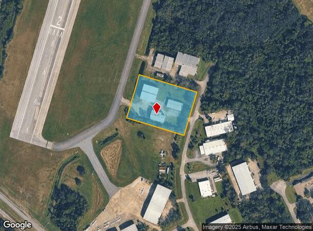
1519 Airway Cir
7312-00-00-0013
Turnbull Bay
Lightindustrial
1 & 12-17-33 N 300 FT OF S 1251.06 FT N OF TURNBULL BAY RD OF THE E 425 FT OF W 450 FT E OF TAXI-WAY PER OR 4188 PG 3833
X
Volusia
12127C0540J
Florida
2025
2.93 AC
2025
South Beach Cities
082802
Deltona/Daytona Beach
20,391 SF
Deltona-Daytona Beach-Ormond Beach, FL
DEMOGRAPHICS near 1519 Airway Cir
1 Mile
3 Mile
5 Mile
2024 Total Population
2,052
25,029
58,381
2029 Population
2,269
28,190
65,844
Pop Growth 2024-2029
+ 10.58%
+ 12.63%
+ 12.78%
Average Age
54
51
50
2024 Total Households
1,063
12,046
26,852
HH Growth 2024-2029
+ 10.72%
+ 12.88%
+ 13.19%
Median Household Inc
$59,570
$60,475
$66,891
Avg Household Size
1.90
2.00
2.10
2024 Avg HH Vehicles
2.00
2.00
2.00
Median Home Value
$242,132
$294,161
$311,983
Median Year Built
1982
1985
1987
Nearby Places
Map Layers
Map Styles
 Street
 Aerial
- Restaurants
- Banks
- Shops
- Fitness
- Groceries
PUBLIC TRANSPORTATION
AIRPORT
Daytona Beach International
DRIVE
WALK
Distance
Daytona Beach International
28 min
15.2 mi
Orlando Sanford International
DRIVE
WALK
Distance
Orlando Sanford International
54 min
34.9 mi
Freight Ports
Port Canaveral
DRIVE
WALK
Distance
Port Canaveral
80 min
63.6 mi
Nearby Properties
Address
Land Use
TOTAL SIZE
Lot Size
Zoning
Address
Land Use
TOTAL SIZE
Lot Size
Zoning
177,619 SF
6.91 AC
10R2
Address
Land Use
TOTAL SIZE
Lot Size
Zoning
108,577 SF
20 AC
10R2
Address
Land Use
TOTAL SIZE
Lot Size
Zoning
Address
Land Use
TOTAL SIZE
Lot Size
Zoning
70,564 SF
2.09 AC
10B1
Address
Land Use
TOTAL SIZE
Lot Size
Zoning
150,044 SF
19.80 AC
R4
Address
Land Use
TOTAL SIZE
Lot Size
Zoning
5,796 SF
71.96 AC
R
Address
Land Use
TOTAL SIZE
Lot Size
Zoning
23,142 SF
7.98 AC
R
Address
Land Use
TOTAL SIZE
Lot Size
Zoning
91,509 SF
4.06 AC
I1
Address
Land Use
TOTAL SIZE
Lot Size
Zoning
7,345 SF
0.43 AC
MH1
Address
Land Use
TOTAL SIZE
Lot Size
Zoning
11.87 AC
10R2A
Address
Land Use
TOTAL SIZE
Lot Size
Zoning
91,759 SF
10.15 AC
10B2
Address
Land Use
TOTAL SIZE
Lot Size
Zoning
87,154 SF
1.08 AC
10R5
Address
Land Use
TOTAL SIZE
Lot Size
Zoning
110,926 SF
7.02 AC
Address
Land Use
TOTAL SIZE
Lot Size
Zoning
51,507 SF
10.61 AC
B3C
Address
Land Use
TOTAL SIZE
Lot Size
Zoning
39,971 SF
281.52 AC
10I3
Address
Land Use
TOTAL SIZE
Lot Size
Zoning
43,852 SF
8.81 AC
RR
Address
Land Use
TOTAL SIZE
Lot Size
Zoning
18,884 SF
12.47 AC
R
Address
Land Use
TOTAL SIZE
Lot Size
Zoning
47,434 SF
11.41 AC
10R3
Address
Land Use
TOTAL SIZE
Lot Size
Zoning
74,609 SF
12.67 AC
10B3
Address
Land Use
TOTAL SIZE
Lot Size
Zoning
119,537 SF
12.06 AC
PUD
Address
Land Use
TOTAL SIZE
Lot Size
Zoning
115,028 SF
16.51 AC
R4
Address
Land Use
TOTAL SIZE
Lot Size
Zoning
44,239 SF
2.31 AC
10B1
Address
Land Use
TOTAL SIZE
Lot Size
Zoning
27,477 SF
14.20 AC
Address
Land Use
TOTAL SIZE
Lot Size
Zoning
70,088 SF
0.30 AC
10R5
Address
Land Use
TOTAL SIZE
Lot Size
Zoning
41,310 SF
1.57 AC
10B1
Address
Land Use
TOTAL SIZE
Lot Size
Zoning
79,518 SF
8.69 AC
B3
Address
Land Use
TOTAL SIZE
Lot Size
Zoning
56,841 SF
8.81 AC
B4C
Address
Land Use
TOTAL SIZE
Lot Size
Zoning
29,657 SF
2.07 AC
10R2
Address
Land Use
TOTAL SIZE
Lot Size
Zoning
33,031 SF
0.55 AC
10R4
Address
Land Use
TOTAL SIZE
Lot Size
Zoning
99,241 SF
8.11 AC
B4
The World's #1 Commercial Real Estate Marketplace
Connect with us
© 2025 CoStar Group
The information above has been obtained from sources believed reliable. While we do not doubt its accuracy we have not verified it and make no guarantee, warranty or representation about it. It is your responsibility to independently confirm its accuracy and completeness. Any projections, opinions, assumptions, or estimates used are for example only and do not represent the current or future performance of the property. The value of this transaction to you depends on tax and other factors which should be evaluated by your tax, financial, and legal advisors. You and your advisors should conduct a careful, independent investigation of the property to determine to your satisfaction the suitability of the property for your needs.