Property Record
15190 Nbn Way, Waynesboro, PA 17268


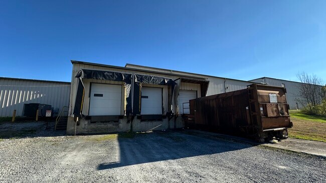
This Property Is For Sale
Current Lease Availabilities
NEARBY LISTINGS FOR SALE OR LEASE
Property Detail
15190 Nbn Way
23-0Q20K-042A-000000
Franklin
Publicstorage
Pennsylvania
X
12.94 AC
24021C0030E
Chambersburg/Waynesboro
2025
Philadelphia
2025
Chambersburg-Waynesboro, PA
012300
DEMOGRAPHICS near 15190 Nbn Way
1 Mile
3 Mile
5 Mile
2024 Total Population
2,036
8,011
16,854
2029 Population
2,100
8,268
17,318
Pop Growth 2024-2029
+ 3.14%
+ 3.21%
+ 2.75%
Average Age
43
44
44
2024 Total Households
848
3,292
6,796
HH Growth 2024-2029
+ 3.07%
+ 3.13%
+ 2.68%
Median Household Inc
$55,297
$69,779
$74,830
Avg Household Size
2.40
2.40
2.40
2024 Avg HH Vehicles
2.00
2.00
2.00
Median Home Value
$245,474
$246,646
$258,685
Median Year Built
1953
1971
1982
Nearby Places
Map Layers
Map Styles
 Street
 Aerial
- Restaurants
- Banks
- Shops
- Fitness
- Groceries
PUBLIC TRANSPORTATION
AIRPORT
Hagerstown Regional/Richard A Henson Field
DRIVE
WALK
Distance
Hagerstown Regional/Richard A Henson Field
34 min
18.0 mi
Freight Ports
Port of Baltimore
DRIVE
WALK
Distance
Port of Baltimore
101 min
71.4 mi
Nearby Properties
Address
Land Use
TOTAL SIZE
Lot Size
Zoning
Address
Land Use
TOTAL SIZE
Lot Size
Zoning
197,652 SF
281.70 AC
IE
Address
Land Use
TOTAL SIZE
Lot Size
Zoning
620.94 AC
I
Address
Land Use
TOTAL SIZE
Lot Size
Zoning
95,779 SF
76.94 AC
U
Address
Land Use
TOTAL SIZE
Lot Size
Zoning
54,646 SF
9.72 AC
RV
Address
Land Use
TOTAL SIZE
Lot Size
Zoning
3.77 AC
SED
Address
Land Use
TOTAL SIZE
Lot Size
Zoning
700 SF
35.49 AC
SED
Address
Land Use
TOTAL SIZE
Lot Size
Zoning
3,038 SF
34.98 AC
SED
Address
Land Use
TOTAL SIZE
Lot Size
Zoning
19,587 SF
23.29 AC
SED
Address
Land Use
TOTAL SIZE
Lot Size
Zoning
11,400 SF
36.81 AC
SED
Address
Land Use
TOTAL SIZE
Lot Size
Zoning
12.23 AC
SED
Address
Land Use
TOTAL SIZE
Lot Size
Zoning
9,398 SF
100 AC
A
Address
Land Use
TOTAL SIZE
Lot Size
Zoning
6.81 AC
U
Address
Land Use
TOTAL SIZE
Lot Size
Zoning
12,810 SF
5 AC
A
Address
Land Use
TOTAL SIZE
Lot Size
Zoning
11,132 SF
12.98 AC
A
Address
Land Use
TOTAL SIZE
Lot Size
Zoning
31.16 AC
C
Address
Land Use
TOTAL SIZE
Lot Size
Zoning
2.77 AC
U
Address
Land Use
TOTAL SIZE
Lot Size
Zoning
10,800 SF
4.91 AC
Address
Land Use
TOTAL SIZE
Lot Size
Zoning
508.39 AC
C
Address
Land Use
TOTAL SIZE
Lot Size
Zoning
9,000 SF
164.51 AC
SED
Address
Land Use
TOTAL SIZE
Lot Size
Zoning
360 SF
38.70 AC
U
Address
Land Use
TOTAL SIZE
Lot Size
Zoning
10,579 SF
5.41 AC
VC
Address
Land Use
TOTAL SIZE
Lot Size
Zoning
5,873 SF
3 AC
R1
Address
Land Use
TOTAL SIZE
Lot Size
Zoning
4.10 AC
I
Address
Land Use
TOTAL SIZE
Lot Size
Zoning
Address
Land Use
TOTAL SIZE
Lot Size
Zoning
147.22 AC
Address
Land Use
TOTAL SIZE
Lot Size
Zoning
4,000 SF
75.68 AC
SED
Address
Land Use
TOTAL SIZE
Lot Size
Zoning
40,000 SF
53.37 AC
U
Address
Land Use
TOTAL SIZE
Lot Size
Zoning
76.31 AC
SED
Address
Land Use
TOTAL SIZE
Lot Size
Zoning
Address
Land Use
TOTAL SIZE
Lot Size
Zoning
74.02 AC
C
The World's #1 Commercial Real Estate Marketplace
Connect with us
© 2025 CoStar Group
The information above has been obtained from sources believed reliable. While we do not doubt its accuracy we have not verified it and make no guarantee, warranty or representation about it. It is your responsibility to independently confirm its accuracy and completeness. Any projections, opinions, assumptions, or estimates used are for example only and do not represent the current or future performance of the property. The value of this transaction to you depends on tax and other factors which should be evaluated by your tax, financial, and legal advisors. You and your advisors should conduct a careful, independent investigation of the property to determine to your satisfaction the suitability of the property for your needs.