Property Record
152 Maple Ln, Sugarloaf, CA 92386


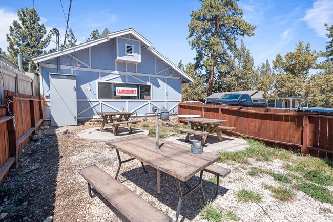
Property Detail
152 Maple Ln
2350-573-29
TRACT NO 1766 B1G BEAR P1NES NO 2 LOTS 33 34 AND 35 BLK 53 EX ST ***** ST 6-29-93 93-278033 *****
Laundromat
SAN BERNARDINO
BVCN
California
D Areas with possible but undetermined flood hazards.
33,34
2025
0.16 AC
2025
Redlands/Loma Linda
011408
Inland Empire (California)
1,500 SF
Riverside-San Bernardino-Ontario, CA
NEARBY LISTINGS FOR SALE OR LEASE
-
-
View all Sugarloaf listings for sale on LoopNet.com
DEMOGRAPHICS near 152 Maple Ln
1 mile
3 mile
5 mile
2025 Total Population
4,040
12,503
14,324
2030 Population
3,989
12,205
13,893
Pop Growth 2025-2030
(1.26%)
(2.38%)
(3.01%)
Average Age
45
45
45
2025 Total Households
1,809
5,410
6,220
HH Growth 2025-2030
(1.60%)
(2.62%)
(3.25%)
Median Household Inc
$69,166
$79,432
$78,796
Avg Household Size
2.20
2.20
2.20
2025 Avg HH Vehicles
2.00
2.00
2.00
Median Home Value
$465,405
$498,721
$501,329
Median Year Built
1977
1977
1977
Nearby Places
Map Layers
Map Styles
 Street
 Aerial
Layers
 Traffic
 Biking
Places
Listings with unknown addresses are not visible on the map
- Restaurants
- Banks
- Shops
- Fitness
- Groceries
SALE & LEASE HISTORY
LISTING DATE
SALE/LEASE

Jul 15, 2024
For Sale
Aug 09, 2017
For Sale
Aug 04, 2017
For Sale
Apr 17, 2024
For Sale
Nearby Properties
Address
Land Use
TOTAL SIZE
Lot Size
Zoning
Address
Land Use
TOTAL SIZE
Lot Size
Zoning
31,584 SF
2.63 AC
Address
Land Use
TOTAL SIZE
Lot Size
Zoning
50,000 SF
34.35 AC
BVRC
Address
Land Use
TOTAL SIZE
Lot Size
Zoning
65,260 SF
3.55 AC
BVIC
Address
Land Use
TOTAL SIZE
Lot Size
Zoning
9,160 SF
1.55 AC
R3
Address
Land Use
TOTAL SIZE
Lot Size
Zoning
11,354 SF
14.33 AC
Address
Land Use
TOTAL SIZE
Lot Size
Zoning
239.80 AC
BVRL20
Address
Land Use
TOTAL SIZE
Lot Size
Zoning
15,403 SF
61.50 AC
BVRS
Address
Land Use
TOTAL SIZE
Lot Size
Zoning
686 SF
0.99 AC
BVRS
Address
Land Use
TOTAL SIZE
Lot Size
Zoning
1.85 AC
BVCG
Address
Land Use
TOTAL SIZE
Lot Size
Zoning
13,224 SF
1.42 AC
Address
Land Use
TOTAL SIZE
Lot Size
Zoning
18,321 SF
12.10 AC
Address
Land Use
TOTAL SIZE
Lot Size
Zoning
11,000 SF
2.53 AC
Address
Land Use
TOTAL SIZE
Lot Size
Zoning
6,930 SF
0.67 AC
BVCG
Address
Land Use
TOTAL SIZE
Lot Size
Zoning
1.27 AC
BVCG
Address
Land Use
TOTAL SIZE
Lot Size
Zoning
14,744 SF
3.39 AC
Address
Land Use
TOTAL SIZE
Lot Size
Zoning
11,326 SF
3.82 AC
Address
Land Use
TOTAL SIZE
Lot Size
Zoning
23,023 SF
47.60 AC
Address
Land Use
TOTAL SIZE
Lot Size
Zoning
11,800 SF
0.34 AC
BVCS
Address
Land Use
TOTAL SIZE
Lot Size
Zoning
4,136 SF
0.80 AC
BVRS
Address
Land Use
TOTAL SIZE
Lot Size
Zoning
2,340 SF
0.31 AC
BVCG
Address
Land Use
TOTAL SIZE
Lot Size
Zoning
7.71 AC
BVCG
Address
Land Use
TOTAL SIZE
Lot Size
Zoning
60 AC
BVRS1
Address
Land Use
TOTAL SIZE
Lot Size
Zoning
2,865 SF
0.19 AC
BVSDRES
Address
Land Use
TOTAL SIZE
Lot Size
Zoning
2,880 SF
8.95 AC
BVRL5
Address
Land Use
TOTAL SIZE
Lot Size
Zoning
9,606 SF
0.80 AC
BVCS
Address
Land Use
TOTAL SIZE
Lot Size
Zoning
3,352 SF
0.35 AC
Address
Land Use
TOTAL SIZE
Lot Size
Zoning
4,908 SF
1.01 AC
BVRS1
Address
Land Use
TOTAL SIZE
Lot Size
Zoning
1.93 AC
BVIC
Address
Land Use
TOTAL SIZE
Lot Size
Zoning
17.50 AC
BVRL20
Address
Land Use
TOTAL SIZE
Lot Size
Zoning
8,683 SF
1.52 AC
BVRS1
The World's #1 Commercial Real Estate Marketplace
Connect with us
© 2026 CoStar Group
The information above has been obtained from sources believed reliable. While we do not doubt its accuracy we have not verified it and make no guarantee, warranty or representation about it. It is your responsibility to independently confirm its accuracy and completeness. Any projections, opinions, assumptions, or estimates used are for example only and do not represent the current or future performance of the property. The value of this transaction to you depends on tax and other factors which should be evaluated by your tax, financial, and legal advisors. You and your advisors should conduct a careful, independent investigation of the property to determine to your satisfaction the suitability of the property for your needs.