Property Record
152 Us Highway 206, Hillsborough, NJ 08844
NEARBY LISTINGS FOR SALE OR LEASE
Property Detail
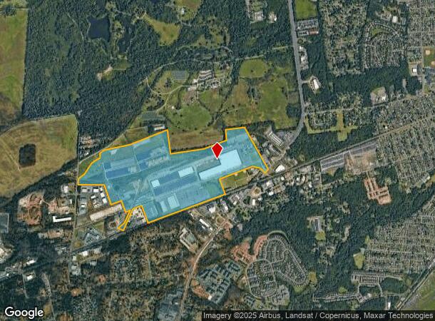
152 Us Highway 206
10-00142-0000-00023
FACILITY NAME: VACANT LAND
Governmentalpublicusegeneral
Somerset
X
New Jersey
34035C0142E
23
0
259.46 AC
2025
Somerset
053804
Northern New Jersey
1,383 SF
Lakewood-New Brunswick, NJ
DEMOGRAPHICS near 152 Us Highway 206
1 Mile
3 Mile
5 Mile
2024 Total Population
3,684
59,767
127,434
2029 Population
3,710
59,979
127,698
Pop Growth 2024-2029
+ 0.71%
+ 0.35%
+ 0.21%
Average Age
42
41
42
2024 Total Households
1,424
23,103
47,291
HH Growth 2024-2029
+ 0.70%
+ 0.39%
+ 0.25%
Median Household Inc
$114,460
$102,976
$117,662
Avg Household Size
2.50
2.50
2.60
2024 Avg HH Vehicles
2.00
2.00
2.00
Median Home Value
$491,847
$370,099
$429,954
Median Year Built
2010
1973
1981
Nearby Places
Map Layers
Map Styles
 Street
 Aerial
- Restaurants
- Banks
- Shops
- Fitness
- Groceries
PUBLIC TRANSPORTATION
COMMUTER RAIL
Somerville (Raritan Valley Line - NJ Transit Commuter Rail (NJ Transit))
DRIVE
WALK
Distance
Somerville (Raritan Valley Line - NJ Transit Commuter Rail (NJ Transit))
7 min
2.7 mi
Raritan (Raritan Valley Line - NJ Transit Commuter Rail (NJ Transit))
DRIVE
WALK
Distance
Raritan (Raritan Valley Line - NJ Transit Commuter Rail (NJ Transit))
9 min
3.8 mi
AIRPORT
Trenton Mercer
DRIVE
WALK
Distance
Trenton Mercer
49 min
25.3 mi
Newark Liberty International
DRIVE
WALK
Distance
Newark Liberty International
50 min
37.4 mi
Freight Ports
New York Container Terminal
DRIVE
WALK
Distance
New York Container Terminal
50 min
34.0 mi
Nearby Properties
Address
Land Use
TOTAL SIZE
Lot Size
Zoning
Address
Land Use
TOTAL SIZE
Lot Size
Zoning
13.59 AC
H
Address
Land Use
TOTAL SIZE
Lot Size
Zoning
22.36 AC
PAC
Address
Land Use
TOTAL SIZE
Lot Size
Zoning
153 AC
Address
Land Use
TOTAL SIZE
Lot Size
Zoning
25.70 AC
PACD
Address
Land Use
TOTAL SIZE
Lot Size
Zoning
Address
Land Use
TOTAL SIZE
Lot Size
Zoning
66.08 AC
M3
Address
Land Use
TOTAL SIZE
Lot Size
Zoning
34.80 AC
OM-3
Address
Land Use
TOTAL SIZE
Lot Size
Zoning
82.79 AC
M-2
Address
Land Use
TOTAL SIZE
Lot Size
Zoning
33.16 AC
M3
Address
Land Use
TOTAL SIZE
Lot Size
Zoning
10.31 AC
PDRD
Address
Land Use
TOTAL SIZE
Lot Size
Zoning
5.60 AC
CG
Address
Land Use
TOTAL SIZE
Lot Size
Zoning
1,056 SF
0.07 AC
Address
Land Use
TOTAL SIZE
Lot Size
Zoning
394 SF
36.05 AC
M105
Address
Land Use
TOTAL SIZE
Lot Size
Zoning
28.44 AC
C2
Address
Land Use
TOTAL SIZE
Lot Size
Zoning
25 SF
10.43 AC
M2
Address
Land Use
TOTAL SIZE
Lot Size
Zoning
19,528 SF
52.97 AC
02
Address
Land Use
TOTAL SIZE
Lot Size
Zoning
289,939 SF
27.31 AC
MUID
Address
Land Use
TOTAL SIZE
Lot Size
Zoning
14.06 AC
GV
Address
Land Use
TOTAL SIZE
Lot Size
Zoning
19.22 AC
AH-3
Address
Land Use
TOTAL SIZE
Lot Size
Zoning
61,757 SF
8.75 AC
TC
Address
Land Use
TOTAL SIZE
Lot Size
Zoning
2.52 AC
Address
Land Use
TOTAL SIZE
Lot Size
Zoning
27.06 AC
GV
Address
Land Use
TOTAL SIZE
Lot Size
Zoning
Address
Land Use
TOTAL SIZE
Lot Size
Zoning
114.10 AC
M2
Address
Land Use
TOTAL SIZE
Lot Size
Zoning
34.14 AC
Address
Land Use
TOTAL SIZE
Lot Size
Zoning
2.84 AC
Address
Land Use
TOTAL SIZE
Lot Size
Zoning
43.66 AC
ARPD
Address
Land Use
TOTAL SIZE
Lot Size
Zoning
780 SF
9.89 AC
GA
Address
Land Use
TOTAL SIZE
Lot Size
Zoning
The World's #1 Commercial Real Estate Marketplace
Connect with us
© 2026 CoStar Group
The information above has been obtained from sources believed reliable. While we do not doubt its accuracy we have not verified it and make no guarantee, warranty or representation about it. It is your responsibility to independently confirm its accuracy and completeness. Any projections, opinions, assumptions, or estimates used are for example only and do not represent the current or future performance of the property. The value of this transaction to you depends on tax and other factors which should be evaluated by your tax, financial, and legal advisors. You and your advisors should conduct a careful, independent investigation of the property to determine to your satisfaction the suitability of the property for your needs.