Property Record
152 Slough Rd, Ferris, TX 75125
Property Detail
152 Slough Rd
65131609010100100
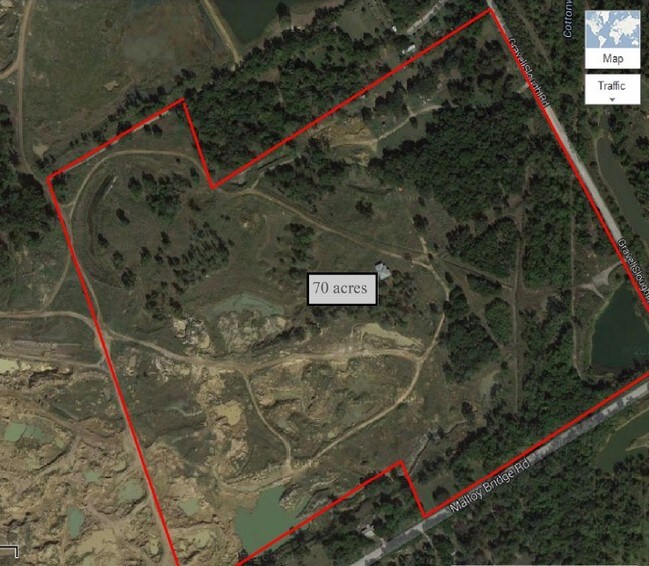
JOHN STADDEN ABST 1316 PG 090 TR 12 ACS 27.444 INT200900355130 DD10142009 CO-D 1316090101200 4NT13160901
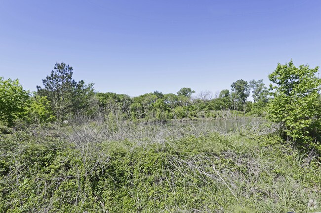
Privatepreserveopenspacevacantlandforestlandconservation
DALLAS
Z05
Texas
AE The base floodplain where base flood elevations are provided. AE Zones are now used on new format FIRMs instead of A1-A30 Zones.
9 AC
2025
Mesquite/Forney/Terrell
2025
Dallas/Ft Worth
016903
Dallas-Fort Worth-Arlington, TX
NEARBY LISTINGS FOR SALE OR LEASE
DEMOGRAPHICS near 152 Slough Rd
1 mile
3 mile
5 mile
2025 Total Population
80
415
11,833
2030 Population
88
451
12,844
Pop Growth 2025-2030
+ 10.00%
+ 8.67%
+ 8.54%
Average Age
33
33
36
2025 Total Households
24
126
3,484
HH Growth 2025-2030
+ 8.33%
+ 8.73%
+ 9.16%
Median Household Inc
$67,500
$66,562
$65,307
Avg Household Size
3.30
3.30
3.20
2025 Avg HH Vehicles
2.00
2.00
2.00
Median Home Value
$158,333
$159,374
$174,356
Median Year Built
2003
2002
1992
Nearby Places
Map Layers
Map Styles
 Street
 Aerial
Layers
 Traffic
 Biking
Places
Listings with unknown addresses are not visible on the map
- Restaurants
- Banks
- Shops
- Fitness
- Groceries
PUBLIC TRANSPORTATION
AIRPORT
Dallas Love Field
Drive
Walk
Distance
Dallas Love Field
39 min
27.4 mi
Freight Ports
Port of Shreveport
Drive
Walk
Distance
Port of Shreveport
210 min
188.2 mi
Nearby Properties
Address
Land Use
TOTAL SIZE
Lot Size
Zoning
Address
Land Use
TOTAL SIZE
Lot Size
Zoning
20.01 AC
Z05
Address
Land Use
TOTAL SIZE
Lot Size
Zoning
129.50 AC
Z268
Address
Land Use
TOTAL SIZE
Lot Size
Zoning
87.15 AC
Z268
Address
Land Use
TOTAL SIZE
Lot Size
Zoning
85.83 AC
Z05
Address
Land Use
TOTAL SIZE
Lot Size
Zoning
58.31 AC
Z268
Address
Land Use
TOTAL SIZE
Lot Size
Zoning
56.52 AC
Z31
Address
Land Use
TOTAL SIZE
Lot Size
Zoning
13,500 SF
3 AC
Address
Land Use
TOTAL SIZE
Lot Size
Zoning
39,518 SF
45.10 AC
Z31
Address
Land Use
TOTAL SIZE
Lot Size
Zoning
153.45 AC
Z268
Address
Land Use
TOTAL SIZE
Lot Size
Zoning
1,012 SF
50 AC
Z31
Address
Land Use
TOTAL SIZE
Lot Size
Zoning
15,000 SF
5 AC
Z05
Address
Land Use
TOTAL SIZE
Lot Size
Zoning
98.66 AC
Z05
Address
Land Use
TOTAL SIZE
Lot Size
Zoning
6,500 SF
1.79 AC
Z05
Address
Land Use
TOTAL SIZE
Lot Size
Zoning
38.25 AC
Z05
Address
Land Use
TOTAL SIZE
Lot Size
Zoning
30 AC
Z05
Address
Land Use
TOTAL SIZE
Lot Size
Zoning
43,440 SF
204.75 AC
Z05
Address
Land Use
TOTAL SIZE
Lot Size
Zoning
28.72 AC
Z05
Address
Land Use
TOTAL SIZE
Lot Size
Zoning
47.59 AC
Z05
Address
Land Use
TOTAL SIZE
Lot Size
Zoning
900 SF
20.02 AC
Z05
Address
Land Use
TOTAL SIZE
Lot Size
Zoning
71.02 AC
Z05
Address
Land Use
TOTAL SIZE
Lot Size
Zoning
10,000 SF
4.99 AC
Z31
Address
Land Use
TOTAL SIZE
Lot Size
Zoning
26,807 SF
9 AC
Z05
Address
Land Use
TOTAL SIZE
Lot Size
Zoning
1,960 SF
186 AC
Z05
Address
Land Use
TOTAL SIZE
Lot Size
Zoning
203.23 AC
Z05
Address
Land Use
TOTAL SIZE
Lot Size
Zoning
40.38 AC
Z05
Address
Land Use
TOTAL SIZE
Lot Size
Zoning
3,410 SF
32.74 AC
Z05
Address
Land Use
TOTAL SIZE
Lot Size
Zoning
29.75 AC
Z05
Address
Land Use
TOTAL SIZE
Lot Size
Zoning
1,200 SF
42.39 AC
Z05
Address
Land Use
TOTAL SIZE
Lot Size
Zoning
20.32 AC
Address
Land Use
TOTAL SIZE
Lot Size
Zoning
5,000 SF
197 AC
Z31
The World's #1 Commercial Real Estate Marketplace
Connect with us
© 2026 CoStar Group
The information above has been obtained from sources believed reliable. While we do not doubt its accuracy we have not verified it and make no guarantee, warranty or representation about it. It is your responsibility to independently confirm its accuracy and completeness. Any projections, opinions, assumptions, or estimates used are for example only and do not represent the current or future performance of the property. The value of this transaction to you depends on tax and other factors which should be evaluated by your tax, financial, and legal advisors. You and your advisors should conduct a careful, independent investigation of the property to determine to your satisfaction the suitability of the property for your needs.