Property Record
152 W 28Th Ave, Oshkosh, WI 54902
NEARBY LISTINGS FOR SALE OR LEASE
-
-
View all Oshkosh listings for lease on LoopNet.com
Property Detail
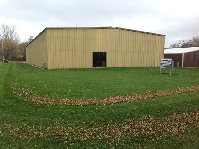
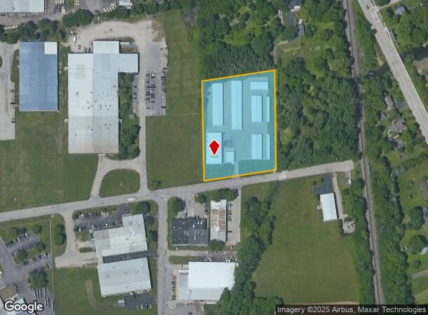
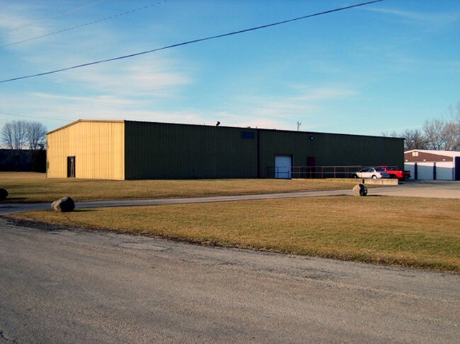
152 W 28Th Ave
Oshkosh-Neenah, WI
Sly 400
14-12610000
SLY 400 FT OF WLY 292.34 FT OF LOT 4 CONANTS SUBD
Commercialnec
Winnebago
X
Wisconsin
55039C0100F
4
2024
2.68 AC
2024
Appleton/Oshkosh
001500
Other Market Areas
27,270 SF
DEMOGRAPHICS near 152 W 28Th Ave
1 Mile
3 Mile
5 Mile
2024 Total Population
2,969
33,759
67,667
2029 Population
2,979
33,875
68,019
Pop Growth 2024-2029
+ 0.34%
+ 0.34%
+ 0.52%
Average Age
41
38
39
2024 Total Households
1,332
14,766
29,220
HH Growth 2024-2029
+ 0.15%
+ 0.30%
+ 0.66%
Median Household Inc
$69,999
$57,263
$57,463
Avg Household Size
2.20
2.10
2.10
2024 Avg HH Vehicles
2.00
2.00
2.00
Median Home Value
$192,267
$151,404
$166,365
Median Year Built
1951
1956
1971
Nearby Places
Map Layers
Map Styles
 Street
 Aerial
- Restaurants
- Banks
- Shops
- Fitness
- Groceries
PUBLIC TRANSPORTATION
AIRPORT
Appleton International
DRIVE
WALK
Distance
Appleton International
35 min
23.0 mi
SALE & LEASE HISTORY
LISTING DATE
SALE/LEASE

Sep 26, 2016
For Lease
Mar 21, 2017
For Lease
Nearby Properties
Address
Land Use
TOTAL SIZE
Lot Size
Zoning
Address
Land Use
TOTAL SIZE
Lot Size
Zoning
931,304 SF
107 AC
M3
Address
Land Use
TOTAL SIZE
Lot Size
Zoning
7.74 AC
Address
Land Use
TOTAL SIZE
Lot Size
Zoning
208,278 SF
22.77 AC
C2
Address
Land Use
TOTAL SIZE
Lot Size
Zoning
570,585 SF
81.26 AC
M2
Address
Land Use
TOTAL SIZE
Lot Size
Zoning
18.38 AC
UIPD
Address
Land Use
TOTAL SIZE
Lot Size
Zoning
128,951 SF
4.95 AC
R1
Address
Land Use
TOTAL SIZE
Lot Size
Zoning
195,847 SF
4.66 AC
UMU-PD
Address
Land Use
TOTAL SIZE
Lot Size
Zoning
2.29 AC
RMUPDRFO
Address
Land Use
TOTAL SIZE
Lot Size
Zoning
110,200 SF
14.77 AC
MR-12-PD
Address
Land Use
TOTAL SIZE
Lot Size
Zoning
70,672 SF
4.97 AC
Address
Land Use
TOTAL SIZE
Lot Size
Zoning
238,238 SF
22.60 AC
M3
Address
Land Use
TOTAL SIZE
Lot Size
Zoning
2.63 AC
RMU-PD-RFO
Address
Land Use
TOTAL SIZE
Lot Size
Zoning
19,488 SF
16.43 AC
C-2
Address
Land Use
TOTAL SIZE
Lot Size
Zoning
136,368 SF
10.24 AC
C-2PD
Address
Land Use
TOTAL SIZE
Lot Size
Zoning
271,088 SF
36.80 AC
M3
Address
Land Use
TOTAL SIZE
Lot Size
Zoning
1.78 AC
C3
Address
Land Use
TOTAL SIZE
Lot Size
Zoning
107,778 SF
8.57 AC
SMUPD
Address
Land Use
TOTAL SIZE
Lot Size
Zoning
117,892 SF
7.36 AC
MR-20
Address
Land Use
TOTAL SIZE
Lot Size
Zoning
9.86 AC
MR-12
Address
Land Use
TOTAL SIZE
Lot Size
Zoning
92,958 SF
1.02 AC
C2
Address
Land Use
TOTAL SIZE
Lot Size
Zoning
128,951 SF
1.15 AC
R1;SINGLE
Address
Land Use
TOTAL SIZE
Lot Size
Zoning
114,338 SF
10.20 AC
C2
Address
Land Use
TOTAL SIZE
Lot Size
Zoning
101,011 SF
16.53 AC
C3
Address
Land Use
TOTAL SIZE
Lot Size
Zoning
58,465 SF
43.67 AC
M3
Address
Land Use
TOTAL SIZE
Lot Size
Zoning
32,430 SF
7.44 AC
M1
Address
Land Use
TOTAL SIZE
Lot Size
Zoning
28,512 SF
6.20 AC
M1
Address
Land Use
TOTAL SIZE
Lot Size
Zoning
100,361 SF
14.25 AC
SMU-PD
Address
Land Use
TOTAL SIZE
Lot Size
Zoning
94,300 SF
1.21 AC
C3
Address
Land Use
TOTAL SIZE
Lot Size
Zoning
91,288 SF
7.29 AC
MR-12
Address
Land Use
TOTAL SIZE
Lot Size
Zoning
88,128 SF
6.33 AC
MR-12
The World's #1 Commercial Real Estate Marketplace
Connect with us
© 2025 CoStar Group
The information above has been obtained from sources believed reliable. While we do not doubt its accuracy we have not verified it and make no guarantee, warranty or representation about it. It is your responsibility to independently confirm its accuracy and completeness. Any projections, opinions, assumptions, or estimates used are for example only and do not represent the current or future performance of the property. The value of this transaction to you depends on tax and other factors which should be evaluated by your tax, financial, and legal advisors. You and your advisors should conduct a careful, independent investigation of the property to determine to your satisfaction the suitability of the property for your needs.