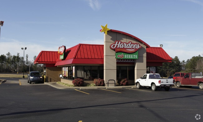
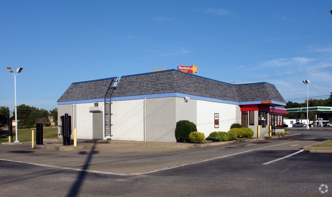
Property Record
1520 Anderson Dr, Williamston, SC 29697

Property Detail
1520 Anderson Dr
221-06-01-004
CP 117/672 F133 D155 PP 1464/11 + 2 HIGHWAY 20/BEAVERDAM RD .90 AC
Restaurantbuilding
Anderson
B and X Area of moderate flood hazard, usually the area between the limits of the 100-year and 500-year floods.
South Carolina
2025
0.90 AC
2025
Anderson Cy S of I-85
010404
Greenville/Spartanburg
3,536 SF
Greenville-Anderson-Greer, SC
NEARBY LISTINGS FOR SALE OR LEASE
DEMOGRAPHICS near 1520 Anderson Dr
1 mile
3 mile
5 mile
2025 Total Population
2,136
12,825
24,604
2030 Population
2,231
13,533
26,046
Pop Growth 2025-2030
+ 4.45%
+ 5.52%
+ 5.86%
Average Age
39
40
40
2025 Total Households
836
4,984
9,446
HH Growth 2025-2030
+ 4.67%
+ 5.80%
+ 6.14%
Median Household Inc
$65,046
$62,856
$63,979
Avg Household Size
2.50
2.50
2.60
2025 Avg HH Vehicles
2.00
2.00
2.00
Median Home Value
$200,694
$193,060
$204,660
Median Year Built
1984
1985
1989
Nearby Places
Map Layers
Map Styles
 Street
 Aerial
Layers
 Traffic
 Biking
Places
Listings with unknown addresses are not visible on the map
- Restaurants
- Banks
- Shops
- Fitness
- Groceries
PUBLIC TRANSPORTATION
AIRPORT
Greenville Spartanburg International
Drive
Walk
Distance
Greenville Spartanburg International
44 min
30.8 mi
Nearby Properties
Address
Land Use
TOTAL SIZE
Lot Size
Zoning
Address
Land Use
TOTAL SIZE
Lot Size
Zoning
40,884 SF
2.66 AC
Address
Land Use
TOTAL SIZE
Lot Size
Zoning
17,360 SF
5.50 AC
Address
Land Use
TOTAL SIZE
Lot Size
Zoning
19,038 SF
10.44 AC
Address
Land Use
TOTAL SIZE
Lot Size
Zoning
10.88 AC
Address
Land Use
TOTAL SIZE
Lot Size
Zoning
68,962 SF
7.33 AC
Address
Land Use
TOTAL SIZE
Lot Size
Zoning
11,421 SF
1.35 AC
Address
Land Use
TOTAL SIZE
Lot Size
Zoning
6,389 SF
1.78 AC
Address
Land Use
TOTAL SIZE
Lot Size
Zoning
27,700 SF
8.99 AC
Address
Land Use
TOTAL SIZE
Lot Size
Zoning
1,546 SF
1.16 AC
Address
Land Use
TOTAL SIZE
Lot Size
Zoning
9,360 SF
1.65 AC
Address
Land Use
TOTAL SIZE
Lot Size
Zoning
7,080 SF
1.59 AC
Address
Land Use
TOTAL SIZE
Lot Size
Zoning
10,032 SF
1.07 AC
Address
Land Use
TOTAL SIZE
Lot Size
Zoning
10,230 SF
1.23 AC
Address
Land Use
TOTAL SIZE
Lot Size
Zoning
3,800 SF
2.76 AC
Address
Land Use
TOTAL SIZE
Lot Size
Zoning
87,702 SF
10.07 AC
Address
Land Use
TOTAL SIZE
Lot Size
Zoning
5,132 SF
2.50 AC
Address
Land Use
TOTAL SIZE
Lot Size
Zoning
8,000 SF
1.03 AC
Address
Land Use
TOTAL SIZE
Lot Size
Zoning
5,105 SF
2.52 AC
Address
Land Use
TOTAL SIZE
Lot Size
Zoning
29,538 SF
12.68 AC
Address
Land Use
TOTAL SIZE
Lot Size
Zoning
3,224 SF
1.84 AC
Address
Land Use
TOTAL SIZE
Lot Size
Zoning
4,436 SF
0.67 AC
Address
Land Use
TOTAL SIZE
Lot Size
Zoning
124,997 SF
12.83 AC
Address
Land Use
TOTAL SIZE
Lot Size
Zoning
1,268 SF
0.93 AC
Address
Land Use
TOTAL SIZE
Lot Size
Zoning
6,505 SF
1.24 AC
Address
Land Use
TOTAL SIZE
Lot Size
Zoning
8,851 SF
179.78 AC
Address
Land Use
TOTAL SIZE
Lot Size
Zoning
16,875 SF
2.43 AC
Address
Land Use
TOTAL SIZE
Lot Size
Zoning
3,063 SF
2.61 AC
Address
Land Use
TOTAL SIZE
Lot Size
Zoning
24,070 SF
1.71 AC
The World's #1 Commercial Real Estate Marketplace
Connect with us
© 2026 CoStar Group
The information above has been obtained from sources believed reliable. While we do not doubt its accuracy we have not verified it and make no guarantee, warranty or representation about it. It is your responsibility to independently confirm its accuracy and completeness. Any projections, opinions, assumptions, or estimates used are for example only and do not represent the current or future performance of the property. The value of this transaction to you depends on tax and other factors which should be evaluated by your tax, financial, and legal advisors. You and your advisors should conduct a careful, independent investigation of the property to determine to your satisfaction the suitability of the property for your needs.