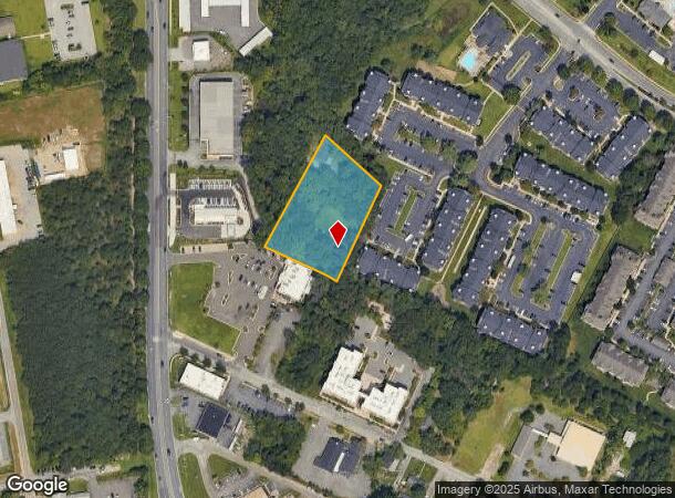
Property Record
1520 Annapolis Rd, Odenton, MD 21113


NEARBY LISTINGS FOR SALE OR LEASE
Property Detail
1520 Annapolis Rd
04-000-00621600
Odenton
Commercialnec
1.54 ACRES ODENTON
X
Anne Arundel
24003C0126E
Maryland
2024
1.54 AC
2025
BWI/Anne Arundel
740305
Baltimore
2,508 SF
Baltimore-Columbia-Towson, MD
DEMOGRAPHICS near 1520 Annapolis Rd
1 Mile
3 Mile
5 Mile
2024 Total Population
10,656
74,460
138,779
2029 Population
11,013
77,128
143,869
Pop Growth 2024-2029
+ 3.35%
+ 3.58%
+ 3.67%
Average Age
35
36
38
2024 Total Households
4,459
27,373
51,905
HH Growth 2024-2029
+ 3.75%
+ 3.67%
+ 3.76%
Median Household Inc
$88,223
$109,288
$112,469
Avg Household Size
2.30
2.60
2.60
2024 Avg HH Vehicles
2.00
2.00
2.00
Median Home Value
$337,880
$387,431
$404,276
Median Year Built
2002
1996
1996
Nearby Places
Map Layers
Map Styles
 Street
 Aerial
- Restaurants
- Banks
- Shops
- Fitness
- Groceries
PUBLIC TRANSPORTATION
COMMUTER RAIL
Odenton (PENN - WASHINGTON - Maryland Area Regional Commuter Trains (The MARC), Penn Line - Maryland Area Regional Commuter Trains (The MARC))
DRIVE
WALK
Distance
Odenton (PENN - WASHINGTON - Maryland Area Regional Commuter Trains (The MARC), Penn Line - Maryland Area Regional Commuter Trains (The MARC))
6 min
2.7 mi
Savage (Camden Line - Maryland Area Regional Commuter Trains (The MARC))
DRIVE
WALK
Distance
Savage (Camden Line - Maryland Area Regional Commuter Trains (The MARC))
13 min
7.5 mi
AIRPORT
Baltimore/Washington International Thurgood Marshall
DRIVE
WALK
Distance
Baltimore/Washington International Thurgood Marshall
18 min
9.4 mi
Ronald Reagan Washington Ntl
DRIVE
WALK
Distance
Ronald Reagan Washington Ntl
49 min
31.0 mi
Freight Ports
Port of Baltimore
DRIVE
WALK
Distance
Port of Baltimore
30 min
17.7 mi
SALE & LEASE HISTORY
LISTING DATE
SALE/LEASE

Jun 10, 2025
For Sale
Nearby Properties
Address
Land Use
TOTAL SIZE
Lot Size
Zoning
Address
Land Use
TOTAL SIZE
Lot Size
Zoning
8,192 SF
13,053.34 AC
R1
Address
Land Use
TOTAL SIZE
Lot Size
Zoning
472,057 SF
15.16 AC
OCOR
Address
Land Use
TOTAL SIZE
Lot Size
Zoning
155,020 SF
19.86 AC
R22
Address
Land Use
TOTAL SIZE
Lot Size
Zoning
41.07 AC
R15
Address
Land Use
TOTAL SIZE
Lot Size
Zoning
432,928 SF
6.33 AC
O-COR
Address
Land Use
TOTAL SIZE
Lot Size
Zoning
88,272 SF
3.43 AC
OTRA
Address
Land Use
TOTAL SIZE
Lot Size
Zoning
279,318 SF
14.38 AC
R22
Address
Land Use
TOTAL SIZE
Lot Size
Zoning
14.65 AC
R15
Address
Land Use
TOTAL SIZE
Lot Size
Zoning
255,561 SF
15.93 AC
R22
Address
Land Use
TOTAL SIZE
Lot Size
Zoning
499,471 SF
10.10 AC
O-COR
Address
Land Use
TOTAL SIZE
Lot Size
Zoning
311,870 SF
10.03 AC
Address
Land Use
TOTAL SIZE
Lot Size
Zoning
296,453 SF
16.23 AC
R15
Address
Land Use
TOTAL SIZE
Lot Size
Zoning
342,024 SF
30.72 AC
W1B
Address
Land Use
TOTAL SIZE
Lot Size
Zoning
230,204 SF
6.74 AC
O COR
Address
Land Use
TOTAL SIZE
Lot Size
Zoning
265,645 SF
12.79 AC
R15
Address
Land Use
TOTAL SIZE
Lot Size
Zoning
24.49 AC
C3
Address
Land Use
TOTAL SIZE
Lot Size
Zoning
169,100 SF
22.85 AC
C3
Address
Land Use
TOTAL SIZE
Lot Size
Zoning
125.95 AC
R5
Address
Land Use
TOTAL SIZE
Lot Size
Zoning
185,440 SF
3.53 AC
W2
Address
Land Use
TOTAL SIZE
Lot Size
Zoning
155,269 SF
13.27 AC
O-EOD
Address
Land Use
TOTAL SIZE
Lot Size
Zoning
342,464 SF
22.95 AC
O-IND
Address
Land Use
TOTAL SIZE
Lot Size
Zoning
89,936 SF
16.40 AC
R15
Address
Land Use
TOTAL SIZE
Lot Size
Zoning
232,480 SF
16.17 AC
R15
Address
Land Use
TOTAL SIZE
Lot Size
Zoning
37,320 SF
18.76 AC
O-COR
Address
Land Use
TOTAL SIZE
Lot Size
Zoning
117,156 SF
3.70 AC
O-NOD
Address
Land Use
TOTAL SIZE
Lot Size
Zoning
10.95 AC
O-EOD
Address
Land Use
TOTAL SIZE
Lot Size
Zoning
111,617 SF
11.87 AC
O-NOD
Address
Land Use
TOTAL SIZE
Lot Size
Zoning
215,104 SF
22.27 AC
W1
Address
Land Use
TOTAL SIZE
Lot Size
Zoning
8.15 AC
R15
Address
Land Use
TOTAL SIZE
Lot Size
Zoning
70,784 SF
18 AC
R15
The World's #1 Commercial Real Estate Marketplace
Connect with us
© 2025 CoStar Group
The information above has been obtained from sources believed reliable. While we do not doubt its accuracy we have not verified it and make no guarantee, warranty or representation about it. It is your responsibility to independently confirm its accuracy and completeness. Any projections, opinions, assumptions, or estimates used are for example only and do not represent the current or future performance of the property. The value of this transaction to you depends on tax and other factors which should be evaluated by your tax, financial, and legal advisors. You and your advisors should conduct a careful, independent investigation of the property to determine to your satisfaction the suitability of the property for your needs.