Property Record
1520 Dabney Dr, Henderson, NC 27536


NEARBY LISTINGS FOR SALE OR LEASE
Property Detail
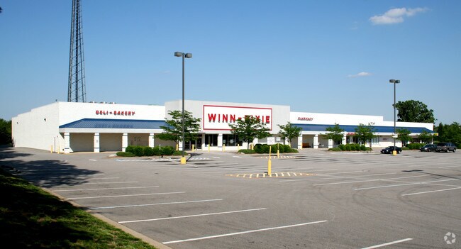
1520 Dabney Dr
0012-01014
M E Whitmore Prop
Stripcommercialcenter
1520 DABNEY DR 6.620
X
Vance
3720196400K
North Carolina
2025
6.62 AC
2025
North Carolina Northeast Area
960500
Other Market Areas
81,065 SF
Henderson, NC
DEMOGRAPHICS near 1520 Dabney Dr
1 Mile
3 Mile
5 Mile
2024 Total Population
2,893
18,296
25,915
2029 Population
2,828
18,191
25,696
Pop Growth 2024-2029
(2.25%)
(0.57%)
(0.85%)
Average Age
43
41
41
2024 Total Households
1,316
7,472
10,431
HH Growth 2024-2029
(2.20%)
(0.58%)
(0.81%)
Median Household Inc
$39,711
$40,072
$39,392
Avg Household Size
2.10
2.40
2.40
2024 Avg HH Vehicles
2.00
2.00
2.00
Median Home Value
$160,333
$119,633
$126,594
Median Year Built
1975
1971
1974
Nearby Places
Map Layers
Map Styles
 Street
 Aerial
- Restaurants
- Banks
- Shops
- Fitness
- Groceries
SALE & LEASE HISTORY
LISTING DATE
SALE/LEASE

Dec 08, 2016
For Lease
Nearby Properties
Address
Land Use
TOTAL SIZE
Lot Size
Zoning
Address
Land Use
TOTAL SIZE
Lot Size
Zoning
82,663 SF
33 AC
HOI
Address
Land Use
TOTAL SIZE
Lot Size
Zoning
125,900 SF
38.64 AC
HI2
Address
Land Use
TOTAL SIZE
Lot Size
Zoning
106,510 SF
45.28 AC
HI2
Address
Land Use
TOTAL SIZE
Lot Size
Zoning
201,508 SF
19.91 AC
HB2
Address
Land Use
TOTAL SIZE
Lot Size
Zoning
96,081 SF
1.33 AC
HB1
Address
Land Use
TOTAL SIZE
Lot Size
Zoning
51,768 SF
40.75 AC
HR8M
Address
Land Use
TOTAL SIZE
Lot Size
Zoning
164,283 SF
20.33 AC
HB2
Address
Land Use
TOTAL SIZE
Lot Size
Zoning
104,496 SF
14.95 AC
HR6
Address
Land Use
TOTAL SIZE
Lot Size
Zoning
64,208 SF
1.90 AC
HB1
Address
Land Use
TOTAL SIZE
Lot Size
Zoning
58,025 SF
12.06 AC
HB4
Address
Land Use
TOTAL SIZE
Lot Size
Zoning
24,888 SF
33.39 AC
HR20
Address
Land Use
TOTAL SIZE
Lot Size
Zoning
54,090 SF
7.61 AC
HB3
Address
Land Use
TOTAL SIZE
Lot Size
Zoning
150,320 SF
9.51 AC
HB3
Address
Land Use
TOTAL SIZE
Lot Size
Zoning
85,355 SF
13.80 AC
HB4
Address
Land Use
TOTAL SIZE
Lot Size
Zoning
27,784 SF
2.04 AC
HB1
Address
Land Use
TOTAL SIZE
Lot Size
Zoning
87,830 SF
14.96 AC
HI2
Address
Land Use
TOTAL SIZE
Lot Size
Zoning
78,661 SF
4.84 AC
HOI
Address
Land Use
TOTAL SIZE
Lot Size
Zoning
70,011 SF
54.94 AC
OI
Address
Land Use
TOTAL SIZE
Lot Size
Zoning
38,331 SF
13.62 AC
HB2A
Address
Land Use
TOTAL SIZE
Lot Size
Zoning
36,173 SF
1.56 AC
HOI
Address
Land Use
TOTAL SIZE
Lot Size
Zoning
19,596 SF
7.60 AC
HR15M
Address
Land Use
TOTAL SIZE
Lot Size
Zoning
21,548 SF
13.77 AC
Address
Land Use
TOTAL SIZE
Lot Size
Zoning
49,414 SF
8.46 AC
HB4
Address
Land Use
TOTAL SIZE
Lot Size
Zoning
1,824 SF
13 AC
HR8
Address
Land Use
TOTAL SIZE
Lot Size
Zoning
57,102 SF
2.90 AC
HI2
Address
Land Use
TOTAL SIZE
Lot Size
Zoning
28,326 SF
7.63 AC
HB2
Address
Land Use
TOTAL SIZE
Lot Size
Zoning
48,490 SF
6.14 AC
HB2A
Address
Land Use
TOTAL SIZE
Lot Size
Zoning
43,590 SF
2.27 AC
HB2A
Address
Land Use
TOTAL SIZE
Lot Size
Zoning
27,344 SF
23.26 AC
HR15M
The World's #1 Commercial Real Estate Marketplace
Connect with us
© 2025 CoStar Group
The information above has been obtained from sources believed reliable. While we do not doubt its accuracy we have not verified it and make no guarantee, warranty or representation about it. It is your responsibility to independently confirm its accuracy and completeness. Any projections, opinions, assumptions, or estimates used are for example only and do not represent the current or future performance of the property. The value of this transaction to you depends on tax and other factors which should be evaluated by your tax, financial, and legal advisors. You and your advisors should conduct a careful, independent investigation of the property to determine to your satisfaction the suitability of the property for your needs.