Property Record
1520 E Sepulveda Blvd, Carson, CA 90745

Property Detail
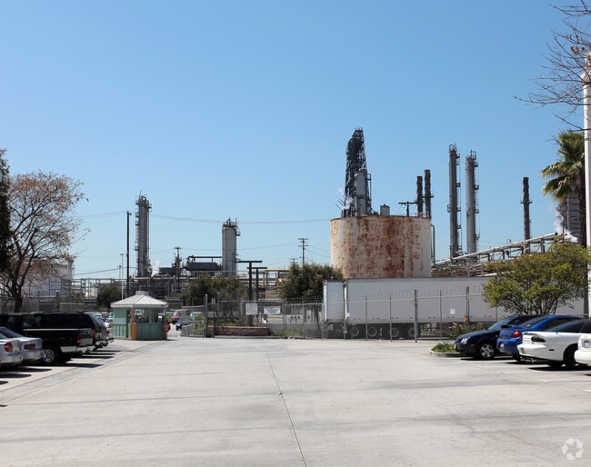
1520 E Sepulveda Blvd
7315-002-021
PM 270-36-41 FOR DESC SEE ASSESSORS MAPS POR OF LOT 2
Refinery
Los Angeles
CAMH*
California
B and X Area of moderate flood hazard, usually the area between the limits of the 100-year and 500-year floods.
2
2024
224.14 AC
2025
Long Beach: Suburban
980002
Los Angeles
108,891 SF
Los Angeles-Long Beach-Glendale, CA
NEARBY LISTINGS FOR SALE OR LEASE
DEMOGRAPHICS near 1520 E Sepulveda Blvd
1 mile
3 mile
5 mile
2025 Total Population
3,490
170,951
514,029
2030 Population
3,436
168,492
509,887
Pop Growth 2025-2030
(1.55%)
(1.44%)
(0.81%)
Average Age
38
40
40
2025 Total Households
859
48,199
171,257
HH Growth 2025-2030
(1.86%)
(1.70%)
(0.85%)
Median Household Inc
$74,463
$84,281
$80,551
Avg Household Size
3.80
3.30
2.80
2025 Avg HH Vehicles
3.00
2.00
2.00
Median Home Value
$703,655
$695,679
$721,953
Median Year Built
1960
1960
1964
Nearby Places
Map Layers
Map Styles
 Street
 Aerial
Transit
 Traffic
 Biking
Places
Listings with unknown addresses are not visible on the map
- Restaurants
- Banks
- Shops
- Fitness
- Groceries
PUBLIC TRANSPORTATION
AIRPORT
Long Beach (Daugherty Field)
Drive
Walk
Distance
Long Beach (Daugherty Field)
13 min
6.5 mi
Los Angeles International
Drive
Walk
Distance
Los Angeles International
26 min
17.4 mi
John Wayne/Orange County
Drive
Walk
Distance
John Wayne/Orange County
35 min
26.7 mi
Freight Ports
Port of Long Beach
Drive
Walk
Distance
Port of Long Beach
11 min
5.7 mi
Nearby Properties
Address
Land Use
TOTAL SIZE
Lot Size
Zoning
Address
Land Use
TOTAL SIZE
Lot Size
Zoning
502,333 SF
21.89 AC
LBI
Address
Land Use
TOTAL SIZE
Lot Size
Zoning
236,582 SF
425.41 AC
CAMH*
Address
Land Use
TOTAL SIZE
Lot Size
Zoning
56,300 SF
116.80 AC
LAM3
Address
Land Use
TOTAL SIZE
Lot Size
Zoning
286,186 SF
8.20 AC
LAMR1
Address
Land Use
TOTAL SIZE
Lot Size
Zoning
119,356 SF
3.86 AC
LAM2
Address
Land Use
TOTAL SIZE
Lot Size
Zoning
285,314 SF
14.28 AC
CAMH*
Address
Land Use
TOTAL SIZE
Lot Size
Zoning
84,365 SF
7.62 AC
LARAS3
Address
Land Use
TOTAL SIZE
Lot Size
Zoning
513,520 SF
19.09 AC
LBPD26
Address
Land Use
TOTAL SIZE
Lot Size
Zoning
194,230 SF
2.58 AC
LBR4N
Address
Land Use
TOTAL SIZE
Lot Size
Zoning
1,800 SF
124.45 AC
CAMH*
Address
Land Use
TOTAL SIZE
Lot Size
Zoning
213,408 SF
13.81 AC
LBR4R
Address
Land Use
TOTAL SIZE
Lot Size
Zoning
350,896 SF
13.43 AC
LBML*
Address
Land Use
TOTAL SIZE
Lot Size
Zoning
135,666 SF
LAM3
Address
Land Use
TOTAL SIZE
Lot Size
Zoning
14.80 AC
CAMH*
Address
Land Use
TOTAL SIZE
Lot Size
Zoning
238,914 SF
12.97 AC
LBIP
Address
Land Use
TOTAL SIZE
Lot Size
Zoning
178,323 SF
12.23 AC
CACR&D&MUR
Address
Land Use
TOTAL SIZE
Lot Size
Zoning
169,056 SF
10.04 AC
LBR4R
Address
Land Use
TOTAL SIZE
Lot Size
Zoning
496,472 SF
21.57 AC
CAMH*
Address
Land Use
TOTAL SIZE
Lot Size
Zoning
110,190 SF
5.16 AC
CAMH*
Address
Land Use
TOTAL SIZE
Lot Size
Zoning
87,211 SF
3.67 AC
CAMH*
Address
Land Use
TOTAL SIZE
Lot Size
Zoning
105,853 SF
9.98 AC
CACA*
Address
Land Use
TOTAL SIZE
Lot Size
Zoning
291,508 SF
15.21 AC
LBR4R
Address
Land Use
TOTAL SIZE
Lot Size
Zoning
354,980 SF
8.36 AC
CAMH*
Address
Land Use
TOTAL SIZE
Lot Size
Zoning
312,272 SF
8.57 AC
CAMH*
Address
Land Use
TOTAL SIZE
Lot Size
Zoning
183,722 SF
5.71 AC
CAMH*
Address
Land Use
TOTAL SIZE
Lot Size
Zoning
150,080 SF
6.59 AC
CAMH*
Address
Land Use
TOTAL SIZE
Lot Size
Zoning
99,090 SF
4.54 AC
CAMH*
Address
Land Use
TOTAL SIZE
Lot Size
Zoning
10,850 SF
76.71 AC
CAMH*
Address
Land Use
TOTAL SIZE
Lot Size
Zoning
136,473 SF
5.62 AC
CACA*
The World's #1 Commercial Real Estate Marketplace
Connect with us
© 2026 CoStar Group
The information above has been obtained from sources believed reliable. While we do not doubt its accuracy we have not verified it and make no guarantee, warranty or representation about it. It is your responsibility to independently confirm its accuracy and completeness. Any projections, opinions, assumptions, or estimates used are for example only and do not represent the current or future performance of the property. The value of this transaction to you depends on tax and other factors which should be evaluated by your tax, financial, and legal advisors. You and your advisors should conduct a careful, independent investigation of the property to determine to your satisfaction the suitability of the property for your needs.