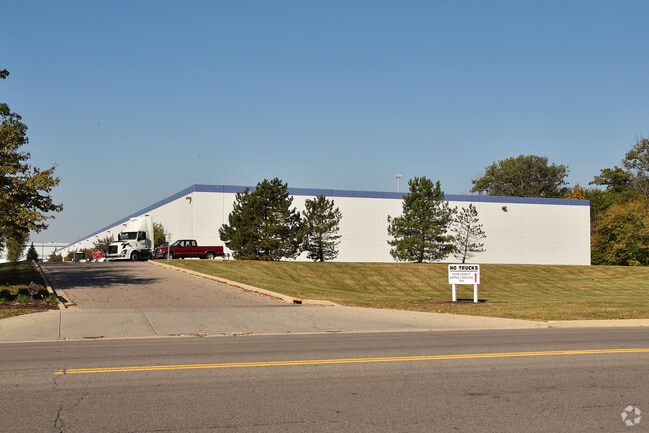
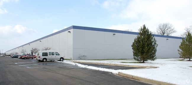
Property Record
1520 Experiment Farm Rd, Troy, OH 45373


Property Detail
1520 Experiment Farm Rd
Dayton, OH
IN LOT 7450
D08099882
Miami
Warehouse
Ohio
B and X Area of moderate flood hazard, usually the area between the limits of the 100-year and 500-year floods.
7450
2025
11.37 AC
2025
North Dayton
365002
Cincinnati/Dayton
160,000 SF
NEARBY LISTINGS FOR SALE OR LEASE
DEMOGRAPHICS near 1520 Experiment Farm Rd
1 mile
3 mile
5 mile
2025 Total Population
2,873
17,399
39,676
2030 Population
2,983
17,964
40,837
Pop Growth 2025-2030
+ 3.83%
+ 3.25%
+ 2.93%
Average Age
43
42
41
2025 Total Households
1,310
7,562
16,516
HH Growth 2025-2030
+ 3.82%
+ 3.23%
+ 2.94%
Median Household Inc
$68,365
$70,220
$71,561
Avg Household Size
2.20
2.20
2.30
2025 Avg HH Vehicles
2.00
2.00
2.00
Median Home Value
$225,471
$264,884
$243,700
Median Year Built
1993
1979
1972
Nearby Places
Map Layers
Map Styles
 Street
 Aerial
Transit
 Traffic
 Biking
Places
Listings with unknown addresses are not visible on the map
- Restaurants
- Banks
- Shops
- Fitness
- Groceries
PUBLIC TRANSPORTATION
AIRPORT
James M Cox Dayton International
Drive
Walk
Distance
James M Cox Dayton International
25 min
17.0 mi
Freight Ports
Port of Toledo
Drive
Walk
Distance
Port of Toledo
156 min
131.8 mi
Nearby Properties
Address
Land Use
TOTAL SIZE
Lot Size
Zoning
Address
Land Use
TOTAL SIZE
Lot Size
Zoning
150,128 SF
11.71 AC
Address
Land Use
TOTAL SIZE
Lot Size
Zoning
3,158 SF
113 AC
Address
Land Use
TOTAL SIZE
Lot Size
Zoning
7,200 SF
25.38 AC
Address
Land Use
TOTAL SIZE
Lot Size
Zoning
1,310 SF
12.31 AC
Address
Land Use
TOTAL SIZE
Lot Size
Zoning
75,861 SF
8 AC
Address
Land Use
TOTAL SIZE
Lot Size
Zoning
50,400 SF
54.09 AC
Address
Land Use
TOTAL SIZE
Lot Size
Zoning
536,448 SF
66.57 AC
Address
Land Use
TOTAL SIZE
Lot Size
Zoning
548,745 SF
56.35 AC
Address
Land Use
TOTAL SIZE
Lot Size
Zoning
68,679 SF
1.72 AC
Address
Land Use
TOTAL SIZE
Lot Size
Zoning
94,555 SF
13.32 AC
Address
Land Use
TOTAL SIZE
Lot Size
Zoning
48,363 SF
14.35 AC
Address
Land Use
TOTAL SIZE
Lot Size
Zoning
12.05 AC
Address
Land Use
TOTAL SIZE
Lot Size
Zoning
148,400 SF
37.74 AC
Address
Land Use
TOTAL SIZE
Lot Size
Zoning
8.18 AC
Address
Land Use
TOTAL SIZE
Lot Size
Zoning
54,671 SF
15.57 AC
Address
Land Use
TOTAL SIZE
Lot Size
Zoning
57,440 SF
1.81 AC
Address
Land Use
TOTAL SIZE
Lot Size
Zoning
3,944 SF
12.18 AC
Address
Land Use
TOTAL SIZE
Lot Size
Zoning
42,118 SF
9.38 AC
Address
Land Use
TOTAL SIZE
Lot Size
Zoning
5,564 SF
21.42 AC
Address
Land Use
TOTAL SIZE
Lot Size
Zoning
223,905 SF
17.75 AC
Address
Land Use
TOTAL SIZE
Lot Size
Zoning
132,772 SF
15.34 AC
Address
Land Use
TOTAL SIZE
Lot Size
Zoning
Address
Land Use
TOTAL SIZE
Lot Size
Zoning
45,900 SF
1.75 AC
Address
Land Use
TOTAL SIZE
Lot Size
Zoning
8.82 AC
Address
Land Use
TOTAL SIZE
Lot Size
Zoning
Address
Land Use
TOTAL SIZE
Lot Size
Zoning
191,424 SF
26.97 AC
Address
Land Use
TOTAL SIZE
Lot Size
Zoning
60,268 SF
2.10 AC
Address
Land Use
TOTAL SIZE
Lot Size
Zoning
12,630 SF
7.13 AC
Address
Land Use
TOTAL SIZE
Lot Size
Zoning
29,690 SF
2.52 AC
The World's #1 Commercial Real Estate Marketplace
Connect with us
© 2026 CoStar Group
The information above has been obtained from sources believed reliable. While we do not doubt its accuracy we have not verified it and make no guarantee, warranty or representation about it. It is your responsibility to independently confirm its accuracy and completeness. Any projections, opinions, assumptions, or estimates used are for example only and do not represent the current or future performance of the property. The value of this transaction to you depends on tax and other factors which should be evaluated by your tax, financial, and legal advisors. You and your advisors should conduct a careful, independent investigation of the property to determine to your satisfaction the suitability of the property for your needs.