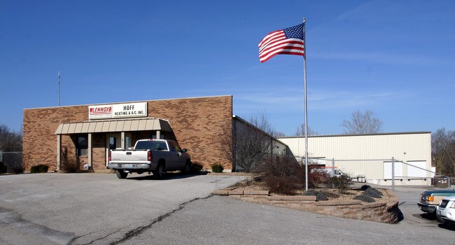
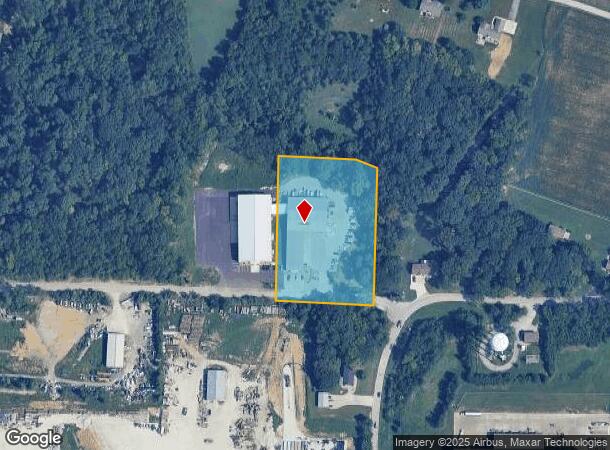
Property Record
1520 Kemmar Ct, O Fallon, MO 63366
NEARBY LISTINGS FOR SALE OR LEASE
Property Detail
1520 Kemmar Ct
St. Louis
Northwood Estate 02
St. Louis, MO-IL
S PT NE 1/4 N OF RD
2-0049-S023-00-0003.9200000
St. Charles
Industrialgeneral
Missouri
2024
3
2025
3.06 AC
312095
St Charles County
18,100 SF
DEMOGRAPHICS near 1520 Kemmar Ct
1 Mile
3 Mile
5 Mile
2024 Total Population
1,138
44,409
122,542
2029 Population
1,217
47,451
130,280
Pop Growth 2024-2029
+ 6.94%
+ 6.85%
+ 6.31%
Average Age
38
41
40
2024 Total Households
398
17,062
45,468
HH Growth 2024-2029
+ 7.04%
+ 6.80%
+ 6.35%
Median Household Inc
$123,181
$97,623
$98,758
Avg Household Size
2.80
2.60
2.70
2024 Avg HH Vehicles
2.00
2.00
2.00
Median Home Value
$341,134
$294,473
$285,628
Median Year Built
2008
1998
1999
Nearby Places
Map Layers
Map Styles
 Street
 Aerial
- Restaurants
- Banks
- Shops
- Fitness
- Groceries
PUBLIC TRANSPORTATION
AIRPORT
St Louis Lambert International
DRIVE
WALK
Distance
St Louis Lambert International
39 min
27.8 mi
Nearby Properties
Address
Land Use
TOTAL SIZE
Lot Size
Zoning
Address
Land Use
TOTAL SIZE
Lot Size
Zoning
482.60 AC
AC7
Address
Land Use
TOTAL SIZE
Lot Size
Zoning
420,705 SF
37.21 AC
Address
Land Use
TOTAL SIZE
Lot Size
Zoning
Address
Land Use
TOTAL SIZE
Lot Size
Zoning
254,435 SF
16.57 AC
Address
Land Use
TOTAL SIZE
Lot Size
Zoning
77.65 AC
AC7
Address
Land Use
TOTAL SIZE
Lot Size
Zoning
251,169 SF
20.19 AC
Address
Land Use
TOTAL SIZE
Lot Size
Zoning
111,573 SF
19.11 AC
Address
Land Use
TOTAL SIZE
Lot Size
Zoning
210,095 SF
12.29 AC
AE9
Address
Land Use
TOTAL SIZE
Lot Size
Zoning
183,416 SF
40.46 AC
Address
Land Use
TOTAL SIZE
Lot Size
Zoning
48.76 AC
AF0
Address
Land Use
TOTAL SIZE
Lot Size
Zoning
147,526 SF
7.51 AC
AE8
Address
Land Use
TOTAL SIZE
Lot Size
Zoning
57.96 AC
Address
Land Use
TOTAL SIZE
Lot Size
Zoning
Address
Land Use
TOTAL SIZE
Lot Size
Zoning
10,690 SF
11.23 AC
AA2
Address
Land Use
TOTAL SIZE
Lot Size
Zoning
106,447 SF
6.53 AC
Address
Land Use
TOTAL SIZE
Lot Size
Zoning
1,484 SF
90.24 AC
Address
Land Use
TOTAL SIZE
Lot Size
Zoning
35.34 AC
Address
Land Use
TOTAL SIZE
Lot Size
Zoning
69,500 SF
9.39 AC
Address
Land Use
TOTAL SIZE
Lot Size
Zoning
Address
Land Use
TOTAL SIZE
Lot Size
Zoning
97,000 SF
6.25 AC
Address
Land Use
TOTAL SIZE
Lot Size
Zoning
54,312 SF
4.34 AC
Address
Land Use
TOTAL SIZE
Lot Size
Zoning
34,636 SF
16.12 AC
Address
Land Use
TOTAL SIZE
Lot Size
Zoning
122,599 SF
5.24 AC
Address
Land Use
TOTAL SIZE
Lot Size
Zoning
104,309 SF
7.99 AC
AA1
Address
Land Use
TOTAL SIZE
Lot Size
Zoning
29,680 SF
2.76 AC
Address
Land Use
TOTAL SIZE
Lot Size
Zoning
46,750 SF
4.81 AC
Address
Land Use
TOTAL SIZE
Lot Size
Zoning
34,160 SF
4.07 AC
AB3
Address
Land Use
TOTAL SIZE
Lot Size
Zoning
644 SF
62 AC
AB6
Address
Land Use
TOTAL SIZE
Lot Size
Zoning
103,538 SF
8.07 AC
AC3
Address
Land Use
TOTAL SIZE
Lot Size
Zoning
26.59 AC
AE9
The World's #1 Commercial Real Estate Marketplace
Connect with us
© 2026 CoStar Group
The information above has been obtained from sources believed reliable. While we do not doubt its accuracy we have not verified it and make no guarantee, warranty or representation about it. It is your responsibility to independently confirm its accuracy and completeness. Any projections, opinions, assumptions, or estimates used are for example only and do not represent the current or future performance of the property. The value of this transaction to you depends on tax and other factors which should be evaluated by your tax, financial, and legal advisors. You and your advisors should conduct a careful, independent investigation of the property to determine to your satisfaction the suitability of the property for your needs.