Property Record
1520 Longleaf Pine Pkwy, Saint Johns, FL 32259


NEARBY LISTINGS FOR SALE OR LEASE
Property Detail
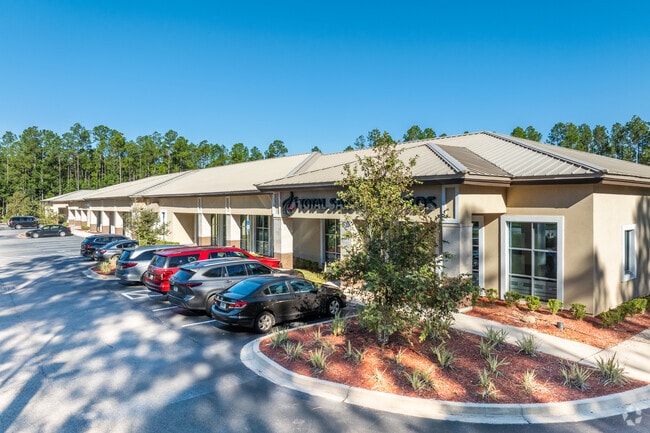
1520 Longleaf Pine Pkwy
Jacksonville, FL
Durbin Crossing South Phase 1
009635-0003
59/73-100 DURBIN CROSSING SOUTH PHASE 1 PARCEL J (EX PRESERVATION EASES #5 & #6 TO CDD IN OR3045/1877) OR4301/1247
Officebuilding
St. Johns
X
Florida
12109C0160J
j
2023
4.17 AC
2025
St Johns County
020808
Jacksonville (Florida)
21,024 SF
DEMOGRAPHICS near 1520 Longleaf Pine Pkwy
1 Mile
3 Mile
5 Mile
2024 Total Population
5,400
42,511
112,669
2029 Population
7,232
55,702
140,703
Pop Growth 2024-2029
+ 33.93%
+ 31.03%
+ 24.88%
Average Age
35
36
37
2024 Total Households
1,628
13,321
38,585
HH Growth 2024-2029
+ 33.72%
+ 30.13%
+ 23.28%
Median Household Inc
$151,943
$144,680
$119,230
Avg Household Size
3.30
3.20
2.90
2024 Avg HH Vehicles
2.00
2.00
2.00
Median Home Value
$438,670
$423,075
$386,756
Median Year Built
2011
2010
2009
Nearby Places
Map Layers
Map Styles
 Street
 Aerial
- Restaurants
- Banks
- Shops
- Fitness
- Groceries
PUBLIC TRANSPORTATION
AIRPORT
Jacksonville International
DRIVE
WALK
Distance
Jacksonville International
49 min
37.1 mi
Freight Ports
Jacksonville Port
DRIVE
WALK
Distance
Jacksonville Port
37 min
26.0 mi
SALE & LEASE HISTORY
LISTING DATE
SALE/LEASE

Jun 05, 2017
For Lease
Nearby Properties
Address
Land Use
TOTAL SIZE
Lot Size
Zoning
Address
Land Use
TOTAL SIZE
Lot Size
Zoning
371,039 SF
20.63 AC
Address
Land Use
TOTAL SIZE
Lot Size
Zoning
241,882 SF
10.83 AC
PUD
Address
Land Use
TOTAL SIZE
Lot Size
Zoning
289,228 SF
38.96 AC
Address
Land Use
TOTAL SIZE
Lot Size
Zoning
233,849 SF
101.31 AC
OR
Address
Land Use
TOTAL SIZE
Lot Size
Zoning
148,628 SF
8.91 AC
Address
Land Use
TOTAL SIZE
Lot Size
Zoning
190,574 SF
20 AC
PUD
Address
Land Use
TOTAL SIZE
Lot Size
Zoning
158,388 SF
33.46 AC
OR
Address
Land Use
TOTAL SIZE
Lot Size
Zoning
45.39 AC
Address
Land Use
TOTAL SIZE
Lot Size
Zoning
78,903 SF
22.19 AC
Address
Land Use
TOTAL SIZE
Lot Size
Zoning
104,451 SF
30.04 AC
OR
Address
Land Use
TOTAL SIZE
Lot Size
Zoning
191,230 SF
17.62 AC
Address
Land Use
TOTAL SIZE
Lot Size
Zoning
54,544 SF
12.20 AC
PUD
Address
Land Use
TOTAL SIZE
Lot Size
Zoning
123,398 SF
25.30 AC
PUD
Address
Land Use
TOTAL SIZE
Lot Size
Zoning
70,936 SF
8.88 AC
PUD
Address
Land Use
TOTAL SIZE
Lot Size
Zoning
80,540 SF
15.46 AC
PUD
Address
Land Use
TOTAL SIZE
Lot Size
Zoning
22,271 SF
11.29 AC
PUD
Address
Land Use
TOTAL SIZE
Lot Size
Zoning
38,266 SF
10.96 AC
Address
Land Use
TOTAL SIZE
Lot Size
Zoning
87,495 SF
22.41 AC
PUD
Address
Land Use
TOTAL SIZE
Lot Size
Zoning
59,535 SF
37.64 AC
OR
Address
Land Use
TOTAL SIZE
Lot Size
Zoning
58,139 SF
7.92 AC
OR
Address
Land Use
TOTAL SIZE
Lot Size
Zoning
107,738 SF
10.91 AC
Address
Land Use
TOTAL SIZE
Lot Size
Zoning
46,238 SF
3.22 AC
Address
Land Use
TOTAL SIZE
Lot Size
Zoning
46,789 SF
5.86 AC
Address
Land Use
TOTAL SIZE
Lot Size
Zoning
1,728 SF
14.35 AC
OR
Address
Land Use
TOTAL SIZE
Lot Size
Zoning
72,600 SF
2.38 AC
PUD
Address
Land Use
TOTAL SIZE
Lot Size
Zoning
1,249 SF
1.61 AC
Address
Land Use
TOTAL SIZE
Lot Size
Zoning
23,842 SF
5.75 AC
PUD
Address
Land Use
TOTAL SIZE
Lot Size
Zoning
2,670 SF
1.91 AC
Address
Land Use
TOTAL SIZE
Lot Size
Zoning
35,063 SF
12.63 AC
PUD
Address
Land Use
TOTAL SIZE
Lot Size
Zoning
10,935 SF
1.90 AC
OR
The World's #1 Commercial Real Estate Marketplace
Connect with us
© 2025 CoStar Group
The information above has been obtained from sources believed reliable. While we do not doubt its accuracy we have not verified it and make no guarantee, warranty or representation about it. It is your responsibility to independently confirm its accuracy and completeness. Any projections, opinions, assumptions, or estimates used are for example only and do not represent the current or future performance of the property. The value of this transaction to you depends on tax and other factors which should be evaluated by your tax, financial, and legal advisors. You and your advisors should conduct a careful, independent investigation of the property to determine to your satisfaction the suitability of the property for your needs.