Property Record
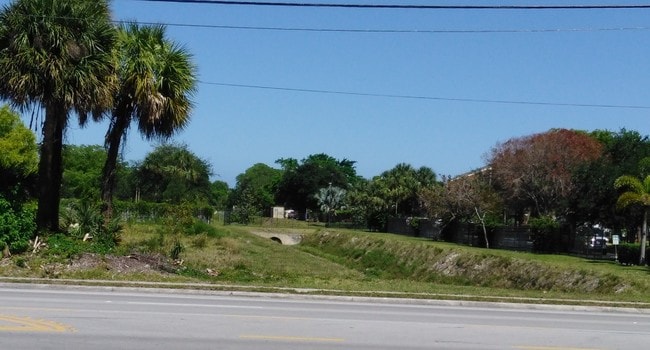
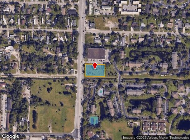
1520 N Haverhill Rd, West Palm Beach, FL 33417
NEARBY LISTINGS FOR SALE OR LEASE
Property Detail
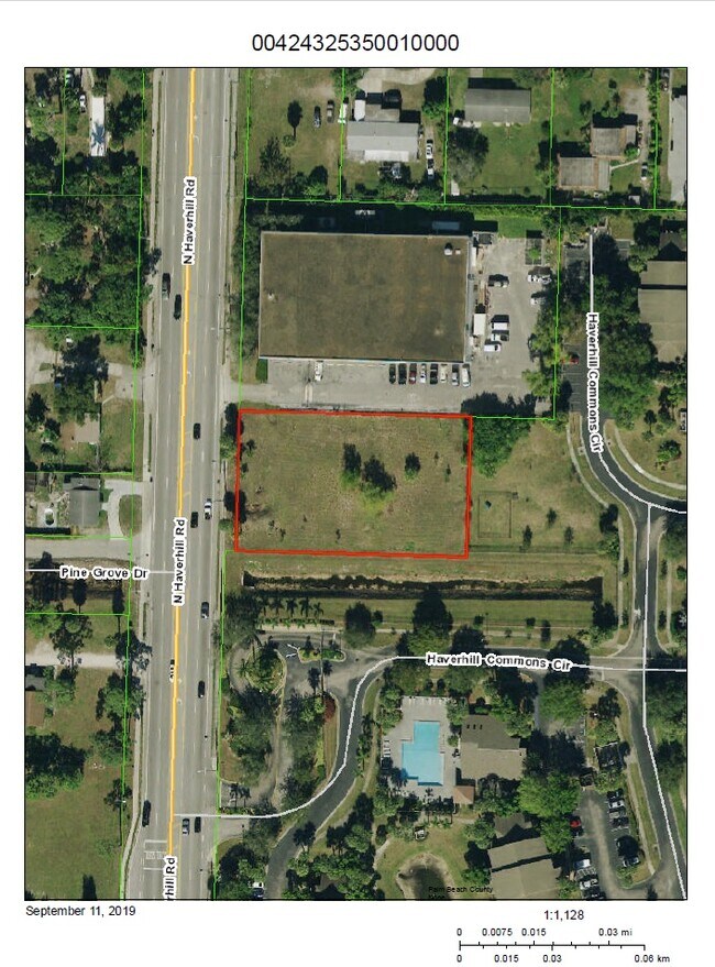
1520 N Haverhill Rd
West Palm Beach-Boca Raton-Delray Beach, FL
Acreage & Unrec
00-42-43-25-35-001-0000
HAVERHILL ROAD MEDICAL OFFICE PAR A
Commercialacreage
Palm Beach
X
Florida
12099C0578F
0.67 AC
2024
West Palm Beach
2025
South Florida
003102
DEMOGRAPHICS near 1520 N Haverhill Rd
1 Mile
3 Mile
5 Mile
2024 Total Population
17,195
113,949
284,010
2029 Population
17,896
118,168
294,466
Pop Growth 2024-2029
+ 4.08%
+ 3.70%
+ 3.68%
Average Age
38
40
40
2024 Total Households
6,260
44,893
110,773
HH Growth 2024-2029
+ 4.09%
+ 3.53%
+ 3.40%
Median Household Inc
$42,994
$49,641
$54,085
Avg Household Size
2.60
2.40
2.40
2024 Avg HH Vehicles
1.00
2.00
2.00
Median Home Value
$181,540
$211,848
$251,255
Median Year Built
1981
1984
1983
Nearby Places
Map Layers
Map Styles
 Street
 Aerial
- Restaurants
- Banks
- Shops
- Fitness
- Groceries
PUBLIC TRANSPORTATION
COMMUTER RAIL
West Palm Beach (Tri-County Commuter - South Florida Regional Transportation Authority (Tri-Rail))
DRIVE
WALK
Distance
West Palm Beach (Tri-County Commuter - South Florida Regional Transportation Authority (Tri-Rail))
9 min
4.6 mi
West Palm Beach (Mainline - Brightline)
DRIVE
WALK
Distance
West Palm Beach (Mainline - Brightline)
11 min
5.0 mi
AIRPORT
Palm Beach International
DRIVE
WALK
Distance
Palm Beach International
8 min
3.3 mi
Freight Ports
Port of Palm Beach
DRIVE
WALK
Distance
Port of Palm Beach
17 min
8.6 mi
SALE & LEASE HISTORY
LISTING DATE
SALE/LEASE

Sep 16, 2019
For Sale
Feb 14, 2025
For Sale
Dec 11, 2023
For Sale
Apr 13, 2018
For Sale
Nearby Properties
Address
Land Use
TOTAL SIZE
Lot Size
Zoning
Address
Land Use
TOTAL SIZE
Lot Size
Zoning
3,150,355 SF
616.71 AC
PO
Address
Land Use
TOTAL SIZE
Lot Size
Zoning
492,288 SF
58.55 AC
CPD
Address
Land Use
TOTAL SIZE
Lot Size
Zoning
981,713 SF
77.89 AC
PO
Address
Land Use
TOTAL SIZE
Lot Size
Zoning
441,083 SF
425.95 AC
PO
Address
Land Use
TOTAL SIZE
Lot Size
Zoning
596,079 SF
21.49 AC
RPD
Address
Land Use
TOTAL SIZE
Lot Size
Zoning
644,690 SF
44.88 AC
MUPD
Address
Land Use
TOTAL SIZE
Lot Size
Zoning
490,757 SF
12.11 AC
PIPD
Address
Land Use
TOTAL SIZE
Lot Size
Zoning
303,776 SF
27.63 AC
CPD
Address
Land Use
TOTAL SIZE
Lot Size
Zoning
404,222 SF
36.71 AC
RH
Address
Land Use
TOTAL SIZE
Lot Size
Zoning
561,484 SF
21.86 AC
PO
Address
Land Use
TOTAL SIZE
Lot Size
Zoning
314,116 SF
10.25 AC
MF20
Address
Land Use
TOTAL SIZE
Lot Size
Zoning
347,853 SF
46.24 AC
PIPD
Address
Land Use
TOTAL SIZE
Lot Size
Zoning
150,344 SF
203.77 AC
PO
Address
Land Use
TOTAL SIZE
Lot Size
Zoning
406,623 SF
47.23 AC
MF14
Address
Land Use
TOTAL SIZE
Lot Size
Zoning
371,177 SF
17.38 AC
RPD
Address
Land Use
TOTAL SIZE
Lot Size
Zoning
276,247 SF
2.48 AC
CPD
Address
Land Use
TOTAL SIZE
Lot Size
Zoning
328,512 SF
15.27 AC
PUD
Address
Land Use
TOTAL SIZE
Lot Size
Zoning
293,524 SF
11.14 AC
RPD
Address
Land Use
TOTAL SIZE
Lot Size
Zoning
210,445 SF
11.18 AC
MUPD
Address
Land Use
TOTAL SIZE
Lot Size
Zoning
334,396 SF
19.54 AC
PO
Address
Land Use
TOTAL SIZE
Lot Size
Zoning
232,751 SF
12.67 AC
RPD
Address
Land Use
TOTAL SIZE
Lot Size
Zoning
302,217 SF
18.17 AC
RPD
Address
Land Use
TOTAL SIZE
Lot Size
Zoning
178,614 SF
10.42 AC
PUD
Address
Land Use
TOTAL SIZE
Lot Size
Zoning
242,559 SF
7.29 AC
RM
Address
Land Use
TOTAL SIZE
Lot Size
Zoning
172,493 SF
20.46 AC
CPD
Address
Land Use
TOTAL SIZE
Lot Size
Zoning
347,973 SF
17.87 AC
RM
Address
Land Use
TOTAL SIZE
Lot Size
Zoning
275,703 SF
27.32 AC
PO
Address
Land Use
TOTAL SIZE
Lot Size
Zoning
248,196 SF
8.74 AC
RPD
Address
Land Use
TOTAL SIZE
Lot Size
Zoning
338,035 SF
26.98 AC
PO
Address
Land Use
TOTAL SIZE
Lot Size
Zoning
209,824 SF
73.38 AC
PO
The World's #1 Commercial Real Estate Marketplace
Connect with us
© 2025 CoStar Group
The information above has been obtained from sources believed reliable. While we do not doubt its accuracy we have not verified it and make no guarantee, warranty or representation about it. It is your responsibility to independently confirm its accuracy and completeness. Any projections, opinions, assumptions, or estimates used are for example only and do not represent the current or future performance of the property. The value of this transaction to you depends on tax and other factors which should be evaluated by your tax, financial, and legal advisors. You and your advisors should conduct a careful, independent investigation of the property to determine to your satisfaction the suitability of the property for your needs.