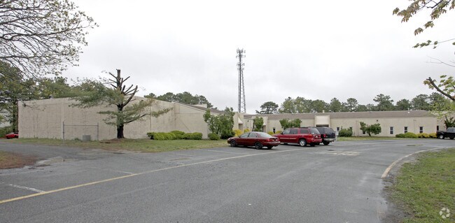
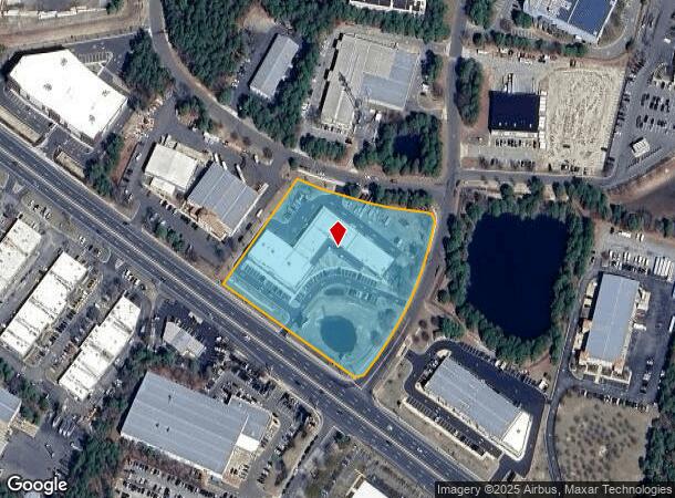
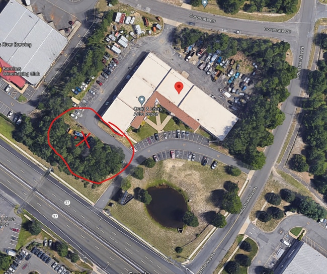
Property Record
1520 Route 37 W, Toms River, NJ 08755

Current Lease Availabilities
NEARBY LISTINGS FOR SALE OR LEASE
Property Detail
1520 Route 37 W
New York-Jersey City-White Plains, NY-NJ
Toms River Indust Park Map
08-00472-0000-00013
4.31AC
Industrialgeneral
Ocean
X
New Jersey
34029C0282F
13
2024
4.31 AC
2025
Ocean County
723000
Northern New Jersey
24,432 SF
DEMOGRAPHICS near 1520 Route 37 W
1 Mile
3 Mile
5 Mile
2024 Total Population
7,592
46,313
110,720
2029 Population
8,025
48,692
116,492
Pop Growth 2024-2029
+ 5.70%
+ 5.14%
+ 5.21%
Average Age
49
55
48
2024 Total Households
3,368
22,579
47,290
HH Growth 2024-2029
+ 5.26%
+ 4.64%
+ 4.50%
Median Household Inc
$56,240
$53,817
$59,158
Avg Household Size
2.10
2.00
2.20
2024 Avg HH Vehicles
2.00
2.00
2.00
Median Home Value
$231,458
$220,410
$252,164
Median Year Built
1978
1979
1981
Nearby Places
- Restaurants
- Banks
- Shops
- Fitness
- Groceries
Nearby Properties
Address
Land Use
TOTAL SIZE
Lot Size
Zoning
Address
Land Use
TOTAL SIZE
Lot Size
Zoning
38.17 AC
HMS
Address
Land Use
TOTAL SIZE
Lot Size
Zoning
75,558 SF
43.30 AC
R15
Address
Land Use
TOTAL SIZE
Lot Size
Zoning
9,730 SF
98.31 AC
RC
Address
Land Use
TOTAL SIZE
Lot Size
Zoning
123,881 SF
93.73 AC
FAAF
Address
Land Use
TOTAL SIZE
Lot Size
Zoning
12,383 SF
39.07 AC
HD-3
Address
Land Use
TOTAL SIZE
Lot Size
Zoning
260 SF
326.26 AC
SPLT
Address
Land Use
TOTAL SIZE
Lot Size
Zoning
1,414 SF
35.40 AC
RHB
Address
Land Use
TOTAL SIZE
Lot Size
Zoning
52.06 AC
TC
Address
Land Use
TOTAL SIZE
Lot Size
Zoning
8.66 AC
RHB
Address
Land Use
TOTAL SIZE
Lot Size
Zoning
61,142 SF
23.53 AC
R40
Address
Land Use
TOTAL SIZE
Lot Size
Zoning
35,800 SF
24.53 AC
RHB
Address
Land Use
TOTAL SIZE
Lot Size
Zoning
71.59 AC
R10
Address
Land Use
TOTAL SIZE
Lot Size
Zoning
148,718 SF
15.74 AC
RUR
Address
Land Use
TOTAL SIZE
Lot Size
Zoning
15,243 SF
5.47 AC
HMS
Address
Land Use
TOTAL SIZE
Lot Size
Zoning
115,528 SF
17.59 AC
SPLT
Address
Land Use
TOTAL SIZE
Lot Size
Zoning
14,432 SF
15.69 AC
RHB
Address
Land Use
TOTAL SIZE
Lot Size
Zoning
72,940 SF
49.84 AC
SPLT
Address
Land Use
TOTAL SIZE
Lot Size
Zoning
38,172 SF
7.36 AC
MF
Address
Land Use
TOTAL SIZE
Lot Size
Zoning
11.26 AC
RHB
Address
Land Use
TOTAL SIZE
Lot Size
Zoning
1,952 SF
38.39 AC
RUR
Address
Land Use
TOTAL SIZE
Lot Size
Zoning
48,688 SF
9.60 AC
TC
Address
Land Use
TOTAL SIZE
Lot Size
Zoning
2,934 SF
16.83 AC
RHB
Address
Land Use
TOTAL SIZE
Lot Size
Zoning
78,980 SF
4.88 AC
R40
Address
Land Use
TOTAL SIZE
Lot Size
Zoning
158 SF
23.51 AC
MP
Address
Land Use
TOTAL SIZE
Lot Size
Zoning
18,024 SF
5.94 AC
MF
Address
Land Use
TOTAL SIZE
Lot Size
Zoning
38,172 SF
10.61 AC
MF
Address
Land Use
TOTAL SIZE
Lot Size
Zoning
0.47 AC
RC
Address
Land Use
TOTAL SIZE
Lot Size
Zoning
34,296 SF
45.24 AC
400C
Address
Land Use
TOTAL SIZE
Lot Size
Zoning
5.73 AC
PRRC
Address
Land Use
TOTAL SIZE
Lot Size
Zoning
1,847 SF
11.31 AC
RHB
The World's #1 Commercial Real Estate Marketplace
Connect with us
© 2025 CoStar Group
The information above has been obtained from sources believed reliable. While we do not doubt its accuracy we have not verified it and make no guarantee, warranty or representation about it. It is your responsibility to independently confirm its accuracy and completeness. Any projections, opinions, assumptions, or estimates used are for example only and do not represent the current or future performance of the property. The value of this transaction to you depends on tax and other factors which should be evaluated by your tax, financial, and legal advisors. You and your advisors should conduct a careful, independent investigation of the property to determine to your satisfaction the suitability of the property for your needs.