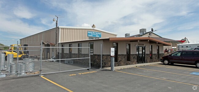
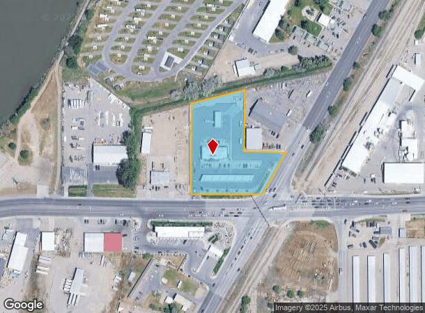
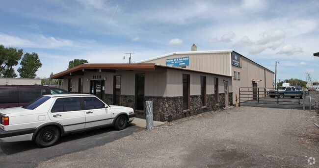
Property Record
1520 W Sunnyside Rd, Idaho Falls, ID 83402
NEARBY LISTINGS FOR SALE OR LEASE
Property Detail
1520 W Sunnyside Rd
Idaho Falls, ID
2.48 A SE1/4 SW1/4 W HWY, SEC 25, T 2N, R 27
RPA00007253976
Bonneville
Conveniencestore
Idaho
2025
2.48 AC
2025
Idaho South Area
971000
Other Market Areas
5,800 SF
DEMOGRAPHICS near 1520 W Sunnyside Rd
1 Mile
3 Mile
5 Mile
2024 Total Population
3,997
52,831
88,596
2029 Population
4,588
59,929
100,388
Pop Growth 2024-2029
+ 14.79%
+ 13.44%
+ 13.31%
Average Age
39
37
37
2024 Total Households
1,413
19,460
32,414
HH Growth 2024-2029
+ 14.65%
+ 13.26%
+ 13.16%
Median Household Inc
$89,640
$68,227
$66,179
Avg Household Size
2.70
2.60
2.60
2024 Avg HH Vehicles
2.00
2.00
2.00
Median Home Value
$394,254
$326,730
$318,539
Median Year Built
2000
1976
1981
Nearby Places
Map Layers
Map Styles
 Street
 Aerial
- Restaurants
- Banks
- Shops
- Fitness
- Groceries
PUBLIC TRANSPORTATION
AIRPORT
Idaho Falls Regional
DRIVE
WALK
Distance
Idaho Falls Regional
9 min
4.3 mi
Freight Ports
Port of Portland
DRIVE
WALK
Distance
Port of Portland
736 min
708.1 mi
Nearby Properties
Address
Land Use
TOTAL SIZE
Lot Size
Zoning
Address
Land Use
TOTAL SIZE
Lot Size
Zoning
57,420 SF
8.59 AC
Address
Land Use
TOTAL SIZE
Lot Size
Zoning
37,287 SF
9.46 AC
Address
Land Use
TOTAL SIZE
Lot Size
Zoning
4,813 SF
13.50 AC
Address
Land Use
TOTAL SIZE
Lot Size
Zoning
4,118 SF
25.18 AC
R2
Address
Land Use
TOTAL SIZE
Lot Size
Zoning
1 SF
35.35 AC
R2
Address
Land Use
TOTAL SIZE
Lot Size
Zoning
220,179 SF
22.20 AC
R2
Address
Land Use
TOTAL SIZE
Lot Size
Zoning
111,649 SF
8.60 AC
Address
Land Use
TOTAL SIZE
Lot Size
Zoning
106,733 SF
2.99 AC
Address
Land Use
TOTAL SIZE
Lot Size
Zoning
108,128 SF
14.53 AC
Address
Land Use
TOTAL SIZE
Lot Size
Zoning
1,908 SF
5.77 AC
Address
Land Use
TOTAL SIZE
Lot Size
Zoning
27,084 SF
3.69 AC
Address
Land Use
TOTAL SIZE
Lot Size
Zoning
7,617 SF
4.65 AC
Address
Land Use
TOTAL SIZE
Lot Size
Zoning
89,263 SF
3.92 AC
Address
Land Use
TOTAL SIZE
Lot Size
Zoning
25,629 SF
14.42 AC
Address
Land Use
TOTAL SIZE
Lot Size
Zoning
61,715 SF
4.12 AC
Address
Land Use
TOTAL SIZE
Lot Size
Zoning
1,472 SF
4.38 AC
Address
Land Use
TOTAL SIZE
Lot Size
Zoning
25,889 SF
2.91 AC
Address
Land Use
TOTAL SIZE
Lot Size
Zoning
98,476 SF
0.66 AC
R2
Address
Land Use
TOTAL SIZE
Lot Size
Zoning
152,632 SF
7.49 AC
R2
Address
Land Use
TOTAL SIZE
Lot Size
Zoning
4,074 SF
10.06 AC
R2
Address
Land Use
TOTAL SIZE
Lot Size
Zoning
91,002 SF
2.70 AC
R2
Address
Land Use
TOTAL SIZE
Lot Size
Zoning
5,584 SF
6.74 AC
Address
Land Use
TOTAL SIZE
Lot Size
Zoning
140,391 SF
17.57 AC
R2
Address
Land Use
TOTAL SIZE
Lot Size
Zoning
122,067 SF
10.51 AC
Address
Land Use
TOTAL SIZE
Lot Size
Zoning
216 SF
3.58 AC
Address
Land Use
TOTAL SIZE
Lot Size
Zoning
74,398 SF
1.87 AC
Address
Land Use
TOTAL SIZE
Lot Size
Zoning
133,191 SF
12.38 AC
Address
Land Use
TOTAL SIZE
Lot Size
Zoning
140,670 SF
7.22 AC
Address
Land Use
TOTAL SIZE
Lot Size
Zoning
33,086 SF
0.30 AC
Address
Land Use
TOTAL SIZE
Lot Size
Zoning
43,783 SF
2.20 AC
R2
The World's #1 Commercial Real Estate Marketplace
Connect with us
© 2026 CoStar Group
The information above has been obtained from sources believed reliable. While we do not doubt its accuracy we have not verified it and make no guarantee, warranty or representation about it. It is your responsibility to independently confirm its accuracy and completeness. Any projections, opinions, assumptions, or estimates used are for example only and do not represent the current or future performance of the property. The value of this transaction to you depends on tax and other factors which should be evaluated by your tax, financial, and legal advisors. You and your advisors should conduct a careful, independent investigation of the property to determine to your satisfaction the suitability of the property for your needs.