Property Record
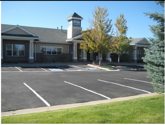
15200 E Orchard Rd, Centennial, CO 80016

NEARBY LISTINGS FOR SALE OR LEASE
Property Detail
15200 E Orchard Rd
Denver-Aurora-Centennial, CO
Prairie Creek Sub 3Rd Flg
2073-19-1-14-002
50361-000-002 LOT 2 PRAIRIE CREEK SUB 3RD FLG
Storebuilding
Arapahoe
AO
Colorado
08005C0481L
002,2
2024
0.81 AC
2025
Centennial
085000
Denver
10,160 SF
DEMOGRAPHICS near 15200 E Orchard Rd
1 Mile
3 Mile
5 Mile
2024 Total Population
7,735
83,498
270,007
2029 Population
7,768
82,957
273,062
Pop Growth 2024-2029
+ 0.43%
(0.65%)
+ 1.13%
Average Age
43
39
39
2024 Total Households
2,769
30,152
102,944
HH Growth 2024-2029
+ 0.36%
(0.67%)
+ 1.30%
Median Household Inc
$148,388
$105,105
$93,604
Avg Household Size
2.70
2.70
2.60
2024 Avg HH Vehicles
2.00
2.00
2.00
Median Home Value
$723,498
$501,337
$467,911
Median Year Built
1996
1989
1990
Nearby Places
Map Layers
Map Styles
 Street
 Aerial
- Restaurants
- Banks
- Shops
- Fitness
- Groceries
PUBLIC TRANSPORTATION
AIRPORT
Denver International
DRIVE
WALK
Distance
Denver International
34 min
25.7 mi
SALE & LEASE HISTORY
LISTING DATE
SALE/LEASE

Apr 22, 2025
For Lease
Nearby Properties
Address
Land Use
TOTAL SIZE
Lot Size
Zoning
Address
Land Use
TOTAL SIZE
Lot Size
Zoning
234,214 SF
5.23 AC
Address
Land Use
TOTAL SIZE
Lot Size
Zoning
280,586 SF
60.97 AC
RPD
Address
Land Use
TOTAL SIZE
Lot Size
Zoning
284,862 SF
23.37 AC
PUD
Address
Land Use
TOTAL SIZE
Lot Size
Zoning
525,600 SF
57.90 AC
Address
Land Use
TOTAL SIZE
Lot Size
Zoning
246,768 SF
12.37 AC
PUD
Address
Land Use
TOTAL SIZE
Lot Size
Zoning
134,316 SF
26.52 AC
Address
Land Use
TOTAL SIZE
Lot Size
Zoning
216,853 SF
5.42 AC
PUD
Address
Land Use
TOTAL SIZE
Lot Size
Zoning
304,620 SF
23.95 AC
AMU
Address
Land Use
TOTAL SIZE
Lot Size
Zoning
103,811 SF
6.36 AC
RPD
Address
Land Use
TOTAL SIZE
Lot Size
Zoning
107,760 SF
5.41 AC
AMU
Address
Land Use
TOTAL SIZE
Lot Size
Zoning
253,296 SF
16.41 AC
Address
Land Use
TOTAL SIZE
Lot Size
Zoning
217,273 SF
18.28 AC
Address
Land Use
TOTAL SIZE
Lot Size
Zoning
171,600 SF
10.32 AC
AA2
Address
Land Use
TOTAL SIZE
Lot Size
Zoning
195,390 SF
14.78 AC
AI1
Address
Land Use
TOTAL SIZE
Lot Size
Zoning
281,429 SF
22.55 AC
PUD
Address
Land Use
TOTAL SIZE
Lot Size
Zoning
150,920 SF
12.18 AC
AA1
Address
Land Use
TOTAL SIZE
Lot Size
Zoning
337,765 SF
23.46 AC
Address
Land Use
TOTAL SIZE
Lot Size
Zoning
91.37 AC
Address
Land Use
TOTAL SIZE
Lot Size
Zoning
149,928 SF
10.73 AC
Address
Land Use
TOTAL SIZE
Lot Size
Zoning
166,431 SF
19.37 AC
Address
Land Use
TOTAL SIZE
Lot Size
Zoning
122,965 SF
12.30 AC
RPD
Address
Land Use
TOTAL SIZE
Lot Size
Zoning
12,726 SF
17.94 AC
Address
Land Use
TOTAL SIZE
Lot Size
Zoning
132,300 SF
11.09 AC
AMU
Address
Land Use
TOTAL SIZE
Lot Size
Zoning
288,737 SF
26.40 AC
AMU
Address
Land Use
TOTAL SIZE
Lot Size
Zoning
150,000 SF
10.83 AC
AA2
Address
Land Use
TOTAL SIZE
Lot Size
Zoning
106,000 SF
27.41 AC
Address
Land Use
TOTAL SIZE
Lot Size
Zoning
157,906 SF
14.47 AC
Address
Land Use
TOTAL SIZE
Lot Size
Zoning
141,360 SF
16.64 AC
Address
Land Use
TOTAL SIZE
Lot Size
Zoning
145,176 SF
11.11 AC
PUD
Address
Land Use
TOTAL SIZE
Lot Size
Zoning
119,074 SF
9.38 AC
AMU
The World's #1 Commercial Real Estate Marketplace
Connect with us
© 2026 CoStar Group
The information above has been obtained from sources believed reliable. While we do not doubt its accuracy we have not verified it and make no guarantee, warranty or representation about it. It is your responsibility to independently confirm its accuracy and completeness. Any projections, opinions, assumptions, or estimates used are for example only and do not represent the current or future performance of the property. The value of this transaction to you depends on tax and other factors which should be evaluated by your tax, financial, and legal advisors. You and your advisors should conduct a careful, independent investigation of the property to determine to your satisfaction the suitability of the property for your needs.