Property Record
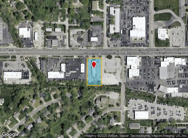
15204 Manchester Rd, Ballwin, MO 63011


NEARBY LISTINGS FOR SALE OR LEASE
Property Detail
15204 Manchester Rd
23S-54-0550
Survey 0000 Sec 34 Twn 45 Range 4
Restaurantbuilding
SURVEY 0000 SEC 34 TWN 45 RANGE 4 200 FEET W OF W LN OLD BALLWIN RD
AE
St. Louis
29099C0025F
Missouri
2024
0.87 AC
2025
West County
217923
St. Louis
4,732 SF
St. Louis, MO-IL
DEMOGRAPHICS near 15204 Manchester Rd
1 mile
3 mile
5 mile
2024 Total Population
11,131
75,635
154,223
2029 Population
10,939
73,726
150,636
Pop Growth 2024-2029
(1.72%)
(2.52%)
(2.33%)
Average Age
40
42
43
2024 Total Households
4,621
29,246
60,738
HH Growth 2024-2029
(1.73%)
(2.54%)
(2.34%)
Median Household Inc
$85,334
$112,768
$113,010
Avg Household Size
2.40
2.50
2.50
2024 Avg HH Vehicles
2.00
2.00
2.00
Median Home Value
$281,055
$332,858
$357,077
Median Year Built
1974
1977
1982
Nearby Places
Map Layers
Map Styles
 Street
 Aerial
Transit
 Traffic
 Biking
Places
Listings with unknown addresses are not visible on the map
- Restaurants
- Banks
- Shops
- Fitness
- Groceries
PUBLIC TRANSPORTATION
COMMUTER RAIL
Drive
Walk
Distance
19 min
9.5 mi
AIRPORT
St Louis Lambert International
Drive
Walk
Distance
St Louis Lambert International
36 min
23.1 mi
Nearby Properties
Address
Land Use
TOTAL SIZE
Lot Size
Zoning
Address
Land Use
TOTAL SIZE
Lot Size
Zoning
96.62 AC
R3
Address
Land Use
TOTAL SIZE
Lot Size
Zoning
156,253 SF
10.64 AC
87PC
Address
Land Use
TOTAL SIZE
Lot Size
Zoning
70.42 AC
87A
Address
Land Use
TOTAL SIZE
Lot Size
Zoning
65.15 AC
105NU
Address
Land Use
TOTAL SIZE
Lot Size
Zoning
60,928 SF
102.43 AC
NU
Address
Land Use
TOTAL SIZE
Lot Size
Zoning
403,166 SF
23.17 AC
R4
Address
Land Use
TOTAL SIZE
Lot Size
Zoning
201,837 SF
27.89 AC
83C
Address
Land Use
TOTAL SIZE
Lot Size
Zoning
223,598 SF
13.95 AC
93C-1
Address
Land Use
TOTAL SIZE
Lot Size
Zoning
175,448 SF
6.95 AC
Address
Land Use
TOTAL SIZE
Lot Size
Zoning
111,719 SF
9.51 AC
19C-1
Address
Land Use
TOTAL SIZE
Lot Size
Zoning
137,873 SF
10.99 AC
PCD
Address
Land Use
TOTAL SIZE
Lot Size
Zoning
7.32 AC
83C
Address
Land Use
TOTAL SIZE
Lot Size
Zoning
153,489 SF
13.01 AC
93C-1
Address
Land Use
TOTAL SIZE
Lot Size
Zoning
247,992 SF
5.72 AC
C
Address
Land Use
TOTAL SIZE
Lot Size
Zoning
2,154 SF
13.19 AC
S
Address
Land Use
TOTAL SIZE
Lot Size
Zoning
7,900 SF
31.95 AC
87A
Address
Land Use
TOTAL SIZE
Lot Size
Zoning
212,328 SF
17.98 AC
94R-1
Address
Land Use
TOTAL SIZE
Lot Size
Zoning
23.18 AC
105NU
Address
Land Use
TOTAL SIZE
Lot Size
Zoning
220,288 SF
11.09 AC
93R-4
Address
Land Use
TOTAL SIZE
Lot Size
Zoning
191,316 SF
7.61 AC
R4
Address
Land Use
TOTAL SIZE
Lot Size
Zoning
181,790 SF
16.64 AC
R4
Address
Land Use
TOTAL SIZE
Lot Size
Zoning
177,250 SF
23.87 AC
M1
Address
Land Use
TOTAL SIZE
Lot Size
Zoning
128,358 SF
12.01 AC
19C-3
Address
Land Use
TOTAL SIZE
Lot Size
Zoning
151,222 SF
11.50 AC
FPR6A
Address
Land Use
TOTAL SIZE
Lot Size
Zoning
115,050 SF
12.46 AC
87C
Address
Land Use
TOTAL SIZE
Lot Size
Zoning
174,250 SF
17.72 AC
R-6A
Address
Land Use
TOTAL SIZE
Lot Size
Zoning
247,511 SF
31.03 AC
19M-1
Address
Land Use
TOTAL SIZE
Lot Size
Zoning
29.26 AC
NU
Address
Land Use
TOTAL SIZE
Lot Size
Zoning
74,614 SF
8.05 AC
93C-1
Address
Land Use
TOTAL SIZE
Lot Size
Zoning
27.05 AC
R1
The World's #1 Commercial Real Estate Marketplace
Connect with us
© 2026 CoStar Group
The information above has been obtained from sources believed reliable. While we do not doubt its accuracy we have not verified it and make no guarantee, warranty or representation about it. It is your responsibility to independently confirm its accuracy and completeness. Any projections, opinions, assumptions, or estimates used are for example only and do not represent the current or future performance of the property. The value of this transaction to you depends on tax and other factors which should be evaluated by your tax, financial, and legal advisors. You and your advisors should conduct a careful, independent investigation of the property to determine to your satisfaction the suitability of the property for your needs.