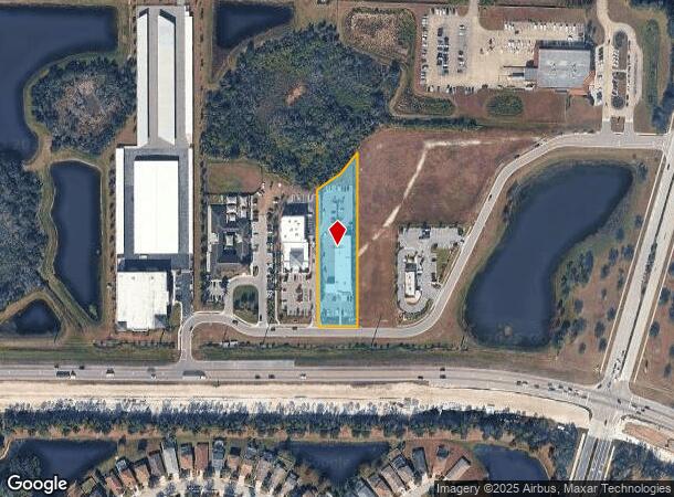
Property Record
15209 S Garnet Trl, Bradenton, FL 34211


NEARBY LISTINGS FOR SALE OR LEASE
-
-
View all Bradenton listings for sale on LoopNet.com
Property Detail
15209 S Garnet Trl
North Port-Sarasota-Bradenton, FL
Garnet Place
5822-0310-9
LOT 2G, GARNET PLACE PI #5822.0310/9
Servicestation
Manatee
X
Florida
12115C0075F
2g
2023
1.38 AC
2025
Manatee Outlying
002019
Tampa/St Petersburg
10,047 SF
DEMOGRAPHICS near 15209 S Garnet Trl
1 Mile
3 Mile
5 Mile
2024 Total Population
3,764
30,381
66,441
2029 Population
4,358
35,941
78,488
Pop Growth 2024-2029
+ 15.78%
+ 18.30%
+ 18.13%
Average Age
41
48
47
2024 Total Households
1,343
12,611
27,078
HH Growth 2024-2029
+ 15.12%
+ 17.55%
+ 17.28%
Median Household Inc
$106,851
$116,929
$114,536
Avg Household Size
2.70
2.40
2.40
2024 Avg HH Vehicles
2.00
2.00
2.00
Median Home Value
$453,553
$499,979
$475,560
Median Year Built
2008
2011
2010
Nearby Places
Map Layers
Map Styles
 Street
 Aerial
- Restaurants
- Banks
- Shops
- Fitness
- Groceries
PUBLIC TRANSPORTATION
AIRPORT
Sarasota/Bradenton International
DRIVE
WALK
Distance
Sarasota/Bradenton International
27 min
15.6 mi
Freight Ports
Port Manatee
DRIVE
WALK
Distance
Port Manatee
32 min
21.5 mi
SALE & LEASE HISTORY
LISTING DATE
SALE/LEASE

May 03, 2024
For Sale
Jun 26, 2023
For Sale
Jul 14, 2021
For Sale
Nearby Properties
Address
Land Use
TOTAL SIZE
Lot Size
Zoning
Address
Land Use
TOTAL SIZE
Lot Size
Zoning
602,710 SF
36.57 AC
PD-MU
Address
Land Use
TOTAL SIZE
Lot Size
Zoning
512,380 SF
11.24 AC
PD-MU
Address
Land Use
TOTAL SIZE
Lot Size
Zoning
409,825 SF
23.98 AC
PD-MU
Address
Land Use
TOTAL SIZE
Lot Size
Zoning
349,151 SF
16.70 AC
PD-MU
Address
Land Use
TOTAL SIZE
Lot Size
Zoning
405,307 SF
23.79 AC
PD-MU
Address
Land Use
TOTAL SIZE
Lot Size
Zoning
422,013 SF
11 AC
PD-MU
Address
Land Use
TOTAL SIZE
Lot Size
Zoning
235,732 SF
49.34 AC
PD-PI
Address
Land Use
TOTAL SIZE
Lot Size
Zoning
210,061 SF
45.14 AC
A-1 SUBURB
Address
Land Use
TOTAL SIZE
Lot Size
Zoning
158,863 SF
71.98 AC
A GENERAL
Address
Land Use
TOTAL SIZE
Lot Size
Zoning
112,961 SF
19.44 AC
Address
Land Use
TOTAL SIZE
Lot Size
Zoning
Address
Land Use
TOTAL SIZE
Lot Size
Zoning
345,812 SF
37 AC
PD-R
Address
Land Use
TOTAL SIZE
Lot Size
Zoning
180,574 SF
22 AC
A GENERAL
Address
Land Use
TOTAL SIZE
Lot Size
Zoning
75,712 SF
33.55 AC
PD-MU
Address
Land Use
TOTAL SIZE
Lot Size
Zoning
109,010 SF
7 AC
PD-MU
Address
Land Use
TOTAL SIZE
Lot Size
Zoning
125,678 SF
48.86 AC
Address
Land Use
TOTAL SIZE
Lot Size
Zoning
139,763 SF
6.66 AC
PD-MU
Address
Land Use
TOTAL SIZE
Lot Size
Zoning
78,773 SF
15.34 AC
Address
Land Use
TOTAL SIZE
Lot Size
Zoning
44,216 SF
74.28 AC
A,PD-R
Address
Land Use
TOTAL SIZE
Lot Size
Zoning
76,672 SF
15.39 AC
PD-C
Address
Land Use
TOTAL SIZE
Lot Size
Zoning
35,634 SF
20.68 AC
A GENERAL
Address
Land Use
TOTAL SIZE
Lot Size
Zoning
58,785 SF
5.49 AC
PD-MU
Address
Land Use
TOTAL SIZE
Lot Size
Zoning
47,803 SF
5 AC
PD-MU
Address
Land Use
TOTAL SIZE
Lot Size
Zoning
73,894 SF
14.99 AC
A GENERAL
Address
Land Use
TOTAL SIZE
Lot Size
Zoning
44,330 SF
1.69 AC
PD-MU
Address
Land Use
TOTAL SIZE
Lot Size
Zoning
10,827 SF
124.39 AC
A GENERAL
Address
Land Use
TOTAL SIZE
Lot Size
Zoning
33,971 SF
0.85 AC
PD-MU
Address
Land Use
TOTAL SIZE
Lot Size
Zoning
39,742 SF
8.98 AC
A GENERAL
Address
Land Use
TOTAL SIZE
Lot Size
Zoning
0.20 AC
A GENERAL
Address
Land Use
TOTAL SIZE
Lot Size
Zoning
26,572 SF
1.85 AC
PD-MU
The World's #1 Commercial Real Estate Marketplace
Connect with us
© 2025 CoStar Group
The information above has been obtained from sources believed reliable. While we do not doubt its accuracy we have not verified it and make no guarantee, warranty or representation about it. It is your responsibility to independently confirm its accuracy and completeness. Any projections, opinions, assumptions, or estimates used are for example only and do not represent the current or future performance of the property. The value of this transaction to you depends on tax and other factors which should be evaluated by your tax, financial, and legal advisors. You and your advisors should conduct a careful, independent investigation of the property to determine to your satisfaction the suitability of the property for your needs.