Property Record
1521 E 231St St, Steger, IL 60475

Property Detail
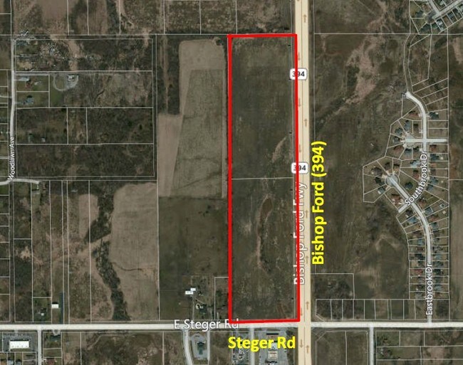
1521 E 231St St
32-35-402-005-0000
COOK
Agriculturalland
Illinois
B and X Area of moderate flood hazard, usually the area between the limits of the 100-year and 500-year floods.
17.59 AC
2023
Far South
2025
Chicago
829600
Chicago-Naperville-Elgin, IL-IN
NEARBY LISTINGS FOR SALE OR LEASE
DEMOGRAPHICS near 1521 E 231St St
1 mile
3 mile
5 mile
2025 Total Population
4,215
28,674
107,449
2030 Population
4,304
29,389
109,736
Pop Growth 2025-2030
+ 2.11%
+ 2.49%
+ 2.13%
Average Age
42
40
41
2025 Total Households
1,444
10,076
39,243
HH Growth 2025-2030
+ 1.80%
+ 2.33%
+ 1.92%
Median Household Inc
$90,926
$70,243
$73,189
Avg Household Size
2.70
2.70
2.60
2025 Avg HH Vehicles
2.00
2.00
2.00
Median Home Value
$184,967
$181,325
$215,856
Median Year Built
1978
1975
1975
Nearby Places
Map Layers
Map Styles
 Street
 Aerial
Transit
 Traffic
 Biking
Places
Listings with unknown addresses are not visible on the map
- Restaurants
- Banks
- Shops
- Fitness
- Groceries
PUBLIC TRANSPORTATION
COMMUTER RAIL
Dyer Amtrak (Cardinal - Amtrak)
Drive
Walk
Distance
Dyer Amtrak (Cardinal - Amtrak)
13 min
6.2 mi
211Th Street (Lincoln Highway) Station (Metra Electric Line - Northeast Illinois Regional Commuter Railroad (Metra))
Drive
Walk
Distance
211Th Street (Lincoln Highway) Station (Metra Electric Line - Northeast Illinois Regional Commuter Railroad (Metra))
18 min
9.4 mi
AIRPORT
Chicago Midway International
Drive
Walk
Distance
Chicago Midway International
44 min
30.1 mi
Freight Ports
Port Milwaukee
Drive
Walk
Distance
Port Milwaukee
147 min
116.4 mi
Nearby Properties
Address
Land Use
TOTAL SIZE
Lot Size
Zoning
Address
Land Use
TOTAL SIZE
Lot Size
Zoning
90,526 SF
22.99 AC
R33
Address
Land Use
TOTAL SIZE
Lot Size
Zoning
8.27 AC
Address
Land Use
TOTAL SIZE
Lot Size
Zoning
10.54 AC
Address
Land Use
TOTAL SIZE
Lot Size
Zoning
49,866 SF
5.57 AC
Address
Land Use
TOTAL SIZE
Lot Size
Zoning
Address
Land Use
TOTAL SIZE
Lot Size
Zoning
87,105 SF
7.74 AC
Address
Land Use
TOTAL SIZE
Lot Size
Zoning
2,845,012 SF
133.73 AC
Address
Land Use
TOTAL SIZE
Lot Size
Zoning
304,256 SF
21.50 AC
Address
Land Use
TOTAL SIZE
Lot Size
Zoning
64,295 SF
2.23 AC
Address
Land Use
TOTAL SIZE
Lot Size
Zoning
26.61 AC
Address
Land Use
TOTAL SIZE
Lot Size
Zoning
36.48 AC
Address
Land Use
TOTAL SIZE
Lot Size
Zoning
628 SF
4.91 AC
Address
Land Use
TOTAL SIZE
Lot Size
Zoning
182,300 SF
144.71 AC
Address
Land Use
TOTAL SIZE
Lot Size
Zoning
562,369 SF
50 AC
Address
Land Use
TOTAL SIZE
Lot Size
Zoning
155,690 SF
17.59 AC
Address
Land Use
TOTAL SIZE
Lot Size
Zoning
Address
Land Use
TOTAL SIZE
Lot Size
Zoning
284,100 SF
12.60 AC
Address
Land Use
TOTAL SIZE
Lot Size
Zoning
35.43 AC
Address
Land Use
TOTAL SIZE
Lot Size
Zoning
Address
Land Use
TOTAL SIZE
Lot Size
Zoning
4,528 SF
43.65 AC
Address
Land Use
TOTAL SIZE
Lot Size
Zoning
269,840 SF
16.04 AC
Address
Land Use
TOTAL SIZE
Lot Size
Zoning
119,200 SF
11.12 AC
Address
Land Use
TOTAL SIZE
Lot Size
Zoning
68,315 SF
5.31 AC
Address
Land Use
TOTAL SIZE
Lot Size
Zoning
377,200 SF
18.90 AC
Address
Land Use
TOTAL SIZE
Lot Size
Zoning
17,931 SF
32.75 AC
Address
Land Use
TOTAL SIZE
Lot Size
Zoning
11.87 AC
Address
Land Use
TOTAL SIZE
Lot Size
Zoning
221,842 SF
30.94 AC
Address
Land Use
TOTAL SIZE
Lot Size
Zoning
118,135 SF
9.42 AC
Address
Land Use
TOTAL SIZE
Lot Size
Zoning
Address
Land Use
TOTAL SIZE
Lot Size
Zoning
40 AC
The World's #1 Commercial Real Estate Marketplace
Connect with us
© 2026 CoStar Group
The information above has been obtained from sources believed reliable. While we do not doubt its accuracy we have not verified it and make no guarantee, warranty or representation about it. It is your responsibility to independently confirm its accuracy and completeness. Any projections, opinions, assumptions, or estimates used are for example only and do not represent the current or future performance of the property. The value of this transaction to you depends on tax and other factors which should be evaluated by your tax, financial, and legal advisors. You and your advisors should conduct a careful, independent investigation of the property to determine to your satisfaction the suitability of the property for your needs.