Property Record
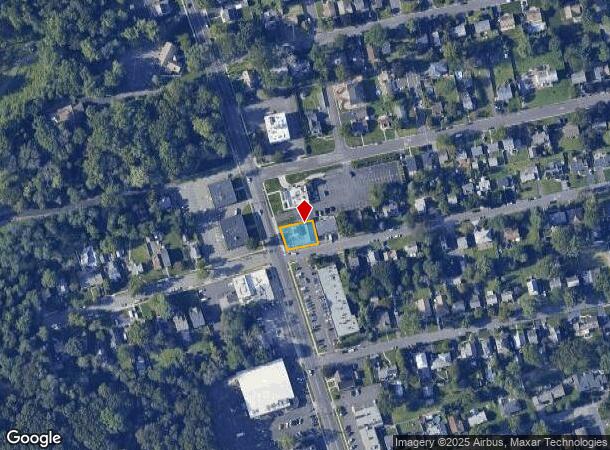
1521 Park Ave, South Plainfield, NJ 07080


NEARBY LISTINGS FOR SALE OR LEASE
Property Detail
1521 Park Ave
New York-Jersey City-White Plains, NY-NJ
Oakdale Park
22-00056-0000-00024
69X94 AL
Commercialnec
Middlesex
X
New Jersey
34023C0032F
24
2024
0.15 AC
2025
Route 287 East
000902
Northern New Jersey
1,344 SF
DEMOGRAPHICS near 1521 Park Ave
1 Mile
3 Mile
5 Mile
2024 Total Population
13,152
135,542
322,591
2029 Population
13,132
133,970
319,835
Pop Growth 2024-2029
(0.15%)
(1.16%)
(0.85%)
Average Age
42
39
40
2024 Total Households
4,395
43,093
106,727
HH Growth 2024-2029
(0.23%)
(1.16%)
(0.89%)
Median Household Inc
$103,972
$94,355
$116,105
Avg Household Size
2.80
3.00
2.90
2024 Avg HH Vehicles
2.00
2.00
2.00
Median Home Value
$391,506
$413,160
$469,305
Median Year Built
1956
1959
1963
Nearby Places
Map Layers
Map Styles
 Street
 Aerial
- Restaurants
- Banks
- Shops
- Fitness
- Groceries
PUBLIC TRANSPORTATION
COMMUTER RAIL
Plainfield (Raritan Valley Line - NJ Transit Commuter Rail (NJ Transit))
DRIVE
WALK
Distance
Plainfield (Raritan Valley Line - NJ Transit Commuter Rail (NJ Transit))
4 min
1.8 mi
Netherwood (Raritan Valley Line - NJ Transit Commuter Rail (NJ Transit))
DRIVE
WALK
Distance
Netherwood (Raritan Valley Line - NJ Transit Commuter Rail (NJ Transit))
7 min
2.5 mi
AIRPORT
Newark Liberty International
DRIVE
WALK
Distance
Newark Liberty International
32 min
20.2 mi
Freight Ports
New York Container Terminal
DRIVE
WALK
Distance
New York Container Terminal
29 min
15.9 mi
SALE & LEASE HISTORY
LISTING DATE
SALE/LEASE

Jun 01, 2017
For Lease
Apr 10, 2020
For Sale
Nearby Properties
Address
Land Use
TOTAL SIZE
Lot Size
Zoning
Address
Land Use
TOTAL SIZE
Lot Size
Zoning
17.01 AC
RM
Address
Land Use
TOTAL SIZE
Lot Size
Zoning
20.08 AC
RML1
Address
Land Use
TOTAL SIZE
Lot Size
Zoning
17.64 AC
R10A
Address
Land Use
TOTAL SIZE
Lot Size
Zoning
16.21 AC
RM
Address
Land Use
TOTAL SIZE
Lot Size
Zoning
233,217 SF
36.91 AC
LI5
Address
Land Use
TOTAL SIZE
Lot Size
Zoning
96.22 AC
RA
Address
Land Use
TOTAL SIZE
Lot Size
Zoning
9.38 AC
RM
Address
Land Use
TOTAL SIZE
Lot Size
Zoning
19.84 AC
Address
Land Use
TOTAL SIZE
Lot Size
Zoning
9.85 AC
10A
Address
Land Use
TOTAL SIZE
Lot Size
Zoning
30.80 AC
R10
Address
Land Use
TOTAL SIZE
Lot Size
Zoning
4.74 AC
NC
Address
Land Use
TOTAL SIZE
Lot Size
Zoning
19.84 AC
H-D
Address
Land Use
TOTAL SIZE
Lot Size
Zoning
44.51 AC
M3
Address
Land Use
TOTAL SIZE
Lot Size
Zoning
19.19 AC
R-3
Address
Land Use
TOTAL SIZE
Lot Size
Zoning
21.60 AC
M3
Address
Land Use
TOTAL SIZE
Lot Size
Zoning
11.20 AC
Address
Land Use
TOTAL SIZE
Lot Size
Zoning
0.39 AC
R5
Address
Land Use
TOTAL SIZE
Lot Size
Zoning
Address
Land Use
TOTAL SIZE
Lot Size
Zoning
5.30 AC
RM
Address
Land Use
TOTAL SIZE
Lot Size
Zoning
Address
Land Use
TOTAL SIZE
Lot Size
Zoning
43.03 AC
R-1
Address
Land Use
TOTAL SIZE
Lot Size
Zoning
4,900 SF
Address
Land Use
TOTAL SIZE
Lot Size
Zoning
50.50 AC
O
Address
Land Use
TOTAL SIZE
Lot Size
Zoning
11.50 AC
UR
Address
Land Use
TOTAL SIZE
Lot Size
Zoning
39,840 SF
10.97 AC
LI1
Address
Land Use
TOTAL SIZE
Lot Size
Zoning
3.68 AC
R-7
Address
Land Use
TOTAL SIZE
Lot Size
Zoning
18.02 AC
OBC3
Address
Land Use
TOTAL SIZE
Lot Size
Zoning
52,960 SF
7.84 AC
ER
Address
Land Use
TOTAL SIZE
Lot Size
Zoning
316.14 AC
Address
Land Use
TOTAL SIZE
Lot Size
Zoning
139,939 SF
16.22 AC
OBC4
The World's #1 Commercial Real Estate Marketplace
Connect with us
© 2025 CoStar Group
The information above has been obtained from sources believed reliable. While we do not doubt its accuracy we have not verified it and make no guarantee, warranty or representation about it. It is your responsibility to independently confirm its accuracy and completeness. Any projections, opinions, assumptions, or estimates used are for example only and do not represent the current or future performance of the property. The value of this transaction to you depends on tax and other factors which should be evaluated by your tax, financial, and legal advisors. You and your advisors should conduct a careful, independent investigation of the property to determine to your satisfaction the suitability of the property for your needs.