Property Record
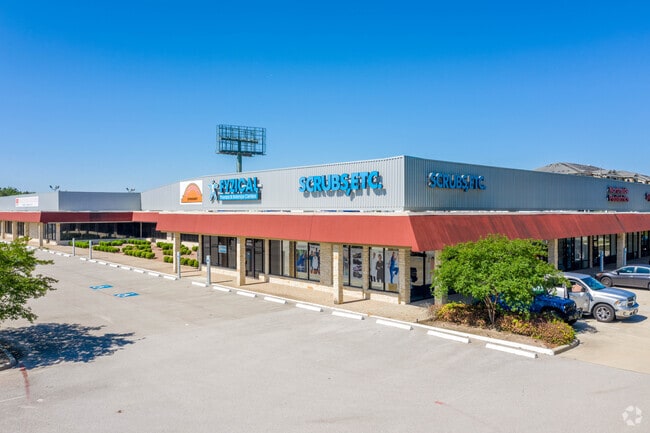
15210 N Interstate 45 S, Conroe, TX 77384


Property Detail
15210 N Interstate 45 S
0577-00-00501
A0577 - TOBY THOMAS, TRACT 5-A, 7, (AKA 1488 CROSSING 01 #2015039005), ACRES 4.222
Commercialnec
MONTGOMERY
6
Texas
C and X Area of minimal flood hazard, usually depicted on FIRMs as above the 500-year flood level.
4.22 AC
2024
Montgomery County
2025
Houston
690610
Houston-Pasadena-The Woodlands, TX
43,574 SF
NEARBY LISTINGS FOR SALE OR LEASE
DEMOGRAPHICS near 15210 N Interstate 45 S
1 mile
3 mile
5 mile
2025 Total Population
6,106
48,579
124,769
2030 Population
7,139
56,894
146,298
Pop Growth 2025-2030
+ 16.92%
+ 17.12%
+ 17.26%
Average Age
40
39
39
2025 Total Households
2,752
18,563
47,075
HH Growth 2025-2030
+ 17.55%
+ 17.73%
+ 17.85%
Median Household Inc
$76,557
$106,815
$102,219
Avg Household Size
2.20
2.60
2.60
2025 Avg HH Vehicles
2.00
2.00
2.00
Median Home Value
$416,784
$381,645
$395,873
Median Year Built
2010
2010
2006
Nearby Places
Map Layers
Map Styles
 Street
 Aerial
Transit
 Traffic
 Biking
Places
Listings with unknown addresses are not visible on the map
- Restaurants
- Banks
- Shops
- Fitness
- Groceries
PUBLIC TRANSPORTATION
AIRPORT
George Bush Intcntl/Houston
Drive
Walk
Distance
George Bush Intcntl/Houston
31 min
26.1 mi
SALE & LEASE HISTORY
LISTING DATE
SALE/LEASE

Sep 28, 2017
For Lease
Sep 24, 2016
For Lease
Dec 14, 2017
For Lease
Nearby Properties
Address
Land Use
TOTAL SIZE
Lot Size
Zoning
Address
Land Use
TOTAL SIZE
Lot Size
Zoning
743,246 SF
40.65 AC
Address
Land Use
TOTAL SIZE
Lot Size
Zoning
465,986 SF
21.55 AC
Address
Land Use
TOTAL SIZE
Lot Size
Zoning
813,318 SF
20.95 AC
Address
Land Use
TOTAL SIZE
Lot Size
Zoning
508,985 SF
29.47 AC
6
Address
Land Use
TOTAL SIZE
Lot Size
Zoning
502,255 SF
15.42 AC
6
Address
Land Use
TOTAL SIZE
Lot Size
Zoning
535,690 SF
15.89 AC
Address
Land Use
TOTAL SIZE
Lot Size
Zoning
109,842 SF
25.58 AC
Address
Land Use
TOTAL SIZE
Lot Size
Zoning
579,596 SF
1.32 AC
Address
Land Use
TOTAL SIZE
Lot Size
Zoning
494,633 SF
17.70 AC
Address
Land Use
TOTAL SIZE
Lot Size
Zoning
880,985 SF
99.32 AC
6
Address
Land Use
TOTAL SIZE
Lot Size
Zoning
189,537 SF
13.52 AC
Address
Land Use
TOTAL SIZE
Lot Size
Zoning
315,885 SF
17.41 AC
Address
Land Use
TOTAL SIZE
Lot Size
Zoning
344,233 SF
15.24 AC
Address
Land Use
TOTAL SIZE
Lot Size
Zoning
292,274 SF
7.55 AC
Address
Land Use
TOTAL SIZE
Lot Size
Zoning
477,509 SF
41.53 AC
Address
Land Use
TOTAL SIZE
Lot Size
Zoning
441,092 SF
29.09 AC
Address
Land Use
TOTAL SIZE
Lot Size
Zoning
269,565 SF
14.58 AC
Address
Land Use
TOTAL SIZE
Lot Size
Zoning
427,151 SF
17.98 AC
Address
Land Use
TOTAL SIZE
Lot Size
Zoning
44,672 SF
13.08 AC
Address
Land Use
TOTAL SIZE
Lot Size
Zoning
304,482 SF
12.15 AC
Address
Land Use
TOTAL SIZE
Lot Size
Zoning
222,721 SF
10.28 AC
Address
Land Use
TOTAL SIZE
Lot Size
Zoning
274,494 SF
28.96 AC
Address
Land Use
TOTAL SIZE
Lot Size
Zoning
291,173 SF
17.77 AC
6
Address
Land Use
TOTAL SIZE
Lot Size
Zoning
221,485 SF
12.36 AC
Address
Land Use
TOTAL SIZE
Lot Size
Zoning
159,144 SF
32.27 AC
Address
Land Use
TOTAL SIZE
Lot Size
Zoning
221,955 SF
7.71 AC
Address
Land Use
TOTAL SIZE
Lot Size
Zoning
261,490 SF
125.16 AC
6
Address
Land Use
TOTAL SIZE
Lot Size
Zoning
270,204 SF
9.85 AC
Address
Land Use
TOTAL SIZE
Lot Size
Zoning
158,093 SF
13.88 AC
The World's #1 Commercial Real Estate Marketplace
Connect with us
© 2026 CoStar Group
The information above has been obtained from sources believed reliable. While we do not doubt its accuracy we have not verified it and make no guarantee, warranty or representation about it. It is your responsibility to independently confirm its accuracy and completeness. Any projections, opinions, assumptions, or estimates used are for example only and do not represent the current or future performance of the property. The value of this transaction to you depends on tax and other factors which should be evaluated by your tax, financial, and legal advisors. You and your advisors should conduct a careful, independent investigation of the property to determine to your satisfaction the suitability of the property for your needs.