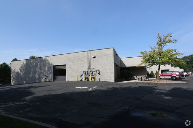
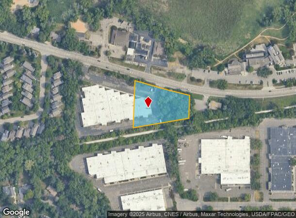
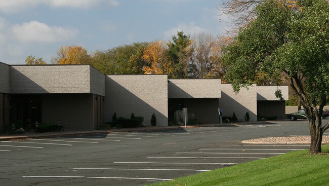
Property Record
15225 Minnetonka Blvd, Minnetonka, MN 55345

Current Lease Availabilities
NEARBY LISTINGS FOR SALE OR LEASE
Property Detail
15225 Minnetonka Blvd
16-117-22-34-0002
Unplatted 16 117 22
Industrialgeneral
UNPLATTED 16 117 22 COM AT A PT OF INTERSEC OF CTR LINE OF MTKA BLVD WITH E LINE OF SE 1/4 OF SW 1/4 TH NWLY ALONG SAID CTR LINE 318 5/10 FT TH S PAR TO E LINE OF T N 323X120X324X260
X
Hennepin
27053C0336F
Minnesota
2024
1.44 AC
2024
Southwest
026205
Minneapolis/St Paul
9,000 SF
Minneapolis-St. Paul-Bloomington, MN-WI
DEMOGRAPHICS near 15225 Minnetonka Blvd
1 Mile
3 Mile
5 Mile
2024 Total Population
4,162
46,644
145,544
2029 Population
4,058
46,014
143,582
Pop Growth 2024-2029
(2.50%)
(1.35%)
(1.35%)
Average Age
43
44
42
2024 Total Households
1,588
19,383
62,828
HH Growth 2024-2029
(2.71%)
(1.44%)
(1.46%)
Median Household Inc
$135,743
$121,198
$101,255
Avg Household Size
2.50
2.30
2.20
2024 Avg HH Vehicles
2.00
2.00
2.00
Median Home Value
$438,767
$452,560
$410,101
Median Year Built
1964
1975
1978
Nearby Places
- Restaurants
- Banks
- Shops
- Fitness
- Groceries
PUBLIC TRANSPORTATION
AIRPORT
Minneapolis-St Paul International/Wold-Chamberlain
DRIVE
WALK
Distance
Minneapolis-St Paul International/Wold-Chamberlain
26 min
18.4 mi
Freight Ports
Port Milwaukee
DRIVE
WALK
Distance
Port Milwaukee
392 min
351.3 mi
Nearby Properties
Address
Land Use
TOTAL SIZE
Lot Size
Zoning
Address
Land Use
TOTAL SIZE
Lot Size
Zoning
324,564 SF
32.54 AC
PID
Address
Land Use
TOTAL SIZE
Lot Size
Zoning
18.27 AC
Address
Land Use
TOTAL SIZE
Lot Size
Zoning
20,710 SF
7.69 AC
PID
Address
Land Use
TOTAL SIZE
Lot Size
Zoning
20,710 SF
7.69 AC
PID
Address
Land Use
TOTAL SIZE
Lot Size
Zoning
6.47 AC
Address
Land Use
TOTAL SIZE
Lot Size
Zoning
19.46 AC
PUD
Address
Land Use
TOTAL SIZE
Lot Size
Zoning
11.93 AC
PID
Address
Land Use
TOTAL SIZE
Lot Size
Zoning
2.38 AC
Address
Land Use
TOTAL SIZE
Lot Size
Zoning
171,900 SF
39.17 AC
B1
Address
Land Use
TOTAL SIZE
Lot Size
Zoning
2.18 AC
Address
Land Use
TOTAL SIZE
Lot Size
Zoning
94,155 SF
2.06 AC
PUD
Address
Land Use
TOTAL SIZE
Lot Size
Zoning
2.12 AC
Address
Land Use
TOTAL SIZE
Lot Size
Zoning
43,180 SF
10.28 AC
PID
Address
Land Use
TOTAL SIZE
Lot Size
Zoning
43,180 SF
10.94 AC
PID
Address
Land Use
TOTAL SIZE
Lot Size
Zoning
14,239 SF
4.44 AC
PID
Address
Land Use
TOTAL SIZE
Lot Size
Zoning
0.07 AC
Address
Land Use
TOTAL SIZE
Lot Size
Zoning
81,834 SF
16.20 AC
PID
Address
Land Use
TOTAL SIZE
Lot Size
Zoning
7.51 AC
Address
Land Use
TOTAL SIZE
Lot Size
Zoning
46,726 SF
2.65 AC
PUD
Address
Land Use
TOTAL SIZE
Lot Size
Zoning
0.48 AC
Address
Land Use
TOTAL SIZE
Lot Size
Zoning
123,774 SF
11.93 AC
PID
Address
Land Use
TOTAL SIZE
Lot Size
Zoning
2,676 SF
3.17 AC
PUD
Address
Land Use
TOTAL SIZE
Lot Size
Zoning
98,096 SF
4.38 AC
R4PURD
Address
Land Use
TOTAL SIZE
Lot Size
Zoning
7.06 AC
PUD
Address
Land Use
TOTAL SIZE
Lot Size
Zoning
49,925 SF
18.37 AC
B1
Address
Land Use
TOTAL SIZE
Lot Size
Zoning
1.37 AC
Address
Land Use
TOTAL SIZE
Lot Size
Zoning
71,990 SF
5.85 AC
PID
Address
Land Use
TOTAL SIZE
Lot Size
Zoning
3,440 SF
3.52 AC
R-1
Address
Land Use
TOTAL SIZE
Lot Size
Zoning
7,209 SF
2.53 AC
B1
Address
Land Use
TOTAL SIZE
Lot Size
Zoning
4 AC
R4PURD
The World's #1 Commercial Real Estate Marketplace
Connect with us
© 2025 CoStar Group
The information above has been obtained from sources believed reliable. While we do not doubt its accuracy we have not verified it and make no guarantee, warranty or representation about it. It is your responsibility to independently confirm its accuracy and completeness. Any projections, opinions, assumptions, or estimates used are for example only and do not represent the current or future performance of the property. The value of this transaction to you depends on tax and other factors which should be evaluated by your tax, financial, and legal advisors. You and your advisors should conduct a careful, independent investigation of the property to determine to your satisfaction the suitability of the property for your needs.