Property Record
15236 N 59Th Ave, Glendale, AZ 85306
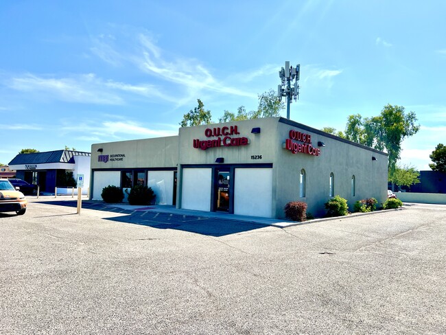
Property Detail
15236 N 59Th Ave
200-72-012C
PT NE4 SEC 7 S 78F OF N 230F OF E 233F OF N 305F OF NE4 NE4 SEC 7 EX E 55F & N 55F RDS
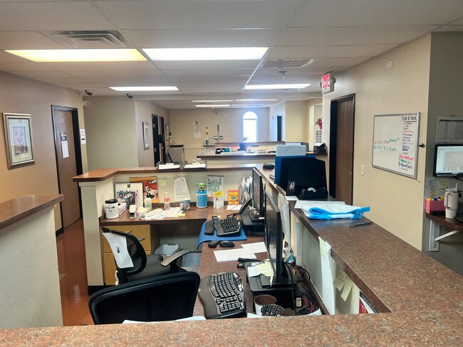
Medicalbuilding
MARICOPA
C-2
Arizona
C and X Area of minimal flood hazard, usually depicted on FIRMs as above the 500-year flood level.
0.32 AC
2025
Arrowhead
2025
Phoenix
104216
Phoenix-Mesa-Chandler, AZ
3,454 SF
NEARBY LISTINGS FOR SALE OR LEASE
-
-
-
-
-
-
-
-
-
-
-
No Photo
-
-
View all Glendale listings for lease on LoopNet.com
DEMOGRAPHICS near 15236 N 59Th Ave
1 mile
3 mile
5 mile
2025 Total Population
14,486
122,116
377,102
2030 Population
15,021
125,684
390,309
Pop Growth 2025-2030
+ 3.69%
+ 2.92%
+ 3.50%
Average Age
40
40
40
2025 Total Households
5,161
44,139
143,477
HH Growth 2025-2030
+ 3.64%
+ 2.94%
+ 3.67%
Median Household Inc
$86,112
$93,240
$77,547
Avg Household Size
2.60
2.60
2.50
2025 Avg HH Vehicles
2.00
2.00
2.00
Median Home Value
$384,246
$426,850
$404,174
Median Year Built
1981
1985
1986
Nearby Places
Map Layers
Map Styles
 Street
 Aerial
Layers
 Traffic
 Biking
Places
Listings with unknown addresses are not visible on the map
- Restaurants
- Banks
- Shops
- Fitness
- Groceries
PUBLIC TRANSPORTATION
AIRPORT
Phoenix Sky Harbor International
Drive
Walk
Distance
Phoenix Sky Harbor International
36 min
23.6 mi
SALE & LEASE HISTORY
LISTING DATE
SALE/LEASE

Sep 22, 2024
For Lease
Aug 08, 2024
For Sale
Nearby Properties
Address
Land Use
TOTAL SIZE
Lot Size
Zoning
Address
Land Use
TOTAL SIZE
Lot Size
Zoning
45,900 SF
11.09 AC
PAD
Address
Land Use
TOTAL SIZE
Lot Size
Zoning
1,019,640 SF
32.10 AC
GO
Address
Land Use
TOTAL SIZE
Lot Size
Zoning
1,360,424 SF
88.31 AC
C-BP
Address
Land Use
TOTAL SIZE
Lot Size
Zoning
7,916 SF
5.26 AC
C-C
Address
Land Use
TOTAL SIZE
Lot Size
Zoning
742,601 SF
295.89 AC
R-8
Address
Land Use
TOTAL SIZE
Lot Size
Zoning
812,333 SF
31.75 AC
SR-30
Address
Land Use
TOTAL SIZE
Lot Size
Zoning
284,223 SF
10.02 AC
C-C
Address
Land Use
TOTAL SIZE
Lot Size
Zoning
708,928 SF
44.86 AC
Address
Land Use
TOTAL SIZE
Lot Size
Zoning
1.93 AC
C-C
Address
Land Use
TOTAL SIZE
Lot Size
Zoning
360,026 SF
74.94 AC
R-6
Address
Land Use
TOTAL SIZE
Lot Size
Zoning
238,942 SF
36.87 AC
R1-8
Address
Land Use
TOTAL SIZE
Lot Size
Zoning
0.47 AC
Address
Land Use
TOTAL SIZE
Lot Size
Zoning
19.95 AC
AG
Address
Land Use
TOTAL SIZE
Lot Size
Zoning
401,879 SF
67.89 AC
Address
Land Use
TOTAL SIZE
Lot Size
Zoning
226,169 SF
20.48 AC
Address
Land Use
TOTAL SIZE
Lot Size
Zoning
348,803 SF
15.91 AC
PAD
Address
Land Use
TOTAL SIZE
Lot Size
Zoning
314,839 SF
39 AC
R-18
Address
Land Use
TOTAL SIZE
Lot Size
Zoning
240,863 SF
35.55 AC
Address
Land Use
TOTAL SIZE
Lot Size
Zoning
241,669 SF
12.78 AC
PAD
Address
Land Use
TOTAL SIZE
Lot Size
Zoning
219,122 SF
33 AC
R-6
Address
Land Use
TOTAL SIZE
Lot Size
Zoning
440,494 SF
26.25 AC
PAD
Address
Land Use
TOTAL SIZE
Lot Size
Zoning
392,885 SF
17.67 AC
M-H
Address
Land Use
TOTAL SIZE
Lot Size
Zoning
126,781 SF
10.06 AC
C-C
Address
Land Use
TOTAL SIZE
Lot Size
Zoning
344,908 SF
20.69 AC
C-C
Address
Land Use
TOTAL SIZE
Lot Size
Zoning
378,106 SF
19.18 AC
R-3
Address
Land Use
TOTAL SIZE
Lot Size
Zoning
126,814 SF
31.56 AC
R17
Address
Land Use
TOTAL SIZE
Lot Size
Zoning
244,979 SF
35.16 AC
C-BP
Address
Land Use
TOTAL SIZE
Lot Size
Zoning
200,658 SF
23.14 AC
C-BP
Address
Land Use
TOTAL SIZE
Lot Size
Zoning
245,400 SF
22.90 AC
PAD
Address
Land Use
TOTAL SIZE
Lot Size
Zoning
115,027 SF
14.46 AC
R-8
The World's #1 Commercial Real Estate Marketplace
Connect with us
© 2026 CoStar Group
The information above has been obtained from sources believed reliable. While we do not doubt its accuracy we have not verified it and make no guarantee, warranty or representation about it. It is your responsibility to independently confirm its accuracy and completeness. Any projections, opinions, assumptions, or estimates used are for example only and do not represent the current or future performance of the property. The value of this transaction to you depends on tax and other factors which should be evaluated by your tax, financial, and legal advisors. You and your advisors should conduct a careful, independent investigation of the property to determine to your satisfaction the suitability of the property for your needs.