Property Record
1525 Bowmansville Rd, Mohnton, PA 19540

NEARBY LISTINGS FOR SALE OR LEASE
-
-
View all Mohnton listings for sale on LoopNet.com
Property Detail
1525 Bowmansville Rd
040-02845-0-0000
1525 BOWMANSVILLE RD
Shipyard
Lancaster
A
Pennsylvania
42071C0210F
49.40 AC
2024
Lancaster County
2025
Philadelphia
012601
Lancaster, PA
12,218 SF
DEMOGRAPHICS near 1525 Bowmansville Rd
1 Mile
3 Mile
5 Mile
2024 Total Population
1,663
10,577
26,829
2029 Population
1,654
10,551
26,735
Pop Growth 2024-2029
(0.54%)
(0.25%)
(0.35%)
Average Age
40
41
41
2024 Total Households
577
3,783
9,590
HH Growth 2024-2029
(0.52%)
(0.24%)
(0.40%)
Median Household Inc
$81,782
$98,965
$93,783
Avg Household Size
2.90
2.80
2.80
2024 Avg HH Vehicles
3.00
3.00
2.00
Median Home Value
$248,520
$273,321
$273,851
Median Year Built
1981
1984
1980
Nearby Places
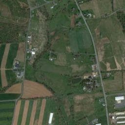
Map Layers
Map Styles
 Street
 Aerial
- Restaurants
- Banks
- Shops
- Fitness
- Groceries
Nearby Properties
Address
Land Use
TOTAL SIZE
Lot Size
Zoning
Address
Land Use
TOTAL SIZE
Lot Size
Zoning
1,588,498 SF
150.55 AC
I-1
Address
Land Use
TOTAL SIZE
Lot Size
Zoning
73,417 SF
15.70 AC
RL
Address
Land Use
TOTAL SIZE
Lot Size
Zoning
75,227 SF
10.60 AC
R-60
Address
Land Use
TOTAL SIZE
Lot Size
Zoning
270,732 SF
9.50 AC
I-1
Address
Land Use
TOTAL SIZE
Lot Size
Zoning
98,846 SF
32.95 AC
Address
Land Use
TOTAL SIZE
Lot Size
Zoning
61,835 SF
10.51 AC
LI
Address
Land Use
TOTAL SIZE
Lot Size
Zoning
61,373 SF
5.77 AC
NC
Address
Land Use
TOTAL SIZE
Lot Size
Zoning
68,000 SF
8.10 AC
I-1
Address
Land Use
TOTAL SIZE
Lot Size
Zoning
16,640 SF
9.90 AC
Address
Land Use
TOTAL SIZE
Lot Size
Zoning
98,042 SF
16.79 AC
HC
Address
Land Use
TOTAL SIZE
Lot Size
Zoning
10,399 SF
107.90 AC
AG
Address
Land Use
TOTAL SIZE
Lot Size
Zoning
70,188 SF
5.40 AC
I-1
Address
Land Use
TOTAL SIZE
Lot Size
Zoning
9,244 SF
206.10 AC
Address
Land Use
TOTAL SIZE
Lot Size
Zoning
21,286 SF
88.30 AC
AG
Address
Land Use
TOTAL SIZE
Lot Size
Zoning
12,109 SF
6.20 AC
RM
Address
Land Use
TOTAL SIZE
Lot Size
Zoning
26,152 SF
14.80 AC
Address
Land Use
TOTAL SIZE
Lot Size
Zoning
56,400 SF
12.06 AC
Address
Land Use
TOTAL SIZE
Lot Size
Zoning
6,624 SF
103.60 AC
AG
Address
Land Use
TOTAL SIZE
Lot Size
Zoning
5,430 SF
106.50 AC
AG
Address
Land Use
TOTAL SIZE
Lot Size
Zoning
38,260 SF
4.30 AC
I1
Address
Land Use
TOTAL SIZE
Lot Size
Zoning
15,566 SF
10.60 AC
AG
Address
Land Use
TOTAL SIZE
Lot Size
Zoning
5,644 SF
56.55 AC
AG
Address
Land Use
TOTAL SIZE
Lot Size
Zoning
22,672 SF
4.57 AC
Address
Land Use
TOTAL SIZE
Lot Size
Zoning
3,903 SF
94.80 AC
AG
Address
Land Use
TOTAL SIZE
Lot Size
Zoning
3,501 SF
108 AC
AG
Address
Land Use
TOTAL SIZE
Lot Size
Zoning
4,207 SF
60 AC
AG
Address
Land Use
TOTAL SIZE
Lot Size
Zoning
10,523 SF
22.12 AC
AG
Address
Land Use
TOTAL SIZE
Lot Size
Zoning
5,910 SF
63 AC
AG
Address
Land Use
TOTAL SIZE
Lot Size
Zoning
7,499 SF
77 AC
AG
The World's #1 Commercial Real Estate Marketplace
Connect with us
© 2026 CoStar Group
The information above has been obtained from sources believed reliable. While we do not doubt its accuracy we have not verified it and make no guarantee, warranty or representation about it. It is your responsibility to independently confirm its accuracy and completeness. Any projections, opinions, assumptions, or estimates used are for example only and do not represent the current or future performance of the property. The value of this transaction to you depends on tax and other factors which should be evaluated by your tax, financial, and legal advisors. You and your advisors should conduct a careful, independent investigation of the property to determine to your satisfaction the suitability of the property for your needs.