Property Record
132 Cr, Hutto, TX 78634


Property Detail
132 Cr
R020320
AW0184 AW0184 - DAUGHERTY, P.O. SUR., ACRES 95.25
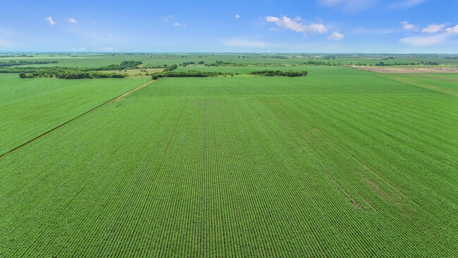
Vacantlandnec
WILLIAMSON
B and X Area of moderate flood hazard, usually the area between the limits of the 100-year and 500-year floods.
Texas
2024
95.25 AC
2025
Georgetown
020813
Austin
1,488 SF
Austin-Round Rock-San Marcos, TX
NEARBY LISTINGS FOR SALE OR LEASE
DEMOGRAPHICS near 132 Cr
1 mile
3 mile
5 mile
2025 Total Population
950
17,472
44,903
2030 Population
1,125
20,678
52,346
Pop Growth 2025-2030
+ 18.42%
+ 18.35%
+ 16.58%
Average Age
36
35
36
2025 Total Households
326
5,479
14,552
HH Growth 2025-2030
+ 19.02%
+ 18.71%
+ 16.97%
Median Household Inc
$153,813
$121,710
$119,149
Avg Household Size
2.90
3.10
3.00
2025 Avg HH Vehicles
3.00
3.00
2.00
Median Home Value
$538,760
$416,536
$396,838
Median Year Built
2011
2010
2010
Nearby Places
Map Layers
Map Styles
 Street
 Aerial
Layers
 Traffic
 Biking
Places
Listings with unknown addresses are not visible on the map
- Restaurants
- Banks
- Shops
- Fitness
- Groceries
PUBLIC TRANSPORTATION
COMMUTER RAIL
Taylor Amtrak (Texas Eagle - Amtrak)
Drive
Walk
Distance
Taylor Amtrak (Texas Eagle - Amtrak)
16 min
8.0 mi
AIRPORT
Austin-Bergstrom International
Drive
Walk
Distance
Austin-Bergstrom International
56 min
40.0 mi
Freight Ports
Calhoun Port
Drive
Walk
Distance
Calhoun Port
216 min
183.0 mi
SALE & LEASE HISTORY
LISTING DATE
SALE/LEASE

May 17, 2021
For Sale
Nearby Properties
Address
Land Use
TOTAL SIZE
Lot Size
Zoning
Address
Land Use
TOTAL SIZE
Lot Size
Zoning
243,097 SF
15.73 AC
Address
Land Use
TOTAL SIZE
Lot Size
Zoning
29,616 SF
158.84 AC
Address
Land Use
TOTAL SIZE
Lot Size
Zoning
304,814 SF
17.04 AC
Address
Land Use
TOTAL SIZE
Lot Size
Zoning
243,097 SF
12.53 AC
Address
Land Use
TOTAL SIZE
Lot Size
Zoning
205,355 SF
13.24 AC
Address
Land Use
TOTAL SIZE
Lot Size
Zoning
297,577 SF
28.22 AC
Address
Land Use
TOTAL SIZE
Lot Size
Zoning
192 SF
102.19 AC
Address
Land Use
TOTAL SIZE
Lot Size
Zoning
183,955 SF
30.94 AC
Address
Land Use
TOTAL SIZE
Lot Size
Zoning
83,300 SF
10.35 AC
Address
Land Use
TOTAL SIZE
Lot Size
Zoning
108,594 SF
3.18 AC
Address
Land Use
TOTAL SIZE
Lot Size
Zoning
49.63 AC
Address
Land Use
TOTAL SIZE
Lot Size
Zoning
42.43 AC
Address
Land Use
TOTAL SIZE
Lot Size
Zoning
68,939 SF
1.28 AC
Address
Land Use
TOTAL SIZE
Lot Size
Zoning
146.58 AC
Address
Land Use
TOTAL SIZE
Lot Size
Zoning
216.42 AC
Address
Land Use
TOTAL SIZE
Lot Size
Zoning
38,893 SF
4.18 AC
Address
Land Use
TOTAL SIZE
Lot Size
Zoning
29,944 SF
10.56 AC
Address
Land Use
TOTAL SIZE
Lot Size
Zoning
6,366 SF
26.29 AC
Address
Land Use
TOTAL SIZE
Lot Size
Zoning
29.42 AC
Address
Land Use
TOTAL SIZE
Lot Size
Zoning
17,105 SF
11.69 AC
Address
Land Use
TOTAL SIZE
Lot Size
Zoning
51.19 AC
Address
Land Use
TOTAL SIZE
Lot Size
Zoning
49.84 AC
Address
Land Use
TOTAL SIZE
Lot Size
Zoning
1,891 SF
15.97 AC
Address
Land Use
TOTAL SIZE
Lot Size
Zoning
32,167 SF
3.21 AC
Address
Land Use
TOTAL SIZE
Lot Size
Zoning
38,850 SF
3.25 AC
Address
Land Use
TOTAL SIZE
Lot Size
Zoning
8,192 SF
8 AC
Address
Land Use
TOTAL SIZE
Lot Size
Zoning
24,208 SF
2.52 AC
Address
Land Use
TOTAL SIZE
Lot Size
Zoning
8,534 SF
2.35 AC
Address
Land Use
TOTAL SIZE
Lot Size
Zoning
10,311 SF
12.80 AC
Address
Land Use
TOTAL SIZE
Lot Size
Zoning
10,131 SF
1.53 AC
The World's #1 Commercial Real Estate Marketplace
Connect with us
© 2026 CoStar Group
The information above has been obtained from sources believed reliable. While we do not doubt its accuracy we have not verified it and make no guarantee, warranty or representation about it. It is your responsibility to independently confirm its accuracy and completeness. Any projections, opinions, assumptions, or estimates used are for example only and do not represent the current or future performance of the property. The value of this transaction to you depends on tax and other factors which should be evaluated by your tax, financial, and legal advisors. You and your advisors should conduct a careful, independent investigation of the property to determine to your satisfaction the suitability of the property for your needs.