Property Record
1525 Distribution Dr, Murfreesboro, TN 37127

Property Detail
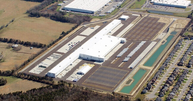
1525 Distribution Dr
126-050.14-000
RUTHERFORD
Warehouse
Tennessee
B and X Area of moderate flood hazard, usually the area between the limits of the 100-year and 500-year floods.
3
2025
74.59 AC
2025
Southeast
041201
Nashville
381,749 SF
Nashville-Davidson--Murfreesboro--Franklin, TN
NEARBY LISTINGS FOR SALE OR LEASE
DEMOGRAPHICS near 1525 Distribution Dr
1 mile
3 mile
5 mile
2025 Total Population
2,010
39,530
96,517
2030 Population
2,198
42,781
104,377
Pop Growth 2025-2030
+ 9.35%
+ 8.22%
+ 8.14%
Average Age
38
36
36
2025 Total Households
744
15,468
37,067
HH Growth 2025-2030
+ 9.54%
+ 8.41%
+ 8.41%
Median Household Inc
$104,510
$69,802
$68,185
Avg Household Size
2.70
2.50
2.50
2025 Avg HH Vehicles
2.00
2.00
2.00
Median Home Value
$382,712
$379,689
$384,908
Median Year Built
2010
1997
1995
Nearby Places
Map Layers
Map Styles
 Street
 Aerial
Layers
 Traffic
 Biking
Places
Listings with unknown addresses are not visible on the map
- Restaurants
- Banks
- Shops
- Fitness
- Groceries
PUBLIC TRANSPORTATION
AIRPORT
Nashville International
Drive
Walk
Distance
Nashville International
41 min
32.4 mi
Freight Ports
Port of Mobile
Drive
Walk
Distance
Port of Mobile
496 min
453.4 mi
SALE & LEASE HISTORY
LISTING DATE
SALE/LEASE

Oct 18, 2016
For Lease
May 01, 2017
For Lease
Nearby Properties
Address
Land Use
TOTAL SIZE
Lot Size
Zoning
Address
Land Use
TOTAL SIZE
Lot Size
Zoning
1,015,800 SF
83.85 AC
Address
Land Use
TOTAL SIZE
Lot Size
Zoning
520,119 SF
34.82 AC
Address
Land Use
TOTAL SIZE
Lot Size
Zoning
844,480 SF
49.10 AC
Address
Land Use
TOTAL SIZE
Lot Size
Zoning
295,095 SF
80 AC
Address
Land Use
TOTAL SIZE
Lot Size
Zoning
166,471 SF
91.35 AC
Address
Land Use
TOTAL SIZE
Lot Size
Zoning
2,472 SF
44.34 AC
Address
Land Use
TOTAL SIZE
Lot Size
Zoning
120,225 SF
20.40 AC
Address
Land Use
TOTAL SIZE
Lot Size
Zoning
172,096 SF
25 AC
Address
Land Use
TOTAL SIZE
Lot Size
Zoning
4,842 SF
17.80 AC
Address
Land Use
TOTAL SIZE
Lot Size
Zoning
5,130 SF
17.07 AC
RM16
Address
Land Use
TOTAL SIZE
Lot Size
Zoning
4,409 SF
21.60 AC
RM16
Address
Land Use
TOTAL SIZE
Lot Size
Zoning
479,592 SF
56.83 AC
I
Address
Land Use
TOTAL SIZE
Lot Size
Zoning
120,638 SF
20.55 AC
Address
Land Use
TOTAL SIZE
Lot Size
Zoning
6,253 SF
38.80 AC
RM16
Address
Land Use
TOTAL SIZE
Lot Size
Zoning
379,080 SF
24.20 AC
Address
Land Use
TOTAL SIZE
Lot Size
Zoning
1,945 SF
16.22 AC
RM16
Address
Land Use
TOTAL SIZE
Lot Size
Zoning
121,104 SF
24.92 AC
Address
Land Use
TOTAL SIZE
Lot Size
Zoning
3,147 SF
8.51 AC
Address
Land Use
TOTAL SIZE
Lot Size
Zoning
6,788 SF
13.80 AC
RM12
Address
Land Use
TOTAL SIZE
Lot Size
Zoning
230,940 SF
20.70 AC
Address
Land Use
TOTAL SIZE
Lot Size
Zoning
364,000 SF
24.15 AC
Address
Land Use
TOTAL SIZE
Lot Size
Zoning
5,620 SF
15.20 AC
RM16
Address
Land Use
TOTAL SIZE
Lot Size
Zoning
4,660 SF
19.41 AC
RM10
Address
Land Use
TOTAL SIZE
Lot Size
Zoning
163,465 SF
23.38 AC
Address
Land Use
TOTAL SIZE
Lot Size
Zoning
1,990 SF
7.42 AC
Address
Land Use
TOTAL SIZE
Lot Size
Zoning
365,556 SF
28.55 AC
Address
Land Use
TOTAL SIZE
Lot Size
Zoning
150,620 SF
25.97 AC
Address
Land Use
TOTAL SIZE
Lot Size
Zoning
210,230 SF
90 AC
Address
Land Use
TOTAL SIZE
Lot Size
Zoning
4,506 SF
11.12 AC
RM16
The World's #1 Commercial Real Estate Marketplace
Connect with us
© 2026 CoStar Group
The information above has been obtained from sources believed reliable. While we do not doubt its accuracy we have not verified it and make no guarantee, warranty or representation about it. It is your responsibility to independently confirm its accuracy and completeness. Any projections, opinions, assumptions, or estimates used are for example only and do not represent the current or future performance of the property. The value of this transaction to you depends on tax and other factors which should be evaluated by your tax, financial, and legal advisors. You and your advisors should conduct a careful, independent investigation of the property to determine to your satisfaction the suitability of the property for your needs.