Property Record
1525 E Fairfield Rd, High Point, NC 27263
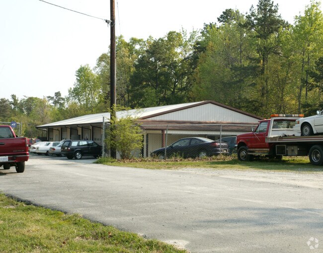

Property Detail
1525 E Fairfield Rd
0161839
3AC HAYWORTH
Industrialgeneral
Guilford
R-5
North Carolina
B and X Area of moderate flood hazard, usually the area between the limits of the 100-year and 500-year floods.
3
2024
2.87 AC
2025
High Point/SW Guilford Cty
016600
Greensboro/Winston-Salem
4,800 SF
Greensboro-High Point, NC
NEARBY LISTINGS FOR SALE OR LEASE
DEMOGRAPHICS near 1525 E Fairfield Rd
1 mile
3 mile
5 mile
2025 Total Population
2,869
27,833
78,697
2030 Population
2,937
28,523
81,604
Pop Growth 2025-2030
+ 2.37%
+ 2.48%
+ 3.69%
Average Age
41
40
39
2025 Total Households
1,092
11,081
29,668
HH Growth 2025-2030
+ 2.47%
+ 2.55%
+ 3.96%
Median Household Inc
$56,201
$50,027
$48,333
Avg Household Size
2.60
2.50
2.40
2025 Avg HH Vehicles
2.00
2.00
2.00
Median Home Value
$175,457
$181,567
$179,678
Median Year Built
1967
1975
1973
Nearby Places
Map Layers
Map Styles
 Street
 Aerial
Transit
 Traffic
 Biking
Places
Listings with unknown addresses are not visible on the map
- Restaurants
- Banks
- Shops
- Fitness
- Groceries
PUBLIC TRANSPORTATION
COMMUTER RAIL
High Point Station (Piedmont - North Carolina by Train (NC Train))
Drive
Walk
Distance
High Point Station (Piedmont - North Carolina by Train (NC Train))
9 min
4.8 mi
AIRPORT
Piedmont Triad International
Drive
Walk
Distance
Piedmont Triad International
32 min
19.4 mi
Nearby Properties
Address
Land Use
TOTAL SIZE
Lot Size
Zoning
Address
Land Use
TOTAL SIZE
Lot Size
Zoning
299,349 SF
21.76 AC
RM-16
Address
Land Use
TOTAL SIZE
Lot Size
Zoning
355,633 SF
63.42 AC
HI
Address
Land Use
TOTAL SIZE
Lot Size
Zoning
204,276 SF
68.51 AC
M-2
Address
Land Use
TOTAL SIZE
Lot Size
Zoning
196,353 SF
13.76 AC
RC
Address
Land Use
TOTAL SIZE
Lot Size
Zoning
156,010 SF
36.21 AC
M-1
Address
Land Use
TOTAL SIZE
Lot Size
Zoning
127,800 SF
57.35 AC
M-1
Address
Land Use
TOTAL SIZE
Lot Size
Zoning
245,194 SF
23.44 AC
LI
Address
Land Use
TOTAL SIZE
Lot Size
Zoning
107,417 SF
6.46 AC
RM-26
Address
Land Use
TOTAL SIZE
Lot Size
Zoning
101,612 SF
15.82 AC
RM-16
Address
Land Use
TOTAL SIZE
Lot Size
Zoning
79,740 SF
24.38 AC
R-5
Address
Land Use
TOTAL SIZE
Lot Size
Zoning
299,394 SF
8.60 AC
M-2
Address
Land Use
TOTAL SIZE
Lot Size
Zoning
90,000 SF
15.36 AC
M-2
Address
Land Use
TOTAL SIZE
Lot Size
Zoning
89,183 SF
17.12 AC
GB
Address
Land Use
TOTAL SIZE
Lot Size
Zoning
170,516 SF
17.08 AC
RC
Address
Land Use
TOTAL SIZE
Lot Size
Zoning
10,810 SF
158.27 AC
PNR
Address
Land Use
TOTAL SIZE
Lot Size
Zoning
7,680 SF
9.95 AC
GRD
Address
Land Use
TOTAL SIZE
Lot Size
Zoning
69,094 SF
5.47 AC
M-2
Address
Land Use
TOTAL SIZE
Lot Size
Zoning
109,950 SF
28.29 AC
M-1
Address
Land Use
TOTAL SIZE
Lot Size
Zoning
28.20 AC
RR
Address
Land Use
TOTAL SIZE
Lot Size
Zoning
98,287 SF
14.50 AC
RM-16
Address
Land Use
TOTAL SIZE
Lot Size
Zoning
105,050 SF
9.58 AC
RM-16
Address
Land Use
TOTAL SIZE
Lot Size
Zoning
7,168 SF
7.51 AC
GRD
Address
Land Use
TOTAL SIZE
Lot Size
Zoning
45,224 SF
8.03 AC
OI
Address
Land Use
TOTAL SIZE
Lot Size
Zoning
73,658 SF
8.45 AC
B-1
Address
Land Use
TOTAL SIZE
Lot Size
Zoning
234,080 SF
14.88 AC
HI
Address
Land Use
TOTAL SIZE
Lot Size
Zoning
13,311 SF
162.92 AC
HI
Address
Land Use
TOTAL SIZE
Lot Size
Zoning
48,913 SF
2.25 AC
B-1
Address
Land Use
TOTAL SIZE
Lot Size
Zoning
74,290 SF
7.31 AC
RC
Address
Land Use
TOTAL SIZE
Lot Size
Zoning
47,822 SF
5.76 AC
SU R-10
Address
Land Use
TOTAL SIZE
Lot Size
Zoning
35,620 SF
5.47 AC
M-2
The World's #1 Commercial Real Estate Marketplace
Connect with us
© 2026 CoStar Group
The information above has been obtained from sources believed reliable. While we do not doubt its accuracy we have not verified it and make no guarantee, warranty or representation about it. It is your responsibility to independently confirm its accuracy and completeness. Any projections, opinions, assumptions, or estimates used are for example only and do not represent the current or future performance of the property. The value of this transaction to you depends on tax and other factors which should be evaluated by your tax, financial, and legal advisors. You and your advisors should conduct a careful, independent investigation of the property to determine to your satisfaction the suitability of the property for your needs.