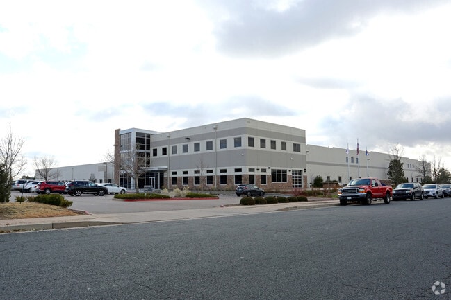
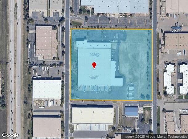
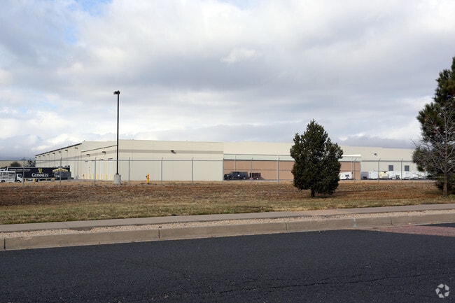
Property Record
1525 N Newport Rd, Colorado Springs, CO 80916

NEARBY LISTINGS FOR SALE OR LEASE
Property Detail
1525 N Newport Rd
Colorado Springs, CO
T R W Sub No 4
64240-06-001
LOT 2 TRW SUB FIL NO 4
Warehouse
El Paso
X
Colorado
08041C0761G
2
2024
13 AC
2025
Southeast
004008
Colorado Springs
107,400 SF
DEMOGRAPHICS near 1525 N Newport Rd
1 Mile
3 Mile
5 Mile
2024 Total Population
7,329
84,206
203,515
2029 Population
7,598
88,300
212,573
Pop Growth 2024-2029
+ 3.67%
+ 4.86%
+ 4.45%
Average Age
34
34
36
2024 Total Households
2,451
30,719
78,636
HH Growth 2024-2029
+ 3.88%
+ 5.29%
+ 4.73%
Median Household Inc
$64,418
$54,716
$60,679
Avg Household Size
2.90
2.60
2.50
2024 Avg HH Vehicles
2.00
2.00
2.00
Median Home Value
$238,067
$257,492
$306,450
Median Year Built
1986
1983
1979
Nearby Places
- Restaurants
- Banks
- Shops
- Fitness
- Groceries
PUBLIC TRANSPORTATION
AIRPORT
City of Colorado Springs Municipal
DRIVE
WALK
Distance
City of Colorado Springs Municipal
10 min
4.2 mi
Freight Ports
Tulsa Port Of Catoosa
DRIVE
WALK
Distance
Tulsa Port Of Catoosa
736 min
690.7 mi
Nearby Properties
Address
Land Use
TOTAL SIZE
Lot Size
Zoning
Address
Land Use
TOTAL SIZE
Lot Size
Zoning
3,486,127 SF
69.25 AC
APD APZ1 A
Address
Land Use
TOTAL SIZE
Lot Size
Zoning
339,516 SF
1,090.76 AC
APD RPZ AP
Address
Land Use
TOTAL SIZE
Lot Size
Zoning
229,081 SF
9.87 AC
MX-N CU SS
Address
Land Use
TOTAL SIZE
Lot Size
Zoning
6,000 SF
3,790.85 AC
Address
Land Use
TOTAL SIZE
Lot Size
Zoning
200,642 SF
6.65 AC
MX-M HR AO
Address
Land Use
TOTAL SIZE
Lot Size
Zoning
233,194 SF
30 AC
R-1 6 AO S
Address
Land Use
TOTAL SIZE
Lot Size
Zoning
162,945 SF
20.05 AC
BP/CR CU A
Address
Land Use
TOTAL SIZE
Lot Size
Zoning
117,648 SF
3,971.89 AC
APD
Address
Land Use
TOTAL SIZE
Lot Size
Zoning
89,487 SF
Address
Land Use
TOTAL SIZE
Lot Size
Zoning
87,577 SF
14.24 AC
CS CAD-O
Address
Land Use
TOTAL SIZE
Lot Size
Zoning
704,240 SF
41.99 AC
BP/CR UV A
Address
Land Use
TOTAL SIZE
Lot Size
Zoning
78,815 SF
Address
Land Use
TOTAL SIZE
Lot Size
Zoning
98,638 SF
7.22 AC
MX-M AO
Address
Land Use
TOTAL SIZE
Lot Size
Zoning
23,535 SF
15.91 AC
BP/CR AO
Address
Land Use
TOTAL SIZE
Lot Size
Zoning
48,255 SF
17.35 AC
A-5 CAD-O
Address
Land Use
TOTAL SIZE
Lot Size
Zoning
69,078 SF
0.03 AC
Address
Land Use
TOTAL SIZE
Lot Size
Zoning
778.79 AC
APD AO RPZ
Address
Land Use
TOTAL SIZE
Lot Size
Zoning
45,328 SF
3.87 AC
R-4 CAD-O
Address
Land Use
TOTAL SIZE
Lot Size
Zoning
185,508 SF
16.48 AC
BP/CR AO S
Address
Land Use
TOTAL SIZE
Lot Size
Zoning
72,105 SF
11.32 AC
MX-T AO
Address
Land Use
TOTAL SIZE
Lot Size
Zoning
91,446 SF
12.60 AC
BP AO
Address
Land Use
TOTAL SIZE
Lot Size
Zoning
24,437 SF
4.78 AC
BP/CR AO
Address
Land Use
TOTAL SIZE
Lot Size
Zoning
105,617 SF
10.10 AC
PBC
Address
Land Use
TOTAL SIZE
Lot Size
Zoning
190,162 SF
15.06 AC
MX-M P AO
Address
Land Use
TOTAL SIZE
Lot Size
Zoning
118,700 SF
22.90 AC
R-1 6 AO
Address
Land Use
TOTAL SIZE
Lot Size
Zoning
210,964 SF
27.40 AC
BP APZ1 AO
Address
Land Use
TOTAL SIZE
Lot Size
Zoning
92.06 AC
APD APZ1 A
Address
Land Use
TOTAL SIZE
Lot Size
Zoning
130,569 SF
3.23 AC
Address
Land Use
TOTAL SIZE
Lot Size
Zoning
50,040 SF
8 AC
R-1 6 AO
Address
Land Use
TOTAL SIZE
Lot Size
Zoning
327,692 SF
16.30 AC
MX-N APZ2
The World's #1 Commercial Real Estate Marketplace
Connect with us
© 2025 CoStar Group
The information above has been obtained from sources believed reliable. While we do not doubt its accuracy we have not verified it and make no guarantee, warranty or representation about it. It is your responsibility to independently confirm its accuracy and completeness. Any projections, opinions, assumptions, or estimates used are for example only and do not represent the current or future performance of the property. The value of this transaction to you depends on tax and other factors which should be evaluated by your tax, financial, and legal advisors. You and your advisors should conduct a careful, independent investigation of the property to determine to your satisfaction the suitability of the property for your needs.