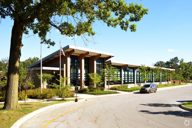
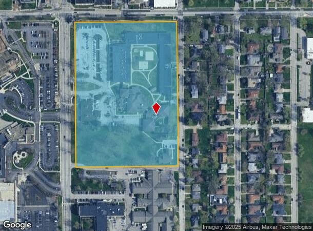
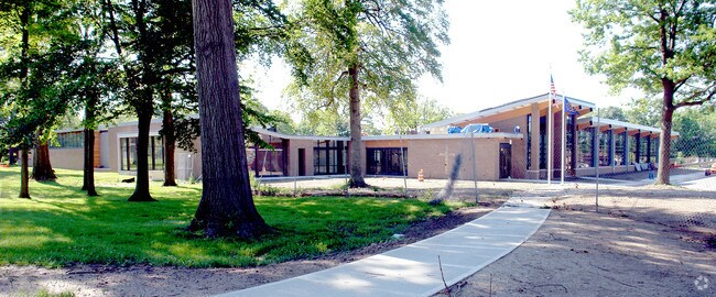
Property Record
1525 N Ritter Ave, Indianapolis, IN 46219
NEARBY LISTINGS FOR SALE OR LEASE
Property Detail
1525 N Ritter Ave
Indianapolis-Carmel-Anderson, IN
PT SE 1/4 S34 T16 R04 BEG 1757.33 N & 45 E OF SW COR P.O.B. N 845.78 E 602.05 S 845.8 W 602.05 TO BEG 11.686 AC
49-07-34-149-005.000-701
Marion
Religious
Indiana
0
156
2024
11.69 AC
360900
Lawrence/East County
77,518 SF
Indianapolis
DEMOGRAPHICS near 1525 N Ritter Ave
1 Mile
3 Mile
5 Mile
2024 Total Population
13,987
99,540
270,997
2029 Population
13,834
99,937
271,534
Pop Growth 2024-2029
(1.09%)
+ 0.40%
+ 0.20%
Average Age
40
38
37
2024 Total Households
6,093
40,836
115,329
HH Growth 2024-2029
(1.25%)
+ 0.26%
+ 0.17%
Median Household Inc
$42,727
$41,707
$48,624
Avg Household Size
2.20
2.30
2.20
2024 Avg HH Vehicles
2.00
1.00
1.00
Median Home Value
$150,077
$120,482
$155,007
Median Year Built
1953
1952
1958
Nearby Places
Map Layers
Map Styles
 Street
 Aerial
- Restaurants
- Banks
- Shops
- Fitness
- Groceries
PUBLIC TRANSPORTATION
COMMUTER RAIL
Indianapolis (Cardinal - Amtrak)
DRIVE
WALK
Distance
Indianapolis (Cardinal - Amtrak)
13 min
7.0 mi
AIRPORT
Indianapolis International
DRIVE
WALK
Distance
Indianapolis International
36 min
20.9 mi
Freight Ports
Port of Toledo
DRIVE
WALK
Distance
Port of Toledo
266 min
222.9 mi
Nearby Properties
Address
Land Use
TOTAL SIZE
Lot Size
Zoning
Address
Land Use
TOTAL SIZE
Lot Size
Zoning
1,202,700 SF
77.25 AC
ZO01
Address
Land Use
TOTAL SIZE
Lot Size
Zoning
25,146 SF
28.58 AC
ZO01
Address
Land Use
TOTAL SIZE
Lot Size
Zoning
47.10 AC
ZO01
Address
Land Use
TOTAL SIZE
Lot Size
Zoning
2,451 SF
0.46 AC
ZO01
Address
Land Use
TOTAL SIZE
Lot Size
Zoning
6,000 SF
8.79 AC
ZO01
Address
Land Use
TOTAL SIZE
Lot Size
Zoning
4,588 SF
24.33 AC
ZO01
Address
Land Use
TOTAL SIZE
Lot Size
Zoning
3.82 AC
ZO01
Address
Land Use
TOTAL SIZE
Lot Size
Zoning
713,497 SF
69.91 AC
ZO01
Address
Land Use
TOTAL SIZE
Lot Size
Zoning
3,523 SF
2.39 AC
ZO01
Address
Land Use
TOTAL SIZE
Lot Size
Zoning
1,768 SF
30.88 AC
ZO01
Address
Land Use
TOTAL SIZE
Lot Size
Zoning
925,384 SF
49.48 AC
ZO01
Address
Land Use
TOTAL SIZE
Lot Size
Zoning
268,930 SF
20.55 AC
ZO01
Address
Land Use
TOTAL SIZE
Lot Size
Zoning
269,450 SF
5.85 AC
Address
Land Use
TOTAL SIZE
Lot Size
Zoning
8,054 SF
20.62 AC
Address
Land Use
TOTAL SIZE
Lot Size
Zoning
71,800 SF
1.88 AC
ZO01
Address
Land Use
TOTAL SIZE
Lot Size
Zoning
254,641 SF
29.53 AC
Address
Land Use
TOTAL SIZE
Lot Size
Zoning
6,252 SF
17.02 AC
ZO01
Address
Land Use
TOTAL SIZE
Lot Size
Zoning
616,065 SF
51.20 AC
ZO01
Address
Land Use
TOTAL SIZE
Lot Size
Zoning
6.53 AC
ZO01
Address
Land Use
TOTAL SIZE
Lot Size
Zoning
1,282,569 SF
65.04 AC
ZO01
Address
Land Use
TOTAL SIZE
Lot Size
Zoning
1,538 SF
14.49 AC
ZO01
Address
Land Use
TOTAL SIZE
Lot Size
Zoning
593,228 SF
34.14 AC
ZO01
Address
Land Use
TOTAL SIZE
Lot Size
Zoning
14,482 SF
8.89 AC
ZO01
Address
Land Use
TOTAL SIZE
Lot Size
Zoning
25,047 SF
0.45 AC
ZO01
Address
Land Use
TOTAL SIZE
Lot Size
Zoning
53,988 SF
13.35 AC
ZO01
Address
Land Use
TOTAL SIZE
Lot Size
Zoning
1.85 AC
ZO01
Address
Land Use
TOTAL SIZE
Lot Size
Zoning
29,624 SF
2.56 AC
ZO01
Address
Land Use
TOTAL SIZE
Lot Size
Zoning
69,463 SF
8.94 AC
ZO01
Address
Land Use
TOTAL SIZE
Lot Size
Zoning
132,254 SF
8.84 AC
ZO01
The World's #1 Commercial Real Estate Marketplace
Connect with us
© 2026 CoStar Group
The information above has been obtained from sources believed reliable. While we do not doubt its accuracy we have not verified it and make no guarantee, warranty or representation about it. It is your responsibility to independently confirm its accuracy and completeness. Any projections, opinions, assumptions, or estimates used are for example only and do not represent the current or future performance of the property. The value of this transaction to you depends on tax and other factors which should be evaluated by your tax, financial, and legal advisors. You and your advisors should conduct a careful, independent investigation of the property to determine to your satisfaction the suitability of the property for your needs.