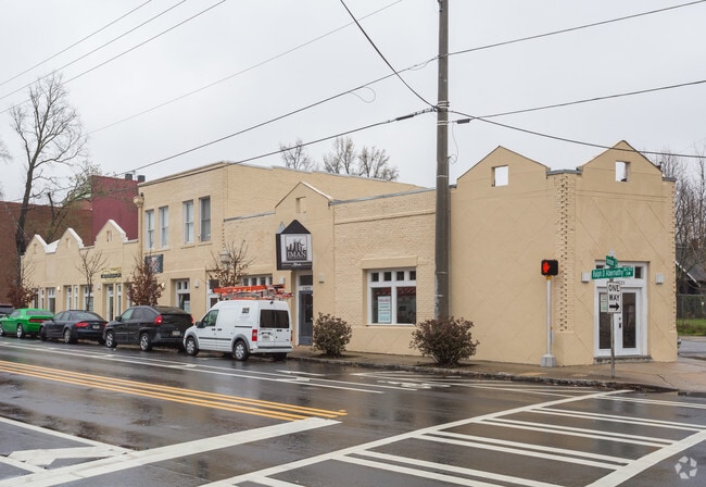
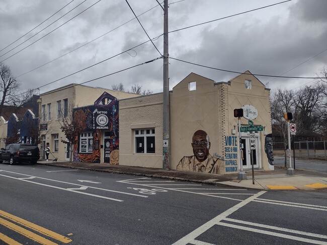
Property Record
1525 Ralph David Abernathy Blvd Sw, Atlanta, GA 30310
Current Lease Availabilities
NEARBY LISTINGS FOR SALE OR LEASE
Property Detail
1525 Ralph David Abernathy Blvd Sw
Atlanta-Sandy Springs-Roswell, GA
West Wood Sub
14-0149-0002-028-2
KA ACCELERATED TAX AND INSURANCE SERVICE
Storebuilding
Fulton
X
Georgia
13121C0352F
81,83
2024
0.30 AC
2025
College Park/SW Atl
004000
Atlanta
6,262 SF
DEMOGRAPHICS near 1525 Ralph David Abernathy Blvd Sw
1 Mile
3 Mile
5 Mile
2024 Total Population
12,181
108,140
334,508
2029 Population
12,752
113,945
349,218
Pop Growth 2024-2029
+ 4.69%
+ 5.37%
+ 4.40%
Average Age
40
38
37
2024 Total Households
5,196
43,946
149,891
HH Growth 2024-2029
+ 4.73%
+ 5.71%
+ 4.63%
Median Household Inc
$49,452
$39,039
$62,624
Avg Household Size
2.20
2.10
2.00
2024 Avg HH Vehicles
1.00
1.00
1.00
Median Home Value
$315,909
$270,588
$325,077
Median Year Built
1950
1968
1987
Nearby Places
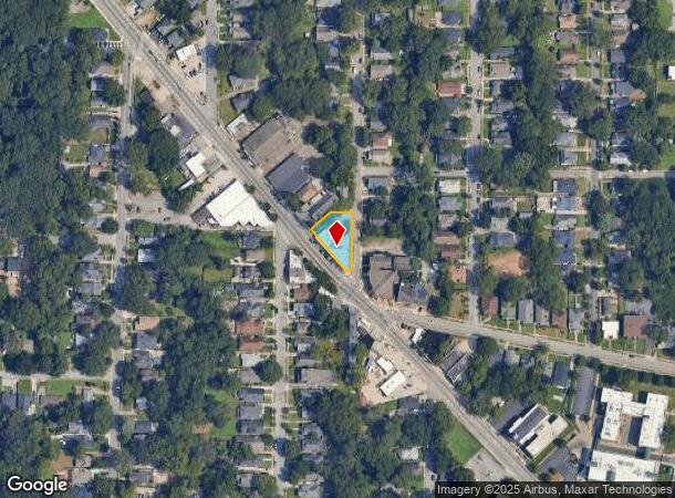
Map Layers
Map Styles
 Street
 Aerial
- Restaurants
- Banks
- Shops
- Fitness
- Groceries
PUBLIC TRANSPORTATION
TRANSIT/SUBWAY
West Lake (Blue Line - Metropolitan Atlanta Rapid Transit Authority (MARTA))
DRIVE
WALK
Distance
West Lake (Blue Line - Metropolitan Atlanta Rapid Transit Authority (MARTA))
2 min
17 min
0.9 mi
COMMUTER RAIL
DRIVE
WALK
Distance
14 min
7.9 mi
AIRPORT
Hartsfield - Jackson Atlanta International
DRIVE
WALK
Distance
Hartsfield - Jackson Atlanta International
19 min
10.9 mi
Nearby Properties
Address
Land Use
TOTAL SIZE
Lot Size
Zoning
Address
Land Use
TOTAL SIZE
Lot Size
Zoning
19.94 AC
SPI1
Address
Land Use
TOTAL SIZE
Lot Size
Zoning
11.74 AC
I1
Address
Land Use
TOTAL SIZE
Lot Size
Zoning
9.80 AC
C5
Address
Land Use
TOTAL SIZE
Lot Size
Zoning
9 AC
C5
Address
Land Use
TOTAL SIZE
Lot Size
Zoning
10.27 AC
C5
Address
Land Use
TOTAL SIZE
Lot Size
Zoning
61.57 AC
C5
Address
Land Use
TOTAL SIZE
Lot Size
Zoning
10,954,869 SF
28.88 AC
C3
Address
Land Use
TOTAL SIZE
Lot Size
Zoning
1.55 AC
SPI1
Address
Land Use
TOTAL SIZE
Lot Size
Zoning
7 AC
C3
Address
Land Use
TOTAL SIZE
Lot Size
Zoning
1,589,465 SF
3.41 AC
SPI1
Address
Land Use
TOTAL SIZE
Lot Size
Zoning
3.62 AC
SPI1
Address
Land Use
TOTAL SIZE
Lot Size
Zoning
961,817 SF
25.44 AC
I2
Address
Land Use
TOTAL SIZE
Lot Size
Zoning
631,858 SF
1.33 AC
C5C
Address
Land Use
TOTAL SIZE
Lot Size
Zoning
1.91 AC
I1
Address
Land Use
TOTAL SIZE
Lot Size
Zoning
34 AC
OI
Address
Land Use
TOTAL SIZE
Lot Size
Zoning
498,515 SF
3.41 AC
C1
Address
Land Use
TOTAL SIZE
Lot Size
Zoning
2,401,682 SF
9.96 AC
I2
Address
Land Use
TOTAL SIZE
Lot Size
Zoning
718,622 SF
4.05 AC
I1
Address
Land Use
TOTAL SIZE
Lot Size
Zoning
0.45 AC
SPI1
Address
Land Use
TOTAL SIZE
Lot Size
Zoning
418,252 SF
3.48 AC
I2
Address
Land Use
TOTAL SIZE
Lot Size
Zoning
979,670 SF
0.82 AC
SPI1
Address
Land Use
TOTAL SIZE
Lot Size
Zoning
659,464 SF
0.74 AC
SPI1
Address
Land Use
TOTAL SIZE
Lot Size
Zoning
903,364 SF
1.08 AC
SPI1
Address
Land Use
TOTAL SIZE
Lot Size
Zoning
494,100 SF
6.10 AC
I2
Address
Land Use
TOTAL SIZE
Lot Size
Zoning
1,146,402 SF
4.74 AC
SPI1
Address
Land Use
TOTAL SIZE
Lot Size
Zoning
469,344 SF
3.62 AC
C3
Address
Land Use
TOTAL SIZE
Lot Size
Zoning
564,481 SF
6.71 AC
I2
Address
Land Use
TOTAL SIZE
Lot Size
Zoning
9.85 AC
SPI1
Address
Land Use
TOTAL SIZE
Lot Size
Zoning
357,153 SF
0.60 AC
SPI1
Address
Land Use
TOTAL SIZE
Lot Size
Zoning
0.08 AC
SPI1
The World's #1 Commercial Real Estate Marketplace
Connect with us
© 2025 CoStar Group
The information above has been obtained from sources believed reliable. While we do not doubt its accuracy we have not verified it and make no guarantee, warranty or representation about it. It is your responsibility to independently confirm its accuracy and completeness. Any projections, opinions, assumptions, or estimates used are for example only and do not represent the current or future performance of the property. The value of this transaction to you depends on tax and other factors which should be evaluated by your tax, financial, and legal advisors. You and your advisors should conduct a careful, independent investigation of the property to determine to your satisfaction the suitability of the property for your needs.