Property Record
1525 Waynesburg Dr Se, Canton, OH 44707
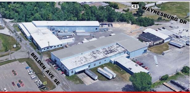

Property Detail
1525 Waynesburg Dr Se
10013809
6,7 WH EA DAUBERMEN; 14NW 5.91A
Lightindustrial
STARK
B and X Area of moderate flood hazard, usually the area between the limits of the 100-year and 500-year floods.
Ohio
0
5.91 AC
2025
Stark County
713100
Cleveland
78,386 SF
Canton-Massillon, OH
NEARBY LISTINGS FOR SALE OR LEASE
DEMOGRAPHICS near 1525 Waynesburg Dr Se
1 mile
3 mile
5 mile
2025 Total Population
4,179
45,583
106,368
2030 Population
4,212
45,756
106,245
Pop Growth 2025-2030
+ 0.79%
+ 0.38%
(0.12%)
Average Age
39
39
40
2025 Total Households
1,764
19,053
45,245
HH Growth 2025-2030
+ 0.68%
+ 0.32%
(0.18%)
Median Household Inc
$45,784
$39,353
$48,594
Avg Household Size
2.30
2.30
2.20
2025 Avg HH Vehicles
1.00
1.00
2.00
Median Home Value
$78,749
$79,211
$124,145
Median Year Built
1956
1948
1952
Nearby Places
Map Layers
Map Styles
 Street
 Aerial
Layers
 Traffic
 Biking
Places
Listings with unknown addresses are not visible on the map
- Restaurants
- Banks
- Shops
- Fitness
- Groceries
PUBLIC TRANSPORTATION
AIRPORT
Akron-Canton Regional
Drive
Walk
Distance
Akron-Canton Regional
17 min
12.9 mi
Freight Ports
Port of Toledo
Drive
Walk
Distance
Port of Toledo
188 min
160.2 mi
SALE & LEASE HISTORY
LISTING DATE
SALE/LEASE

Dec 04, 2019
For Lease
Nearby Properties
Address
Land Use
TOTAL SIZE
Lot Size
Zoning
Address
Land Use
TOTAL SIZE
Lot Size
Zoning
551,338 SF
7.26 AC
Address
Land Use
TOTAL SIZE
Lot Size
Zoning
397,897 SF
3.76 AC
Address
Land Use
TOTAL SIZE
Lot Size
Zoning
521,112 SF
14.28 AC
Address
Land Use
TOTAL SIZE
Lot Size
Zoning
356,172 SF
4.06 AC
Address
Land Use
TOTAL SIZE
Lot Size
Zoning
346,374 SF
32.23 AC
Address
Land Use
TOTAL SIZE
Lot Size
Zoning
115,674 SF
24.41 AC
Address
Land Use
TOTAL SIZE
Lot Size
Zoning
1,069,826 SF
158.31 AC
Address
Land Use
TOTAL SIZE
Lot Size
Zoning
345,570 SF
29.76 AC
Address
Land Use
TOTAL SIZE
Lot Size
Zoning
118,619 SF
2.14 AC
Address
Land Use
TOTAL SIZE
Lot Size
Zoning
107,248 SF
0.09 AC
Address
Land Use
TOTAL SIZE
Lot Size
Zoning
423,783 SF
26.11 AC
Address
Land Use
TOTAL SIZE
Lot Size
Zoning
476,634 SF
15.08 AC
Address
Land Use
TOTAL SIZE
Lot Size
Zoning
116,912 SF
18.85 AC
Address
Land Use
TOTAL SIZE
Lot Size
Zoning
316,099 SF
8.47 AC
Address
Land Use
TOTAL SIZE
Lot Size
Zoning
82,950 SF
Address
Land Use
TOTAL SIZE
Lot Size
Zoning
158,390 SF
0.92 AC
Address
Land Use
TOTAL SIZE
Lot Size
Zoning
1,096,089 SF
144.96 AC
Address
Land Use
TOTAL SIZE
Lot Size
Zoning
113,535 SF
41.24 AC
Address
Land Use
TOTAL SIZE
Lot Size
Zoning
180,088 SF
71.80 AC
Address
Land Use
TOTAL SIZE
Lot Size
Zoning
0.35 AC
Address
Land Use
TOTAL SIZE
Lot Size
Zoning
59,211 SF
3.53 AC
Address
Land Use
TOTAL SIZE
Lot Size
Zoning
57,852 SF
3.32 AC
Address
Land Use
TOTAL SIZE
Lot Size
Zoning
227,370 SF
0.77 AC
Address
Land Use
TOTAL SIZE
Lot Size
Zoning
1,213,508 SF
44.15 AC
Address
Land Use
TOTAL SIZE
Lot Size
Zoning
57,075 SF
4.25 AC
Address
Land Use
TOTAL SIZE
Lot Size
Zoning
227,370 SF
0.77 AC
Address
Land Use
TOTAL SIZE
Lot Size
Zoning
124,758 SF
6.22 AC
Address
Land Use
TOTAL SIZE
Lot Size
Zoning
135,840 SF
21 AC
Address
Land Use
TOTAL SIZE
Lot Size
Zoning
82,746 SF
2.68 AC
Address
Land Use
TOTAL SIZE
Lot Size
Zoning
58,021 SF
13.25 AC
The World's #1 Commercial Real Estate Marketplace
Connect with us
© 2026 CoStar Group
The information above has been obtained from sources believed reliable. While we do not doubt its accuracy we have not verified it and make no guarantee, warranty or representation about it. It is your responsibility to independently confirm its accuracy and completeness. Any projections, opinions, assumptions, or estimates used are for example only and do not represent the current or future performance of the property. The value of this transaction to you depends on tax and other factors which should be evaluated by your tax, financial, and legal advisors. You and your advisors should conduct a careful, independent investigation of the property to determine to your satisfaction the suitability of the property for your needs.