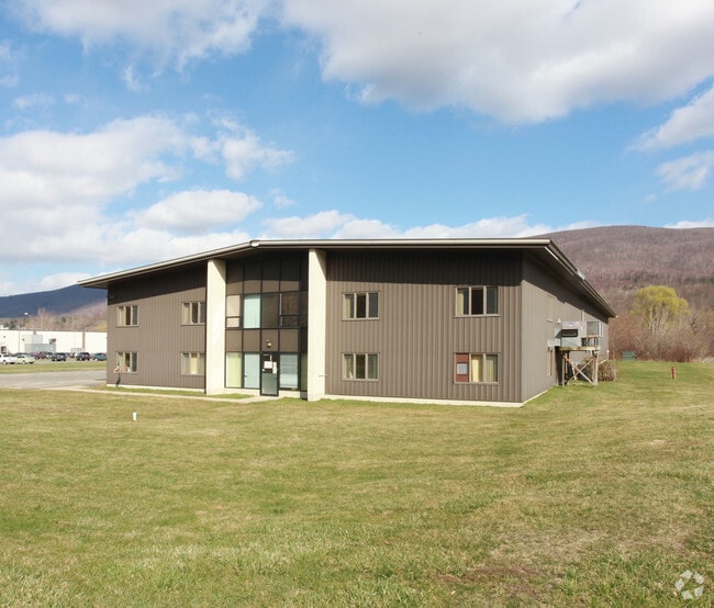
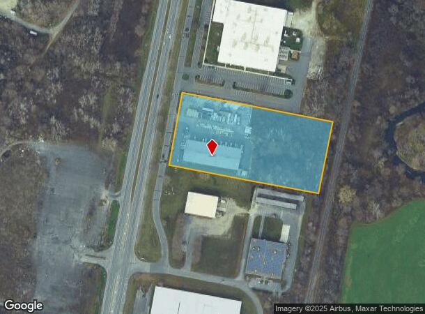
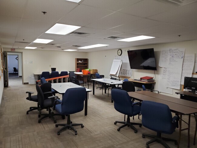
Property Record
1526 Curran Hwy, North Adams, MA 01247
NEARBY LISTINGS FOR SALE OR LEASE
Property Detail
1526 Curran Hwy
Pittsfield, MA
Berkshire
NADA-000015-000000-000017A
Massachusetts
Manufacturinglight
17a
2025
4.45 AC
2025
Massachusetts North/West Area
921400
Other Market Areas
17,920 SF
DEMOGRAPHICS near 1526 Curran Hwy
1 Mile
3 Mile
5 Mile
2024 Total Population
806
14,081
23,805
2029 Population
804
13,973
23,546
Pop Growth 2024-2029
(0.25%)
(0.77%)
(1.09%)
Average Age
48
43
44
2024 Total Households
394
6,536
10,793
HH Growth 2024-2029
(0.25%)
(0.86%)
(1.18%)
Median Household Inc
$30,781
$45,504
$49,344
Avg Household Size
2.00
2.00
2.10
2024 Avg HH Vehicles
2.00
1.00
2.00
Median Home Value
$88,781
$176,158
$188,203
Median Year Built
1953
1947
1948
Nearby Places
- Restaurants
- Banks
- Shops
- Fitness
- Groceries
SALE & LEASE HISTORY
LISTING DATE
SALE/LEASE

Oct 27, 2020
For Lease
Oct 27, 2020
For Sale
Nearby Properties
Address
Land Use
TOTAL SIZE
Lot Size
Zoning
Address
Land Use
TOTAL SIZE
Lot Size
Zoning
370 AC
Address
Land Use
TOTAL SIZE
Lot Size
Zoning
333,969 SF
19 AC
Address
Land Use
TOTAL SIZE
Lot Size
Zoning
463,524 SF
8.80 AC
Address
Land Use
TOTAL SIZE
Lot Size
Zoning
1.21 AC
Address
Land Use
TOTAL SIZE
Lot Size
Zoning
2,952 SF
299.59 AC
Address
Land Use
TOTAL SIZE
Lot Size
Zoning
180,332 SF
23.51 AC
Address
Land Use
TOTAL SIZE
Lot Size
Zoning
603,161 SF
11.31 AC
Address
Land Use
TOTAL SIZE
Lot Size
Zoning
156,060 SF
23.52 AC
Address
Land Use
TOTAL SIZE
Lot Size
Zoning
79,263 SF
3.78 AC
Address
Land Use
TOTAL SIZE
Lot Size
Zoning
63,515 SF
1.16 AC
Address
Land Use
TOTAL SIZE
Lot Size
Zoning
317,241 SF
427 AC
I
Address
Land Use
TOTAL SIZE
Lot Size
Zoning
109,980 SF
81.60 AC
Address
Land Use
TOTAL SIZE
Lot Size
Zoning
14,294 SF
17 AC
I
Address
Land Use
TOTAL SIZE
Lot Size
Zoning
2,295.68 AC
R1
Address
Land Use
TOTAL SIZE
Lot Size
Zoning
69,876 SF
12.30 AC
C
Address
Land Use
TOTAL SIZE
Lot Size
Zoning
114,992 SF
5.95 AC
Address
Land Use
TOTAL SIZE
Lot Size
Zoning
79,084 SF
1.38 AC
Address
Land Use
TOTAL SIZE
Lot Size
Zoning
4.40 AC
Address
Land Use
TOTAL SIZE
Lot Size
Zoning
32,036 SF
2.62 AC
Address
Land Use
TOTAL SIZE
Lot Size
Zoning
21,369 SF
0.58 AC
Address
Land Use
TOTAL SIZE
Lot Size
Zoning
81,415 SF
4.73 AC
Address
Land Use
TOTAL SIZE
Lot Size
Zoning
117,566 SF
10 AC
Address
Land Use
TOTAL SIZE
Lot Size
Zoning
77,827 SF
1.80 AC
C
Address
Land Use
TOTAL SIZE
Lot Size
Zoning
3,831 SF
1.30 AC
C
Address
Land Use
TOTAL SIZE
Lot Size
Zoning
93,436 SF
11.54 AC
Address
Land Use
TOTAL SIZE
Lot Size
Zoning
75,398 SF
1.71 AC
Address
Land Use
TOTAL SIZE
Lot Size
Zoning
57,340 SF
6.60 AC
Address
Land Use
TOTAL SIZE
Lot Size
Zoning
9,952 SF
3 AC
C
Address
Land Use
TOTAL SIZE
Lot Size
Zoning
29,351 SF
0.40 AC
Address
Land Use
TOTAL SIZE
Lot Size
Zoning
108,428 SF
1.50 AC
R1
The World's #1 Commercial Real Estate Marketplace
Connect with us
© 2025 CoStar Group
The information above has been obtained from sources believed reliable. While we do not doubt its accuracy we have not verified it and make no guarantee, warranty or representation about it. It is your responsibility to independently confirm its accuracy and completeness. Any projections, opinions, assumptions, or estimates used are for example only and do not represent the current or future performance of the property. The value of this transaction to you depends on tax and other factors which should be evaluated by your tax, financial, and legal advisors. You and your advisors should conduct a careful, independent investigation of the property to determine to your satisfaction the suitability of the property for your needs.