Property Record
15260 Ne 152Nd Pl, Fort Mc Coy, FL 32134
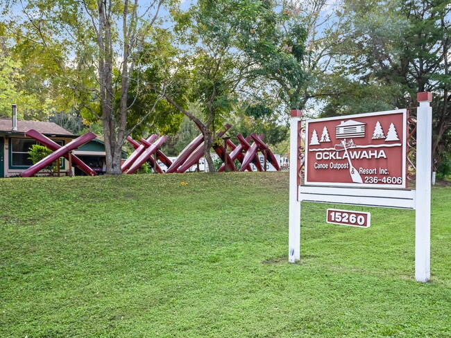
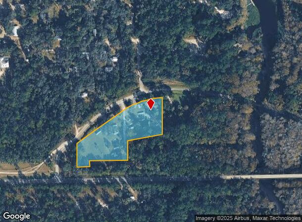
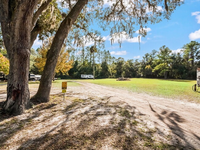
This Property Is For Sale
NEARBY LISTINGS FOR SALE OR LEASE
-
-
View all Fort Mc Coy listings for sale on LoopNet.com
Property Detail
15260 Ne 152Nd Pl
Ocala, FL
Eureka Creek Known As Ocklawaha River
10146-000-00
Marion
Sfr
Florida
X
7.21 AC
12083C0360D
Outlying Marion County
3,540 SF
Ocala
DEMOGRAPHICS near 15260 Ne 152Nd Pl
1 Mile
3 Mile
5 Mile
2024 Total Population
1,019
2,415
3,918
2029 Population
1,175
2,797
4,539
Pop Growth 2024-2029
+ 15.31%
+ 15.82%
+ 15.85%
Average Age
45
46
46
2024 Total Households
411
1,009
1,645
HH Growth 2024-2029
+ 15.82%
+ 16.15%
+ 16.17%
Median Household Inc
$67,666
$57,349
$57,420
Avg Household Size
2.40
2.40
2.30
2024 Avg HH Vehicles
2.00
2.00
2.00
Median Home Value
$228,571
$224,532
$231,789
Median Year Built
1984
1983
1983
Nearby Places
Map Layers
Map Styles
 Street
 Aerial
- Restaurants
- Banks
- Shops
- Fitness
- Groceries
Nearby Properties
Address
Land Use
TOTAL SIZE
Lot Size
Zoning
Address
Land Use
TOTAL SIZE
Lot Size
Zoning
50,232 SF
42.50 AC
R3
Address
Land Use
TOTAL SIZE
Lot Size
Zoning
438.60 AC
A1
Address
Land Use
TOTAL SIZE
Lot Size
Zoning
2,512 SF
12.24 AC
A1
Address
Land Use
TOTAL SIZE
Lot Size
Zoning
4,732 SF
4.89 AC
B4
Address
Land Use
TOTAL SIZE
Lot Size
Zoning
2,501 SF
1.18 AC
B4
Address
Land Use
TOTAL SIZE
Lot Size
Zoning
2.56 AC
A1
Address
Land Use
TOTAL SIZE
Lot Size
Zoning
4,861 SF
9.53 AC
A1
Address
Land Use
TOTAL SIZE
Lot Size
Zoning
3,177 SF
24.54 AC
A1
Address
Land Use
TOTAL SIZE
Lot Size
Zoning
8,108 SF
5.50 AC
M2
Address
Land Use
TOTAL SIZE
Lot Size
Zoning
4,159 SF
2 AC
B5
Address
Land Use
TOTAL SIZE
Lot Size
Zoning
2,400 SF
1.15 AC
B4
Address
Land Use
TOTAL SIZE
Lot Size
Zoning
2,937 SF
4.55 AC
B4
Address
Land Use
TOTAL SIZE
Lot Size
Zoning
3,307 SF
1.50 AC
A1
Address
Land Use
TOTAL SIZE
Lot Size
Zoning
2,171 SF
5 AC
B4
Address
Land Use
TOTAL SIZE
Lot Size
Zoning
2,068 SF
0.69 AC
B5
Address
Land Use
TOTAL SIZE
Lot Size
Zoning
1,560 SF
3.34 AC
A1
Address
Land Use
TOTAL SIZE
Lot Size
Zoning
10.27 AC
A1
Address
Land Use
TOTAL SIZE
Lot Size
Zoning
20 AC
A1
Address
Land Use
TOTAL SIZE
Lot Size
Zoning
2,843 SF
1.94 AC
R4
Address
Land Use
TOTAL SIZE
Lot Size
Zoning
10.01 AC
A1
Address
Land Use
TOTAL SIZE
Lot Size
Zoning
18 AC
A1
Address
Land Use
TOTAL SIZE
Lot Size
Zoning
10.01 AC
A1
Address
Land Use
TOTAL SIZE
Lot Size
Zoning
15.76 AC
R4
Address
Land Use
TOTAL SIZE
Lot Size
Zoning
10 AC
A1
Address
Land Use
TOTAL SIZE
Lot Size
Zoning
10.38 AC
A1
Address
Land Use
TOTAL SIZE
Lot Size
Zoning
10 AC
A1
Address
Land Use
TOTAL SIZE
Lot Size
Zoning
2,367 SF
10 AC
A1
Address
Land Use
TOTAL SIZE
Lot Size
Zoning
11 AC
A1
Address
Land Use
TOTAL SIZE
Lot Size
Zoning
1.03 AC
R4
The World's #1 Commercial Real Estate Marketplace
Connect with us
© 2026 CoStar Group
The information above has been obtained from sources believed reliable. While we do not doubt its accuracy we have not verified it and make no guarantee, warranty or representation about it. It is your responsibility to independently confirm its accuracy and completeness. Any projections, opinions, assumptions, or estimates used are for example only and do not represent the current or future performance of the property. The value of this transaction to you depends on tax and other factors which should be evaluated by your tax, financial, and legal advisors. You and your advisors should conduct a careful, independent investigation of the property to determine to your satisfaction the suitability of the property for your needs.