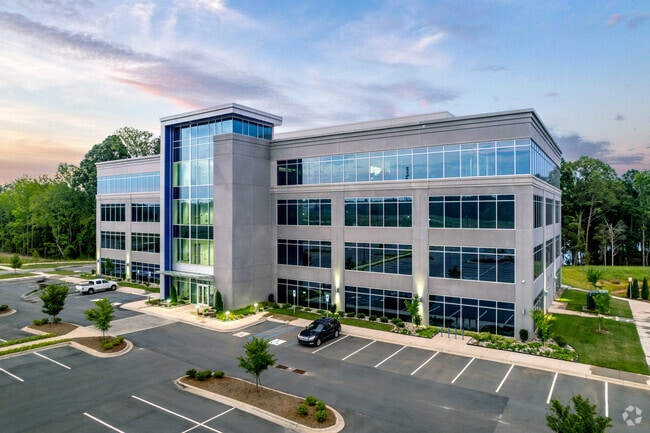
Property Record
153 Langtree Campus Dr, Mooresville, NC 28117


NEARBY LISTINGS FOR SALE OR LEASE
Property Detail
153 Langtree Campus Dr
Charlotte
Plat Of Langtree Lake Norman
Charlotte-Concord-Gastonia, NC-SC
LOT 1 LANGTREE LAKE NORMAN PB68-28
4644-68-2792.000
Iredell
Officebuilding
North Carolina
2025
1
2025
10.66 AC
061407
Iredell County
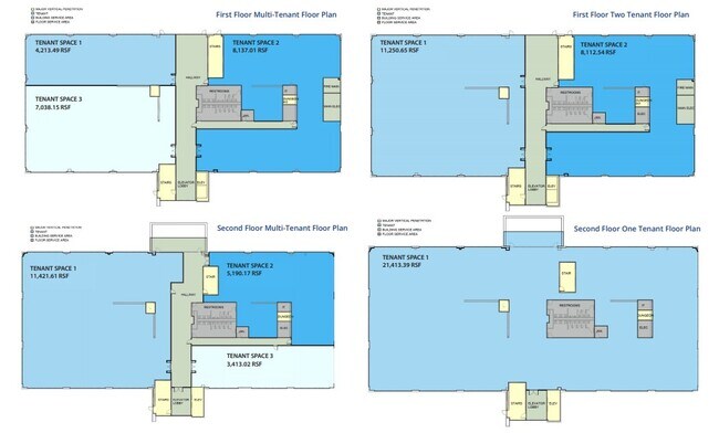
92,768 SF
DEMOGRAPHICS near 153 Langtree Campus Dr
1 Mile
3 Mile
5 Mile
2024 Total Population
3,033
32,325
91,950
2029 Population
3,354
35,179
100,700
Pop Growth 2024-2029
+ 10.58%
+ 8.83%
+ 9.52%
Average Age
45
42
41
2024 Total Households
1,346
13,191
36,937
HH Growth 2024-2029
+ 10.48%
+ 9.01%
+ 9.49%
Median Household Inc
$109,456
$104,638
$101,786
Avg Household Size
2.20
2.30
2.40
2024 Avg HH Vehicles
2.00
2.00
2.00
Median Home Value
$531,159
$476,684
$417,509
Median Year Built
1997
1999
2001
Nearby Places
Map Layers
Map Styles
 Street
 Aerial
- Restaurants
- Banks
- Shops
- Fitness
- Groceries
PUBLIC TRANSPORTATION
AIRPORT
Concord-Padgett Regional
DRIVE
WALK
Distance
Concord-Padgett Regional
34 min
22.6 mi
Charlotte/Douglas International
DRIVE
WALK
Distance
Charlotte/Douglas International
45 min
30.6 mi
Freight Ports
North Charleston Terminal
DRIVE
WALK
Distance
North Charleston Terminal
257 min
222.8 mi
SALE & LEASE HISTORY
LISTING DATE
SALE/LEASE

Jul 07, 2021
For Lease
Dec 05, 2019
For Lease
Nearby Properties
Address
Land Use
TOTAL SIZE
Lot Size
Zoning
Address
Land Use
TOTAL SIZE
Lot Size
Zoning
7,250 SF
136.59 AC
PD
Address
Land Use
TOTAL SIZE
Lot Size
Zoning
1,664,047 SF
221.21 AC
CC
Address
Land Use
TOTAL SIZE
Lot Size
Zoning
78,336 SF
14.60 AC
CM
Address
Land Use
TOTAL SIZE
Lot Size
Zoning
199,918 SF
27.58 AC
CM
Address
Land Use
TOTAL SIZE
Lot Size
Zoning
569,776 SF
49.01 AC
VIP
Address
Land Use
TOTAL SIZE
Lot Size
Zoning
320,754 SF
40.55 AC
NR
Address
Land Use
TOTAL SIZE
Lot Size
Zoning
222,382 SF
31.89 AC
NR
Address
Land Use
TOTAL SIZE
Lot Size
Zoning
245,990 SF
5.21 AC
Address
Land Use
TOTAL SIZE
Lot Size
Zoning
7,297 SF
8.65 AC
CM
Address
Land Use
TOTAL SIZE
Lot Size
Zoning
14,382 SF
4.40 AC
CM
Address
Land Use
TOTAL SIZE
Lot Size
Zoning
163,432 SF
3.40 AC
LPA
Address
Land Use
TOTAL SIZE
Lot Size
Zoning
166,340 SF
14.67 AC
C
Address
Land Use
TOTAL SIZE
Lot Size
Zoning
194,079 SF
10.03 AC
LPA
Address
Land Use
TOTAL SIZE
Lot Size
Zoning
14,824 SF
5.76 AC
CM
Address
Land Use
TOTAL SIZE
Lot Size
Zoning
20,000 SF
23.91 AC
RLI
Address
Land Use
TOTAL SIZE
Lot Size
Zoning
118,825 SF
70.60 AC
RA
Address
Land Use
TOTAL SIZE
Lot Size
Zoning
139,665 SF
14.37 AC
HC
Address
Land Use
TOTAL SIZE
Lot Size
Zoning
14,877 SF
13.57 AC
CM
Address
Land Use
TOTAL SIZE
Lot Size
Zoning
96,656 SF
2.45 AC
CZ(MPD)
Address
Land Use
TOTAL SIZE
Lot Size
Zoning
72,450 SF
14.50 AC
C
Address
Land Use
TOTAL SIZE
Lot Size
Zoning
119,077 SF
4.25 AC
C
Address
Land Use
TOTAL SIZE
Lot Size
Zoning
71 AC
CC
Address
Land Use
TOTAL SIZE
Lot Size
Zoning
142,187 SF
18.88 AC
VIP
Address
Land Use
TOTAL SIZE
Lot Size
Zoning
132,319 SF
16.64 AC
Address
Land Use
TOTAL SIZE
Lot Size
Zoning
38,161 SF
2.57 AC
CM
Address
Land Use
TOTAL SIZE
Lot Size
Zoning
111 AC
RPA
Address
Land Use
TOTAL SIZE
Lot Size
Zoning
81,864 SF
12.33 AC
R2
Address
Land Use
TOTAL SIZE
Lot Size
Zoning
81,022 SF
2.06 AC
CZ(MPD)
Address
Land Use
TOTAL SIZE
Lot Size
Zoning
70,711 SF
6.35 AC
The World's #1 Commercial Real Estate Marketplace
Connect with us
© 2025 CoStar Group
The information above has been obtained from sources believed reliable. While we do not doubt its accuracy we have not verified it and make no guarantee, warranty or representation about it. It is your responsibility to independently confirm its accuracy and completeness. Any projections, opinions, assumptions, or estimates used are for example only and do not represent the current or future performance of the property. The value of this transaction to you depends on tax and other factors which should be evaluated by your tax, financial, and legal advisors. You and your advisors should conduct a careful, independent investigation of the property to determine to your satisfaction the suitability of the property for your needs.