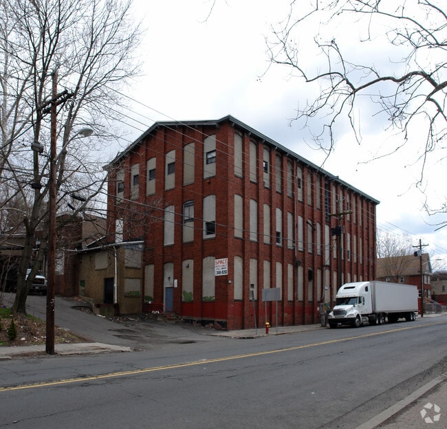
Property Record
153 Mcbride Ave, Paterson, NJ 07501

Property Detail
153 Mcbride Ave
08-04802-0000-00006
PASSAIC
Industrialgeneral
New Jersey
GFHD
6
AE The base floodplain where base flood elevations are provided. AE Zones are now used on new format FIRMs instead of A1-A30 Zones.
1.60 AC
2024
Paterson
2025
Northern New Jersey
183200
New York-Jersey City-White Plains, NY-NJ
55,296 SF
NEARBY LISTINGS FOR SALE OR LEASE
DEMOGRAPHICS near 153 Mcbride Ave
1 mile
3 mile
5 mile
2025 Total Population
46,369
250,306
538,904
2030 Population
46,544
252,768
547,601
Pop Growth 2025-2030
+ 0.38%
+ 0.98%
+ 1.61%
Average Age
36
39
39
2025 Total Households
14,686
81,951
181,350
HH Growth 2025-2030
+ 0.59%
+ 1.07%
+ 1.69%
Median Household Inc
$48,482
$68,455
$86,266
Avg Household Size
3.00
2.90
2.80
2025 Avg HH Vehicles
1.00
1.00
2.00
Median Home Value
$343,076
$452,254
$506,716
Median Year Built
1954
1955
1955
Nearby Places
Map Layers
Map Styles
 Street
 Aerial
Transit
 Traffic
 Biking
Places
Listings with unknown addresses are not visible on the map
- Restaurants
- Banks
- Shops
- Fitness
- Groceries
PUBLIC TRANSPORTATION
COMMUTER RAIL
Paterson (Main/Port Jervis Line - NJ Transit Commuter Rail (NJ Transit))
Drive
Walk
Distance
Paterson (Main/Port Jervis Line - NJ Transit Commuter Rail (NJ Transit))
2 min
20 min
1.0 mi
Hawthorne (Main/Port Jervis Line - NJ Transit Commuter Rail (NJ Transit))
Drive
Walk
Distance
Hawthorne (Main/Port Jervis Line - NJ Transit Commuter Rail (NJ Transit))
6 min
3.2 mi
AIRPORT
Newark Liberty International
Drive
Walk
Distance
Newark Liberty International
25 min
21.0 mi
LaGuardia
Drive
Walk
Distance
LaGuardia
37 min
25.7 mi
Westchester County
Drive
Walk
Distance
Westchester County
58 min
41.4 mi
Freight Ports
Port Newark Container Terminal
Drive
Walk
Distance
Port Newark Container Terminal
31 min
20.3 mi
SALE & LEASE HISTORY
LISTING DATE
SALE/LEASE

Sep 24, 2016
For Lease
Jun 05, 2018
For Lease
Nearby Properties
Address
Land Use
TOTAL SIZE
Lot Size
Zoning
Address
Land Use
TOTAL SIZE
Lot Size
Zoning
8.75 AC
Address
Land Use
TOTAL SIZE
Lot Size
Zoning
12,506 SF
130 AC
B-2
Address
Land Use
TOTAL SIZE
Lot Size
Zoning
45,000 SF
124.04 AC
R-A
Address
Land Use
TOTAL SIZE
Lot Size
Zoning
56.67 AC
Address
Land Use
TOTAL SIZE
Lot Size
Zoning
260,609 SF
35.39 AC
Address
Land Use
TOTAL SIZE
Lot Size
Zoning
20.43 AC
Address
Land Use
TOTAL SIZE
Lot Size
Zoning
79,310 SF
2 AC
B-2
Address
Land Use
TOTAL SIZE
Lot Size
Zoning
26,816 SF
25.50 AC
POP
Address
Land Use
TOTAL SIZE
Lot Size
Zoning
24,200 SF
19.33 AC
Address
Land Use
TOTAL SIZE
Lot Size
Zoning
152,050 SF
1.96 AC
B-1
Address
Land Use
TOTAL SIZE
Lot Size
Zoning
84.08 AC
Address
Land Use
TOTAL SIZE
Lot Size
Zoning
315,332 SF
19.60 AC
Address
Land Use
TOTAL SIZE
Lot Size
Zoning
7.83 AC
Address
Land Use
TOTAL SIZE
Lot Size
Zoning
12.86 AC
Address
Land Use
TOTAL SIZE
Lot Size
Zoning
1.80 AC
Address
Land Use
TOTAL SIZE
Lot Size
Zoning
0.69 AC
I-1
Address
Land Use
TOTAL SIZE
Lot Size
Zoning
19.20 AC
Address
Land Use
TOTAL SIZE
Lot Size
Zoning
271,679 SF
20.79 AC
Address
Land Use
TOTAL SIZE
Lot Size
Zoning
1,512 SF
90 AC
Address
Land Use
TOTAL SIZE
Lot Size
Zoning
90.48 AC
Address
Land Use
TOTAL SIZE
Lot Size
Zoning
Address
Land Use
TOTAL SIZE
Lot Size
Zoning
342,518 SF
31.80 AC
IP
Address
Land Use
TOTAL SIZE
Lot Size
Zoning
648 SF
108.80 AC
Address
Land Use
TOTAL SIZE
Lot Size
Zoning
1,482 SF
55.66 AC
R-B
Address
Land Use
TOTAL SIZE
Lot Size
Zoning
14,152 SF
23.87 AC
Address
Land Use
TOTAL SIZE
Lot Size
Zoning
27.25 AC
Address
Land Use
TOTAL SIZE
Lot Size
Zoning
15.80 AC
IND
Address
Land Use
TOTAL SIZE
Lot Size
Zoning
764,364 SF
16.60 AC
I-2
Address
Land Use
TOTAL SIZE
Lot Size
Zoning
11.87 AC
Address
Land Use
TOTAL SIZE
Lot Size
Zoning
0.12 AC
The World's #1 Commercial Real Estate Marketplace
Connect with us
© 2026 CoStar Group
The information above has been obtained from sources believed reliable. While we do not doubt its accuracy we have not verified it and make no guarantee, warranty or representation about it. It is your responsibility to independently confirm its accuracy and completeness. Any projections, opinions, assumptions, or estimates used are for example only and do not represent the current or future performance of the property. The value of this transaction to you depends on tax and other factors which should be evaluated by your tax, financial, and legal advisors. You and your advisors should conduct a careful, independent investigation of the property to determine to your satisfaction the suitability of the property for your needs.