Property Record
153 Mckinney Rd, Mount Airy, NC 27030

NEARBY LISTINGS FOR SALE OR LEASE
Property Detail
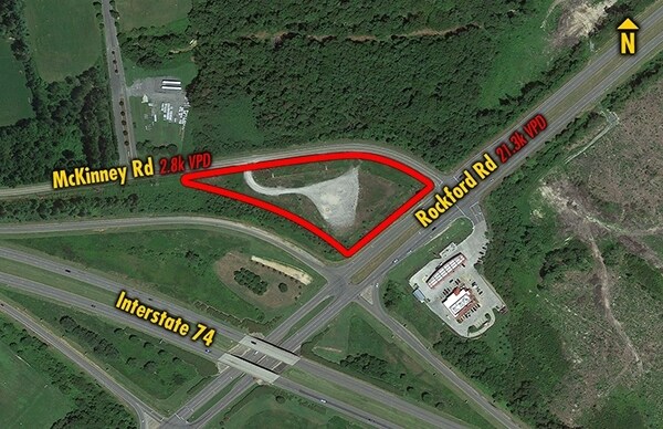
153 Mckinney Rd
Mount Airy, NC
Hwy 601 & 52
5919-00-70-7155
PB 17 PG 84
Realpropertynec
Surry
X
North Carolina
3710591900J
2.12 AC
2025
Hickory/Morganton
2025
Other Market Areas
930502
DEMOGRAPHICS near 153 Mckinney Rd
1 Mile
3 Mile
5 Mile
2024 Total Population
531
8,388
24,556
2029 Population
526
8,426
24,716
Pop Growth 2024-2029
(0.94%)
+ 0.45%
+ 0.65%
Average Age
42
43
43
2024 Total Households
219
3,625
10,561
HH Growth 2024-2029
(0.46%)
+ 0.47%
+ 0.69%
Median Household Inc
$49,166
$39,104
$47,199
Avg Household Size
2.30
2.20
2.30
2024 Avg HH Vehicles
2.00
2.00
2.00
Median Home Value
$169,491
$144,208
$150,641
Median Year Built
1977
1971
1975
Nearby Places
Map Layers
Map Styles
 Street
 Aerial
- Restaurants
- Banks
- Shops
- Fitness
- Groceries
SALE & LEASE HISTORY
LISTING DATE
SALE/LEASE

Aug 16, 2021
For Sale
Nearby Properties
Address
Land Use
TOTAL SIZE
Lot Size
Zoning
Address
Land Use
TOTAL SIZE
Lot Size
Zoning
240,171 SF
12 AC
B5
Address
Land Use
TOTAL SIZE
Lot Size
Zoning
198,395 SF
20.80 AC
B4
Address
Land Use
TOTAL SIZE
Lot Size
Zoning
1,428 SF
45.45 AC
M1
Address
Land Use
TOTAL SIZE
Lot Size
Zoning
12,088 SF
37.77 AC
RL
Address
Land Use
TOTAL SIZE
Lot Size
Zoning
80,883 SF
56.99 AC
RA
Address
Land Use
TOTAL SIZE
Lot Size
Zoning
112,521 SF
10.33 AC
B4
Address
Land Use
TOTAL SIZE
Lot Size
Zoning
29,624 SF
12.70 AC
B4
Address
Land Use
TOTAL SIZE
Lot Size
Zoning
77,952 SF
48 AC
HB
Address
Land Use
TOTAL SIZE
Lot Size
Zoning
52,080 SF
12.90 AC
B4
Address
Land Use
TOTAL SIZE
Lot Size
Zoning
39,024 SF
3.04 AC
B2
Address
Land Use
TOTAL SIZE
Lot Size
Zoning
49,390 SF
32.52 AC
RR
Address
Land Use
TOTAL SIZE
Lot Size
Zoning
60,016 SF
10.16 AC
R8
Address
Land Use
TOTAL SIZE
Lot Size
Zoning
108,476 SF
14.17 AC
B4
Address
Land Use
TOTAL SIZE
Lot Size
Zoning
60,252 SF
8.34 AC
B4
Address
Land Use
TOTAL SIZE
Lot Size
Zoning
24,213 SF
4.08 AC
B5
Address
Land Use
TOTAL SIZE
Lot Size
Zoning
48,486 SF
3.78 AC
B2
Address
Land Use
TOTAL SIZE
Lot Size
Zoning
32,734 SF
5.35 AC
B5
Address
Land Use
TOTAL SIZE
Lot Size
Zoning
43,628 SF
4.66 AC
B4
Address
Land Use
TOTAL SIZE
Lot Size
Zoning
40,840 SF
43.01 AC
M1
Address
Land Use
TOTAL SIZE
Lot Size
Zoning
110,800 SF
30.19 AC
M1
Address
Land Use
TOTAL SIZE
Lot Size
Zoning
4,320 SF
1,106.67 AC
MI
Address
Land Use
TOTAL SIZE
Lot Size
Zoning
21,974 SF
7.08 AC
B4
Address
Land Use
TOTAL SIZE
Lot Size
Zoning
22,492 SF
3.08 AC
B2
Address
Land Use
TOTAL SIZE
Lot Size
Zoning
30,234 SF
2.60 AC
M1
Address
Land Use
TOTAL SIZE
Lot Size
Zoning
14,820 SF
1.56 AC
B2
Address
Land Use
TOTAL SIZE
Lot Size
Zoning
27,719 SF
7.80 AC
RA
Address
Land Use
TOTAL SIZE
Lot Size
Zoning
13,298 SF
1.87 AC
B4
Address
Land Use
TOTAL SIZE
Lot Size
Zoning
22,086 SF
3.40 AC
B4
Address
Land Use
TOTAL SIZE
Lot Size
Zoning
5,312 SF
2.53 AC
B4
Address
Land Use
TOTAL SIZE
Lot Size
Zoning
36,739 SF
7.57 AC
B4
The World's #1 Commercial Real Estate Marketplace
Connect with us
© 2025 CoStar Group
The information above has been obtained from sources believed reliable. While we do not doubt its accuracy we have not verified it and make no guarantee, warranty or representation about it. It is your responsibility to independently confirm its accuracy and completeness. Any projections, opinions, assumptions, or estimates used are for example only and do not represent the current or future performance of the property. The value of this transaction to you depends on tax and other factors which should be evaluated by your tax, financial, and legal advisors. You and your advisors should conduct a careful, independent investigation of the property to determine to your satisfaction the suitability of the property for your needs.