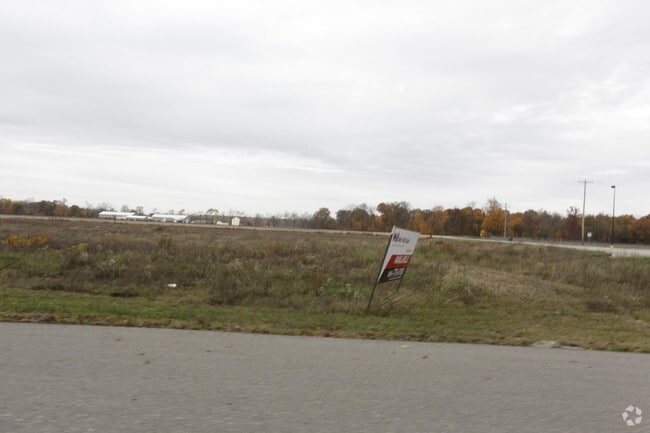
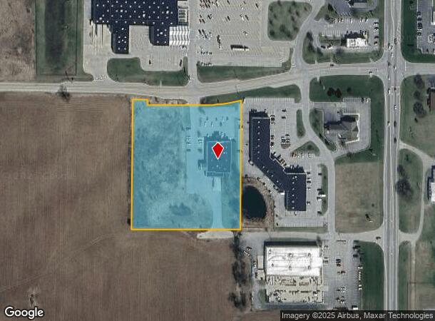
Property Record
153 W Sprague Rd, Ionia, MI 48846
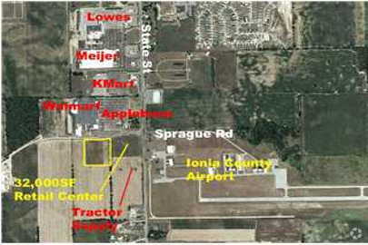
NEARBY LISTINGS FOR SALE OR LEASE
Property Detail
153 W Sprague Rd
011-001-000-085-90
PT NE 1/4 SEC 1 COM NE COR SEC TH S 1378.5FT, TH W 628.32FT TO POB, TH W 439.48FT, TH N 521.1FT, TH S88*33'13E 58.56FT
Commercialnec
Ionia
X
Michigan
26067C0179D
5.12 AC
2024
Ionia County
2025
West Michigan
031900
Grand Rapids-Wyoming-Kentwood, MI
14,224 SF
DEMOGRAPHICS near 153 W Sprague Rd
1 Mile
3 Mile
5 Mile
2024 Total Population
1,203
9,947
20,310
2029 Population
1,232
10,080
20,674
Pop Growth 2024-2029
+ 2.41%
+ 1.34%
+ 1.79%
Average Age
41
41
40
2024 Total Households
463
1,944
5,406
HH Growth 2024-2029
+ 2.38%
+ 2.42%
+ 2.48%
Median Household Inc
$66,714
$57,678
$58,357
Avg Household Size
2.50
2.50
2.50
2024 Avg HH Vehicles
2.00
2.00
2.00
Median Home Value
$156,071
$141,352
$146,302
Median Year Built
1984
1973
1964
Nearby Places
Map Layers
Map Styles
 Street
 Aerial
- Restaurants
- Banks
- Shops
- Fitness
- Groceries
PUBLIC TRANSPORTATION
AIRPORT
Capital Region International
DRIVE
WALK
Distance
Capital Region International
41 min
32.3 mi
Gerald R Ford International
DRIVE
WALK
Distance
Gerald R Ford International
43 min
32.4 mi
SALE & LEASE HISTORY
LISTING DATE
SALE/LEASE

Sep 24, 2016
For Sale
Nearby Properties
Address
Land Use
TOTAL SIZE
Lot Size
Zoning
Address
Land Use
TOTAL SIZE
Lot Size
Zoning
209,286 SF
23.37 AC
Address
Land Use
TOTAL SIZE
Lot Size
Zoning
178,310 SF
21.07 AC
Address
Land Use
TOTAL SIZE
Lot Size
Zoning
Address
Land Use
TOTAL SIZE
Lot Size
Zoning
96,695 SF
11.92 AC
I-1
Address
Land Use
TOTAL SIZE
Lot Size
Zoning
111,316 SF
14.62 AC
Address
Land Use
TOTAL SIZE
Lot Size
Zoning
131,333 SF
14.07 AC
Address
Land Use
TOTAL SIZE
Lot Size
Zoning
127,496 SF
10.70 AC
I-1
Address
Land Use
TOTAL SIZE
Lot Size
Zoning
94,800 SF
13.63 AC
Address
Land Use
TOTAL SIZE
Lot Size
Zoning
1,920 SF
68.57 AC
Address
Land Use
TOTAL SIZE
Lot Size
Zoning
31,242 SF
0.25 AC
B-2
Address
Land Use
TOTAL SIZE
Lot Size
Zoning
23,904 SF
0.31 AC
B-2
Address
Land Use
TOTAL SIZE
Lot Size
Zoning
628.74 AC
Address
Land Use
TOTAL SIZE
Lot Size
Zoning
4.31 AC
RM-1
Address
Land Use
TOTAL SIZE
Lot Size
Zoning
2,396 SF
72.30 AC
Address
Land Use
TOTAL SIZE
Lot Size
Zoning
24,672 SF
4.46 AC
Address
Land Use
TOTAL SIZE
Lot Size
Zoning
5,247 SF
1.74 AC
Address
Land Use
TOTAL SIZE
Lot Size
Zoning
7,200 SF
2.72 AC
Address
Land Use
TOTAL SIZE
Lot Size
Zoning
1.45 AC
Address
Land Use
TOTAL SIZE
Lot Size
Zoning
32,565 SF
5.61 AC
Address
Land Use
TOTAL SIZE
Lot Size
Zoning
11,701 SF
2.13 AC
B-3
Address
Land Use
TOTAL SIZE
Lot Size
Zoning
33,556 SF
2 AC
Address
Land Use
TOTAL SIZE
Lot Size
Zoning
6,148 SF
3.43 AC
B-3
Address
Land Use
TOTAL SIZE
Lot Size
Zoning
2.17 AC
Address
Land Use
TOTAL SIZE
Lot Size
Zoning
13,000 SF
82.44 AC
Address
Land Use
TOTAL SIZE
Lot Size
Zoning
4,208 SF
1.45 AC
Address
Land Use
TOTAL SIZE
Lot Size
Zoning
7,524 SF
1.23 AC
B-3
Address
Land Use
TOTAL SIZE
Lot Size
Zoning
15,804 SF
0.25 AC
B-2
Address
Land Use
TOTAL SIZE
Lot Size
Zoning
190 AC
Address
Land Use
TOTAL SIZE
Lot Size
Zoning
19,062 SF
3.17 AC
The World's #1 Commercial Real Estate Marketplace
Connect with us
© 2026 CoStar Group
The information above has been obtained from sources believed reliable. While we do not doubt its accuracy we have not verified it and make no guarantee, warranty or representation about it. It is your responsibility to independently confirm its accuracy and completeness. Any projections, opinions, assumptions, or estimates used are for example only and do not represent the current or future performance of the property. The value of this transaction to you depends on tax and other factors which should be evaluated by your tax, financial, and legal advisors. You and your advisors should conduct a careful, independent investigation of the property to determine to your satisfaction the suitability of the property for your needs.