Property Record
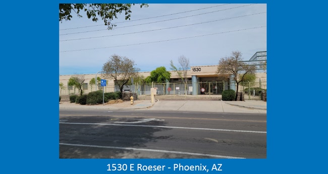
1530 E Roeser Rd, Phoenix, AZ 85040

Property Detail
1530 E Roeser Rd
113-54-017A
PT S2 SE4 NE4 SEC 28 DAF BEG PT ON E LN SD SEC 43F N E4 COR THEN N 507F TH W 429.5F TO POB EX E 40F & EX S 33F & EX 25F X 25F CORNER IN SWLY PT & EX RD P/F 04-1347986
Transportationcommunicationsgeneral
MARICOPA
C-C
Arizona
C and X Area of minimal flood hazard, usually depicted on FIRMs as above the 500-year flood level.
21
0
4.22 AC
2025
Southwest Phoenix
115900
Phoenix
52,372 SF
Phoenix-Mesa-Chandler, AZ
NEARBY LISTINGS FOR SALE OR LEASE
DEMOGRAPHICS near 1530 E Roeser Rd
1 mile
3 mile
5 mile
2025 Total Population
18,067
95,339
239,825
2030 Population
18,669
99,377
251,124
Pop Growth 2025-2030
+ 3.33%
+ 4.24%
+ 4.71%
Average Age
35
36
36
2025 Total Households
5,680
29,716
81,541
HH Growth 2025-2030
+ 3.38%
+ 4.28%
+ 4.95%
Median Household Inc
$60,393
$68,329
$66,937
Avg Household Size
3.00
3.10
2.80
2025 Avg HH Vehicles
2.00
2.00
2.00
Median Home Value
$340,561
$382,900
$379,863
Median Year Built
1983
1989
1986
Nearby Places
Map Layers
Map Styles
 Street
 Aerial
Transit
 Traffic
 Biking
Places
Listings with unknown addresses are not visible on the map
- Restaurants
- Banks
- Shops
- Fitness
- Groceries
PUBLIC TRANSPORTATION
AIRPORT
Phoenix Sky Harbor International
Drive
Walk
Distance
Phoenix Sky Harbor International
13 min
5.6 mi
Phoenix-Mesa Gateway
Drive
Walk
Distance
Phoenix-Mesa Gateway
41 min
29.5 mi
Freight Ports
Port of San Diego
Drive
Walk
Distance
Port of San Diego
403 min
360.2 mi
SALE & LEASE HISTORY
LISTING DATE
SALE/LEASE

Feb 04, 2025
For Sale
Nearby Properties
Address
Land Use
TOTAL SIZE
Lot Size
Zoning
Address
Land Use
TOTAL SIZE
Lot Size
Zoning
24.15 AC
Address
Land Use
TOTAL SIZE
Lot Size
Zoning
2,705,875 SF
133.42 AC
I-1
Address
Land Use
TOTAL SIZE
Lot Size
Zoning
81,816 SF
7.95 AC
Address
Land Use
TOTAL SIZE
Lot Size
Zoning
94,162 SF
9.40 AC
I-2
Address
Land Use
TOTAL SIZE
Lot Size
Zoning
Address
Land Use
TOTAL SIZE
Lot Size
Zoning
10,776 SF
10.14 AC
C-C
Address
Land Use
TOTAL SIZE
Lot Size
Zoning
709,191 SF
52.85 AC
I-1
Address
Land Use
TOTAL SIZE
Lot Size
Zoning
635,169 SF
92.76 AC
I-1
Address
Land Use
TOTAL SIZE
Lot Size
Zoning
13.72 AC
Address
Land Use
TOTAL SIZE
Lot Size
Zoning
469,025 SF
199.15 AC
A-1
Address
Land Use
TOTAL SIZE
Lot Size
Zoning
277,910 SF
53.82 AC
A-1
Address
Land Use
TOTAL SIZE
Lot Size
Zoning
359,401 SF
96.70 AC
R-6
Address
Land Use
TOTAL SIZE
Lot Size
Zoning
25,289 SF
2.70 AC
I-2
Address
Land Use
TOTAL SIZE
Lot Size
Zoning
369,723 SF
19.41 AC
R3
Address
Land Use
TOTAL SIZE
Lot Size
Zoning
34,520 SF
1.79 AC
C-G
Address
Land Use
TOTAL SIZE
Lot Size
Zoning
351,199 SF
22.04 AC
I-1
Address
Land Use
TOTAL SIZE
Lot Size
Zoning
494,504 SF
18.83 AC
I-1
Address
Land Use
TOTAL SIZE
Lot Size
Zoning
734,975 SF
10.53 AC
Address
Land Use
TOTAL SIZE
Lot Size
Zoning
269,181 SF
78.11 AC
I-1
Address
Land Use
TOTAL SIZE
Lot Size
Zoning
558,712 SF
30.72 AC
A2
Address
Land Use
TOTAL SIZE
Lot Size
Zoning
391,630 SF
23 AC
A-1
Address
Land Use
TOTAL SIZE
Lot Size
Zoning
51,000 SF
0.87 AC
C-G
Address
Land Use
TOTAL SIZE
Lot Size
Zoning
283,648 SF
6.83 AC
Address
Land Use
TOTAL SIZE
Lot Size
Zoning
227,269 SF
40.19 AC
I-1
Address
Land Use
TOTAL SIZE
Lot Size
Zoning
3.59 AC
Address
Land Use
TOTAL SIZE
Lot Size
Zoning
321,010 SF
15.01 AC
I-1
Address
Land Use
TOTAL SIZE
Lot Size
Zoning
278,400 SF
10.17 AC
R-6
Address
Land Use
TOTAL SIZE
Lot Size
Zoning
6.55 AC
C-G
Address
Land Use
TOTAL SIZE
Lot Size
Zoning
220,379 SF
16.87 AC
Address
Land Use
TOTAL SIZE
Lot Size
Zoning
308,180 SF
18.77 AC
I-P
The World's #1 Commercial Real Estate Marketplace
Connect with us
© 2026 CoStar Group
The information above has been obtained from sources believed reliable. While we do not doubt its accuracy we have not verified it and make no guarantee, warranty or representation about it. It is your responsibility to independently confirm its accuracy and completeness. Any projections, opinions, assumptions, or estimates used are for example only and do not represent the current or future performance of the property. The value of this transaction to you depends on tax and other factors which should be evaluated by your tax, financial, and legal advisors. You and your advisors should conduct a careful, independent investigation of the property to determine to your satisfaction the suitability of the property for your needs.