Property Record
1530 Walmart Dr, Lebanon, OH 45036


NEARBY LISTINGS FOR SALE OR LEASE
Property Detail
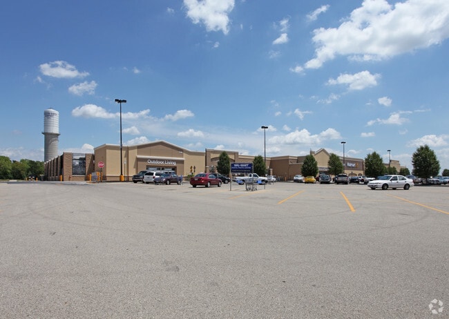
1530 Walmart Dr
Cincinnati, OH-KY-IN
Wal-Mart 3 Rp
09-25-400-020
WAL-MART 3 RP LOT 7896 B
Departmentstore
Warren
X
Ohio
39165C0133E
7896b
2024
26.43 AC
2024
Outlying Warren County
031200
Cincinnati/Dayton
216,555 SF
DEMOGRAPHICS near 1530 Walmart Dr
1 Mile
3 Mile
5 Mile
2024 Total Population
1,420
21,370
35,913
2029 Population
1,536
23,291
39,029
Pop Growth 2024-2029
+ 8.17%
+ 8.99%
+ 8.68%
Average Age
41
40
40
2024 Total Households
532
8,347
13,232
HH Growth 2024-2029
+ 8.08%
+ 9.12%
+ 9.04%
Median Household Inc
$90,427
$76,819
$84,726
Avg Household Size
2.50
2.50
2.60
2024 Avg HH Vehicles
2.00
2.00
2.00
Median Home Value
$273,170
$245,258
$269,354
Median Year Built
1975
1981
1987
Nearby Places
Map Layers
Map Styles
 Street
 Aerial
- Restaurants
- Banks
- Shops
- Fitness
- Groceries
PUBLIC TRANSPORTATION
AIRPORT
James M Cox Dayton International
DRIVE
WALK
Distance
James M Cox Dayton International
58 min
38.4 mi
Cincinnati/Northern Kentucky International
DRIVE
WALK
Distance
Cincinnati/Northern Kentucky International
69 min
47.4 mi
Nearby Properties
Address
Land Use
TOTAL SIZE
Lot Size
Zoning
Address
Land Use
TOTAL SIZE
Lot Size
Zoning
93,197 SF
78.42 AC
Address
Land Use
TOTAL SIZE
Lot Size
Zoning
Address
Land Use
TOTAL SIZE
Lot Size
Zoning
16.77 AC
Address
Land Use
TOTAL SIZE
Lot Size
Zoning
75.95 AC
R1
Address
Land Use
TOTAL SIZE
Lot Size
Zoning
16.77 AC
Address
Land Use
TOTAL SIZE
Lot Size
Zoning
2.36 AC
Address
Land Use
TOTAL SIZE
Lot Size
Zoning
12,992 SF
7.57 AC
Address
Land Use
TOTAL SIZE
Lot Size
Zoning
180,062 SF
18 AC
Address
Land Use
TOTAL SIZE
Lot Size
Zoning
44,735 SF
80.43 AC
Address
Land Use
TOTAL SIZE
Lot Size
Zoning
2,468 SF
4.60 AC
Address
Land Use
TOTAL SIZE
Lot Size
Zoning
39,383 SF
26.29 AC
Address
Land Use
TOTAL SIZE
Lot Size
Zoning
53,677 SF
10.95 AC
Address
Land Use
TOTAL SIZE
Lot Size
Zoning
42,767 SF
32.58 AC
Address
Land Use
TOTAL SIZE
Lot Size
Zoning
13,488 SF
2.36 AC
Address
Land Use
TOTAL SIZE
Lot Size
Zoning
35,101 SF
19.32 AC
Address
Land Use
TOTAL SIZE
Lot Size
Zoning
7,752 SF
2.23 AC
Address
Land Use
TOTAL SIZE
Lot Size
Zoning
23,941 SF
8.53 AC
Address
Land Use
TOTAL SIZE
Lot Size
Zoning
110,102 SF
10.44 AC
Address
Land Use
TOTAL SIZE
Lot Size
Zoning
31,054 SF
4.34 AC
Address
Land Use
TOTAL SIZE
Lot Size
Zoning
9,038 SF
5.67 AC
Address
Land Use
TOTAL SIZE
Lot Size
Zoning
38,677 SF
14.97 AC
Address
Land Use
TOTAL SIZE
Lot Size
Zoning
50,952 SF
8.98 AC
Address
Land Use
TOTAL SIZE
Lot Size
Zoning
48,122 SF
13.71 AC
Address
Land Use
TOTAL SIZE
Lot Size
Zoning
15,932 SF
33 AC
Address
Land Use
TOTAL SIZE
Lot Size
Zoning
2,880 SF
23.21 AC
Address
Land Use
TOTAL SIZE
Lot Size
Zoning
34,240 SF
3.58 AC
Address
Land Use
TOTAL SIZE
Lot Size
Zoning
15,704 SF
0.02 AC
Address
Land Use
TOTAL SIZE
Lot Size
Zoning
15,950 SF
9.59 AC
Address
Land Use
TOTAL SIZE
Lot Size
Zoning
5,093 SF
1.30 AC
The World's #1 Commercial Real Estate Marketplace
Connect with us
© 2026 CoStar Group
The information above has been obtained from sources believed reliable. While we do not doubt its accuracy we have not verified it and make no guarantee, warranty or representation about it. It is your responsibility to independently confirm its accuracy and completeness. Any projections, opinions, assumptions, or estimates used are for example only and do not represent the current or future performance of the property. The value of this transaction to you depends on tax and other factors which should be evaluated by your tax, financial, and legal advisors. You and your advisors should conduct a careful, independent investigation of the property to determine to your satisfaction the suitability of the property for your needs.