Property Record
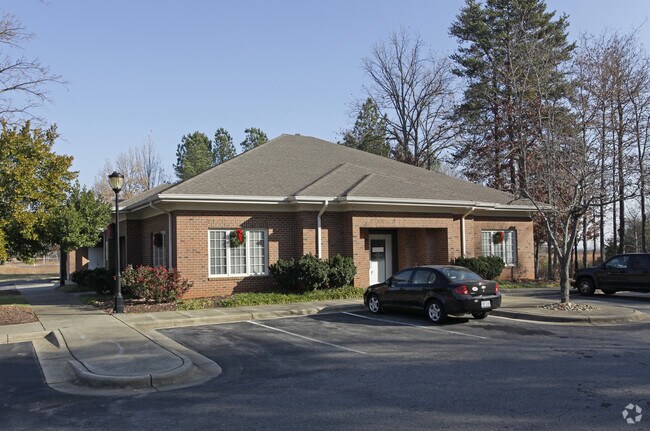
1531 S Post Rd, Shelby, NC 28152


Property Detail
1531 S Post Rd
4655
1.621ACHWY180S&226SOCLEVE LAND BRANCH
Officebuilding
Cleveland
GB
North Carolina
B and X Area of moderate flood hazard, usually the area between the limits of the 100-year and 500-year floods.
12
2025
1.32 AC
2025
Cleveland County
9516021012
Charlotte
3,064 SF
Shelby-Kings Mountain, NC
NEARBY LISTINGS FOR SALE OR LEASE
-
-
-
-
-
No Photo
-
-
View all Shelby listings for sale on LoopNet.com
DEMOGRAPHICS near 1531 S Post Rd
1 mile
3 mile
5 mile
2025 Total Population
1,179
11,320
36,692
2030 Population
1,212
11,529
37,489
Pop Growth 2025-2030
+ 2.80%
+ 1.85%
+ 2.17%
Average Age
42
41
41
2025 Total Households
499
4,721
15,070
HH Growth 2025-2030
+ 2.81%
+ 1.82%
+ 2.15%
Median Household Inc
$64,918
$54,312
$56,937
Avg Household Size
2.30
2.30
2.30
2025 Avg HH Vehicles
2.00
2.00
2.00
Median Home Value
$201,961
$200,756
$214,851
Median Year Built
1977
1979
1976
Nearby Places
Map Layers
Map Styles
 Street
 Aerial
Transit
 Traffic
 Biking
Places
Listings with unknown addresses are not visible on the map
- Restaurants
- Banks
- Shops
- Fitness
- Groceries
PUBLIC TRANSPORTATION
AIRPORT
Charlotte/Douglas International
Drive
Walk
Distance
Charlotte/Douglas International
57 min
39.1 mi
SALE & LEASE HISTORY
LISTING DATE
SALE/LEASE

Sep 10, 2018
For Sale
Jun 21, 2018
For Sale
Nearby Properties
Address
Land Use
TOTAL SIZE
Lot Size
Zoning
Address
Land Use
TOTAL SIZE
Lot Size
Zoning
5,036 SF
29.46 AC
CPD
Address
Land Use
TOTAL SIZE
Lot Size
Zoning
92,278 SF
41.63 AC
R10
Address
Land Use
TOTAL SIZE
Lot Size
Zoning
12.80 AC
R10
Address
Land Use
TOTAL SIZE
Lot Size
Zoning
139,067 SF
25 AC
R20
Address
Land Use
TOTAL SIZE
Lot Size
Zoning
29,747 SF
21.06 AC
RO
Address
Land Use
TOTAL SIZE
Lot Size
Zoning
9.55 AC
RO
Address
Land Use
TOTAL SIZE
Lot Size
Zoning
8,712 SF
13.95 AC
R6
Address
Land Use
TOTAL SIZE
Lot Size
Zoning
224,162 SF
15 AC
GBCU
Address
Land Use
TOTAL SIZE
Lot Size
Zoning
8,880 SF
8.28 AC
CPD
Address
Land Use
TOTAL SIZE
Lot Size
Zoning
253,504 SF
30.57 AC
LI
Address
Land Use
TOTAL SIZE
Lot Size
Zoning
17,634 SF
19.06 AC
GB
Address
Land Use
TOTAL SIZE
Lot Size
Zoning
66,184 SF
56.38 AC
ROCU
Address
Land Use
TOTAL SIZE
Lot Size
Zoning
4,040 SF
22.83 AC
GB
Address
Land Use
TOTAL SIZE
Lot Size
Zoning
71,644 SF
7.67 AC
GB
Address
Land Use
TOTAL SIZE
Lot Size
Zoning
50,771 SF
2.40 AC
GB
Address
Land Use
TOTAL SIZE
Lot Size
Zoning
91,986 SF
29.44 AC
R15
Address
Land Use
TOTAL SIZE
Lot Size
Zoning
52.33 AC
R8
Address
Land Use
TOTAL SIZE
Lot Size
Zoning
46,948 SF
2.06 AC
GB
Address
Land Use
TOTAL SIZE
Lot Size
Zoning
78,165 SF
8.02 AC
GB
Address
Land Use
TOTAL SIZE
Lot Size
Zoning
134,978 SF
14.50 AC
GB2CU
Address
Land Use
TOTAL SIZE
Lot Size
Zoning
37,580 SF
2 AC
GB
Address
Land Use
TOTAL SIZE
Lot Size
Zoning
36,511 SF
11.57 AC
GB2
Address
Land Use
TOTAL SIZE
Lot Size
Zoning
159,172 SF
30.75 AC
GB
Address
Land Use
TOTAL SIZE
Lot Size
Zoning
35,829 SF
4 AC
GB
Address
Land Use
TOTAL SIZE
Lot Size
Zoning
34,448 SF
1.65 AC
GB
Address
Land Use
TOTAL SIZE
Lot Size
Zoning
1,416 SF
10.74 AC
R6
Address
Land Use
TOTAL SIZE
Lot Size
Zoning
130,560 SF
7.27 AC
Address
Land Use
TOTAL SIZE
Lot Size
Zoning
34,936 SF
5.60 AC
GB
Address
Land Use
TOTAL SIZE
Lot Size
Zoning
53,684 SF
20.06 AC
GB
Address
Land Use
TOTAL SIZE
Lot Size
Zoning
27,014 SF
9.93 AC
GB
The World's #1 Commercial Real Estate Marketplace
Connect with us
© 2026 CoStar Group
The information above has been obtained from sources believed reliable. While we do not doubt its accuracy we have not verified it and make no guarantee, warranty or representation about it. It is your responsibility to independently confirm its accuracy and completeness. Any projections, opinions, assumptions, or estimates used are for example only and do not represent the current or future performance of the property. The value of this transaction to you depends on tax and other factors which should be evaluated by your tax, financial, and legal advisors. You and your advisors should conduct a careful, independent investigation of the property to determine to your satisfaction the suitability of the property for your needs.