Property Record
15311 W Mcdowell Rd, Goodyear, AZ 85395


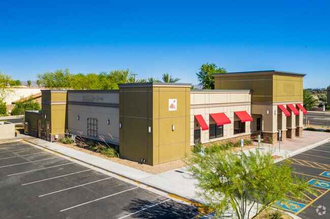

Property Detail
15311 W Mcdowell Rd
500-04-972C
TH POR NW4 SEC 5 LY NLY OF NLY R/W LN OF I-10 FRWY DESC P/DKT 13160 PG 112 DAF BEG SW COR SEC 5 TH N 5278.78F TO NW COR SD SEC 5 TH E 2618.41F TO N4 COR SD SEC 5 TH S 1366.41F TH S 37D 28M E 208.74F TH S 2505.88F TO N LN OF S 1242F OF SD SEC 5 TH W 1
Regionalshoppingcenterormallwithanchorstore
Maricopa
C-G
Arizona
C and X Area of minimal flood hazard, usually depicted on FIRMs as above the 500-year flood level.
31.41 AC
2025
N Goodyear/Litchfield
2025
Phoenix
061054
Phoenix-Mesa-Chandler, AZ
320,888 SF
NEARBY LISTINGS FOR SALE OR LEASE
DEMOGRAPHICS near 15311 W Mcdowell Rd
1 mile
3 mile
5 mile
2025 Total Population
10,748
78,875
173,994
2030 Population
11,611
83,179
183,781
Pop Growth 2025-2030
+ 8.03%
+ 5.46%
+ 5.62%
Average Age
38
41
38
2025 Total Households
3,789
28,077
57,663
HH Growth 2025-2030
+ 7.89%
+ 5.57%
+ 5.70%
Median Household Inc
$88,241
$97,958
$95,750
Avg Household Size
2.80
2.80
2.90
2025 Avg HH Vehicles
2.00
2.00
2.00
Median Home Value
$544,149
$496,744
$468,326
Median Year Built
2010
2006
2005
Nearby Places
Map Layers
Map Styles
 Street
 Aerial
Transit
 Traffic
 Biking
Places
Listings with unknown addresses are not visible on the map
- Restaurants
- Banks
- Shops
- Fitness
- Groceries
PUBLIC TRANSPORTATION
AIRPORT
Phoenix Sky Harbor International
Drive
Walk
Distance
Phoenix Sky Harbor International
34 min
24.8 mi
Nearby Properties
Address
Land Use
TOTAL SIZE
Lot Size
Zoning
Address
Land Use
TOTAL SIZE
Lot Size
Zoning
16.70 AC
Address
Land Use
TOTAL SIZE
Lot Size
Zoning
76,301 SF
15.91 AC
Address
Land Use
TOTAL SIZE
Lot Size
Zoning
49,475 SF
5.70 AC
PAD
Address
Land Use
TOTAL SIZE
Lot Size
Zoning
370,726 SF
23.41 AC
PAD
Address
Land Use
TOTAL SIZE
Lot Size
Zoning
324,374 SF
18.26 AC
PAD
Address
Land Use
TOTAL SIZE
Lot Size
Zoning
2.51 AC
Address
Land Use
TOTAL SIZE
Lot Size
Zoning
563,328 SF
24.43 AC
C2
Address
Land Use
TOTAL SIZE
Lot Size
Zoning
401,714 SF
100.01 AC
PAD
Address
Land Use
TOTAL SIZE
Lot Size
Zoning
438,256 SF
48.59 AC
Address
Land Use
TOTAL SIZE
Lot Size
Zoning
802,439 SF
56.30 AC
PAD
Address
Land Use
TOTAL SIZE
Lot Size
Zoning
901,699 SF
49.92 AC
I1
Address
Land Use
TOTAL SIZE
Lot Size
Zoning
220,494 SF
50.53 AC
AG
Address
Land Use
TOTAL SIZE
Lot Size
Zoning
855,336 SF
45.11 AC
Address
Land Use
TOTAL SIZE
Lot Size
Zoning
802,671 SF
48.81 AC
I1
Address
Land Use
TOTAL SIZE
Lot Size
Zoning
398,872 SF
9.39 AC
PAD
Address
Land Use
TOTAL SIZE
Lot Size
Zoning
601,124 SF
39.88 AC
PAD
Address
Land Use
TOTAL SIZE
Lot Size
Zoning
790,980 SF
42.95 AC
I1
Address
Land Use
TOTAL SIZE
Lot Size
Zoning
643,798 SF
42.24 AC
PAD
Address
Land Use
TOTAL SIZE
Lot Size
Zoning
643,756 SF
39.25 AC
PAD
Address
Land Use
TOTAL SIZE
Lot Size
Zoning
295,014 SF
37.63 AC
PAD
Address
Land Use
TOTAL SIZE
Lot Size
Zoning
380,477 SF
40 AC
RT
Address
Land Use
TOTAL SIZE
Lot Size
Zoning
222,900 SF
15.99 AC
Address
Land Use
TOTAL SIZE
Lot Size
Zoning
643,798 SF
39.40 AC
PAD
Address
Land Use
TOTAL SIZE
Lot Size
Zoning
355,597 SF
14.83 AC
PAD
Address
Land Use
TOTAL SIZE
Lot Size
Zoning
337,781 SF
9.11 AC
PF
Address
Land Use
TOTAL SIZE
Lot Size
Zoning
295,635 SF
16.57 AC
PAD
Address
Land Use
TOTAL SIZE
Lot Size
Zoning
293,849 SF
33.20 AC
PAD
Address
Land Use
TOTAL SIZE
Lot Size
Zoning
392,000 SF
26.57 AC
PAD
Address
Land Use
TOTAL SIZE
Lot Size
Zoning
663,150 SF
34.49 AC
The World's #1 Commercial Real Estate Marketplace
Connect with us
© 2026 CoStar Group
The information above has been obtained from sources believed reliable. While we do not doubt its accuracy we have not verified it and make no guarantee, warranty or representation about it. It is your responsibility to independently confirm its accuracy and completeness. Any projections, opinions, assumptions, or estimates used are for example only and do not represent the current or future performance of the property. The value of this transaction to you depends on tax and other factors which should be evaluated by your tax, financial, and legal advisors. You and your advisors should conduct a careful, independent investigation of the property to determine to your satisfaction the suitability of the property for your needs.