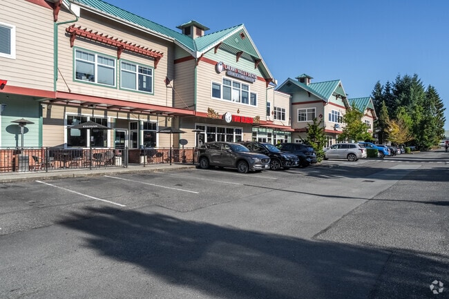
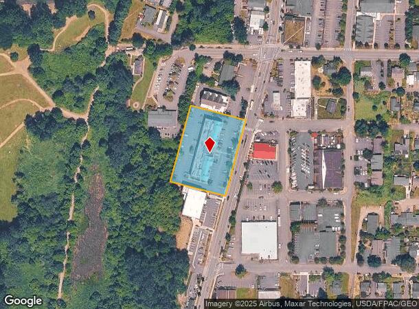
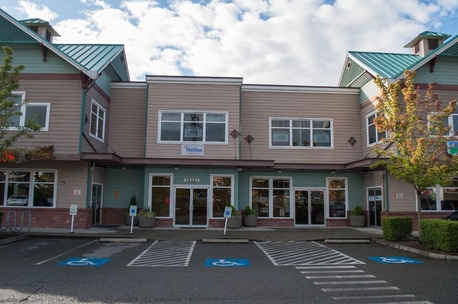
Property Record
15321 Main St Ne, Duvall, WA 98019

NEARBY LISTINGS FOR SALE OR LEASE
-
-
View all Duvall listings for lease on LoopNet.com
Property Detail
15321 Main St Ne
Seattle-Tacoma-Bellevue, WA
Duvall Business Tracts
212990-0030
DUVALL BUSINESS TRACTS AKA LOT A DUVALL LLA 01-002 REC #20010802-900008
Storebuilding
King
X
Washington
53033C0401G
a
2025
1.50 AC
2024
E King County
032401
Seattle/Puget Sound
41,244 SF
DEMOGRAPHICS near 15321 Main St Ne
1 Mile
3 Mile
5 Mile
2024 Total Population
4,700
15,168
41,537
2029 Population
4,708
15,165
41,571
Pop Growth 2024-2029
+ 0.17%
(0.02%)
+ 0.08%
Average Age
37
44
42
2024 Total Households
1,612
5,618
14,619
HH Growth 2024-2029
(0.12%)
(0.23%)
(0.09%)
Median Household Inc
$171,467
$162,282
$174,022
Avg Household Size
2.90
2.70
2.80
2024 Avg HH Vehicles
2.00
2.00
2.00
Median Home Value
$726,818
$817,375
$888,185
Median Year Built
2001
1998
1995
Nearby Places
Map Layers
Map Styles
 Street
 Aerial
- Restaurants
- Banks
- Shops
- Fitness
- Groceries
PUBLIC TRANSPORTATION
AIRPORT
Seattle Paine Field International
DRIVE
WALK
Distance
Seattle Paine Field International
43 min
25.9 mi
Seattle-Tacoma International
DRIVE
WALK
Distance
Seattle-Tacoma International
52 min
33.7 mi
Freight Ports
Port of Everett
DRIVE
WALK
Distance
Port of Everett
40 min
25.8 mi
SALE & LEASE HISTORY
LISTING DATE
SALE/LEASE

Sep 25, 2016
For Lease
Sep 23, 2016
For Sale
Jun 16, 2023
For Lease
Jul 17, 2018
For Lease
Jan 04, 2017
For Lease
Nearby Properties
Address
Land Use
TOTAL SIZE
Lot Size
Zoning
Address
Land Use
TOTAL SIZE
Lot Size
Zoning
93,333 SF
42.85 AC
PF
Address
Land Use
TOTAL SIZE
Lot Size
Zoning
89,407 SF
0.95 AC
LI
Address
Land Use
TOTAL SIZE
Lot Size
Zoning
44,816 SF
5.86 AC
CO
Address
Land Use
TOTAL SIZE
Lot Size
Zoning
46,415 SF
11.05 AC
RA2.5
Address
Land Use
TOTAL SIZE
Lot Size
Zoning
14,272 SF
30 AC
RA5
Address
Land Use
TOTAL SIZE
Lot Size
Zoning
37,864 SF
10.19 AC
PF
Address
Land Use
TOTAL SIZE
Lot Size
Zoning
2,940 SF
7.46 AC
PF
Address
Land Use
TOTAL SIZE
Lot Size
Zoning
4,641 SF
1.50 AC
MT
Address
Land Use
TOTAL SIZE
Lot Size
Zoning
26,000 SF
0.54 AC
MT
Address
Land Use
TOTAL SIZE
Lot Size
Zoning
34,412 SF
5.25 AC
LI
Address
Land Use
TOTAL SIZE
Lot Size
Zoning
22,040 SF
0.26 AC
PF
Address
Land Use
TOTAL SIZE
Lot Size
Zoning
6,307 SF
1.64 AC
CO
Address
Land Use
TOTAL SIZE
Lot Size
Zoning
Address
Land Use
TOTAL SIZE
Lot Size
Zoning
12,177 SF
1.05 AC
R20
Address
Land Use
TOTAL SIZE
Lot Size
Zoning
7,810 SF
0.44 AC
MT
Address
Land Use
TOTAL SIZE
Lot Size
Zoning
12,830 SF
0.50 AC
MT
Address
Land Use
TOTAL SIZE
Lot Size
Zoning
7,312 SF
0.47 AC
UT-1
Address
Land Use
TOTAL SIZE
Lot Size
Zoning
11,300 SF
1.13 AC
LI
Address
Land Use
TOTAL SIZE
Lot Size
Zoning
13,364 SF
0.32 AC
PF
Address
Land Use
TOTAL SIZE
Lot Size
Zoning
8,290 SF
0.26 AC
OT
Address
Land Use
TOTAL SIZE
Lot Size
Zoning
9,818 SF
0.20 AC
OT
Address
Land Use
TOTAL SIZE
Lot Size
Zoning
11,952 SF
0.14 AC
OT
Address
Land Use
TOTAL SIZE
Lot Size
Zoning
1.80 AC
RA5
Address
Land Use
TOTAL SIZE
Lot Size
Zoning
17,136 SF
1.21 AC
MT
Address
Land Use
TOTAL SIZE
Lot Size
Zoning
20,269 SF
12.16 AC
R6
Address
Land Use
TOTAL SIZE
Lot Size
Zoning
11,920 SF
0.15 AC
OT
The World's #1 Commercial Real Estate Marketplace
Connect with us
© 2026 CoStar Group
The information above has been obtained from sources believed reliable. While we do not doubt its accuracy we have not verified it and make no guarantee, warranty or representation about it. It is your responsibility to independently confirm its accuracy and completeness. Any projections, opinions, assumptions, or estimates used are for example only and do not represent the current or future performance of the property. The value of this transaction to you depends on tax and other factors which should be evaluated by your tax, financial, and legal advisors. You and your advisors should conduct a careful, independent investigation of the property to determine to your satisfaction the suitability of the property for your needs.