Property Record
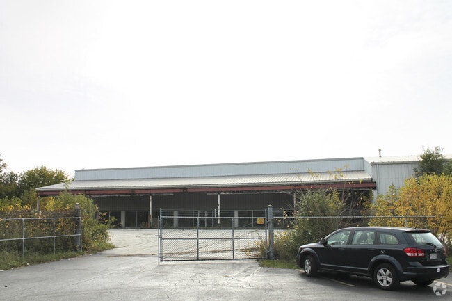
1533 E 162Nd St, South Holland, IL 60473


NEARBY LISTINGS FOR SALE OR LEASE
Property Detail
1533 E 162Nd St
Servicestation
Cook
X
Illinois
17031C0752J
12.08 AC
2023
Near South Cook
2024
Chicago
827901
Chicago-Naperville-Elgin, IL-IN-WI
18,873 SF
29-23-201-034-0000
DEMOGRAPHICS near 1533 E 162Nd St
1 Mile
3 Mile
5 Mile
2024 Total Population
9,767
106,282
253,010
2029 Population
9,428
103,839
249,146
Pop Growth 2024-2029
(3.47%)
(2.30%)
(1.53%)
Average Age
47
40
39
2024 Total Households
4,178
39,753
94,138
HH Growth 2024-2029
(3.95%)
(2.68%)
(1.82%)
Median Household Inc
$61,526
$57,323
$51,555
Avg Household Size
2.20
2.60
2.60
2024 Avg HH Vehicles
2.00
2.00
2.00
Median Home Value
$161,555
$138,423
$136,859
Median Year Built
1971
1965
1961
Nearby Places
Map Layers
Map Styles
 Street
 Aerial
- Restaurants
- Banks
- Shops
- Fitness
- Groceries
PUBLIC TRANSPORTATION
COMMUTER RAIL
Harvey Station (Metra Electric Line - Northeast Illinois Regional Commuter Railroad (Metra))
DRIVE
WALK
Distance
Harvey Station (Metra Electric Line - Northeast Illinois Regional Commuter Railroad (Metra))
10 min
4.4 mi
147Th St. (Metra Electric - Metra)
DRIVE
WALK
Distance
147Th St. (Metra Electric - Metra)
9 min
4.5 mi
AIRPORT
Chicago Midway International
DRIVE
WALK
Distance
Chicago Midway International
35 min
21.9 mi
Freight Ports
Port Milwaukee
DRIVE
WALK
Distance
Port Milwaukee
135 min
107.2 mi
Nearby Properties
Address
Land Use
TOTAL SIZE
Lot Size
Zoning
Address
Land Use
TOTAL SIZE
Lot Size
Zoning
24.56 AC
Address
Land Use
TOTAL SIZE
Lot Size
Zoning
5.01 AC
Address
Land Use
TOTAL SIZE
Lot Size
Zoning
Address
Land Use
TOTAL SIZE
Lot Size
Zoning
119,082 SF
11.26 AC
Address
Land Use
TOTAL SIZE
Lot Size
Zoning
51,204 SF
0.34 AC
Address
Land Use
TOTAL SIZE
Lot Size
Zoning
7.31 AC
Address
Land Use
TOTAL SIZE
Lot Size
Zoning
454,999 SF
27.43 AC
Address
Land Use
TOTAL SIZE
Lot Size
Zoning
Address
Land Use
TOTAL SIZE
Lot Size
Zoning
450,777 SF
25.25 AC
Address
Land Use
TOTAL SIZE
Lot Size
Zoning
60,864 SF
5.55 AC
Address
Land Use
TOTAL SIZE
Lot Size
Zoning
398,668 SF
13.92 AC
Address
Land Use
TOTAL SIZE
Lot Size
Zoning
69,894 SF
7.60 AC
Address
Land Use
TOTAL SIZE
Lot Size
Zoning
Address
Land Use
TOTAL SIZE
Lot Size
Zoning
89,853 SF
2.68 AC
Address
Land Use
TOTAL SIZE
Lot Size
Zoning
159,145 SF
15.36 AC
Address
Land Use
TOTAL SIZE
Lot Size
Zoning
40,489 SF
6.43 AC
Address
Land Use
TOTAL SIZE
Lot Size
Zoning
142,376 SF
24 AC
Address
Land Use
TOTAL SIZE
Lot Size
Zoning
38,111 SF
6.70 AC
Address
Land Use
TOTAL SIZE
Lot Size
Zoning
Address
Land Use
TOTAL SIZE
Lot Size
Zoning
17,856 SF
0.32 AC
Address
Land Use
TOTAL SIZE
Lot Size
Zoning
233,490 SF
10.19 AC
Address
Land Use
TOTAL SIZE
Lot Size
Zoning
3,500 SF
41.36 AC
Address
Land Use
TOTAL SIZE
Lot Size
Zoning
180,139 SF
18.78 AC
Address
Land Use
TOTAL SIZE
Lot Size
Zoning
179,402 SF
10.40 AC
Address
Land Use
TOTAL SIZE
Lot Size
Zoning
136,486 SF
8.73 AC
Address
Land Use
TOTAL SIZE
Lot Size
Zoning
48,134 SF
5.33 AC
Address
Land Use
TOTAL SIZE
Lot Size
Zoning
72,652 SF
0.94 AC
Address
Land Use
TOTAL SIZE
Lot Size
Zoning
615,006 SF
61.84 AC
Address
Land Use
TOTAL SIZE
Lot Size
Zoning
16,980 SF
0.15 AC
Address
Land Use
TOTAL SIZE
Lot Size
Zoning
79,660 SF
2.57 AC
The World's #1 Commercial Real Estate Marketplace
Connect with us
© 2025 CoStar Group
The information above has been obtained from sources believed reliable. While we do not doubt its accuracy we have not verified it and make no guarantee, warranty or representation about it. It is your responsibility to independently confirm its accuracy and completeness. Any projections, opinions, assumptions, or estimates used are for example only and do not represent the current or future performance of the property. The value of this transaction to you depends on tax and other factors which should be evaluated by your tax, financial, and legal advisors. You and your advisors should conduct a careful, independent investigation of the property to determine to your satisfaction the suitability of the property for your needs.