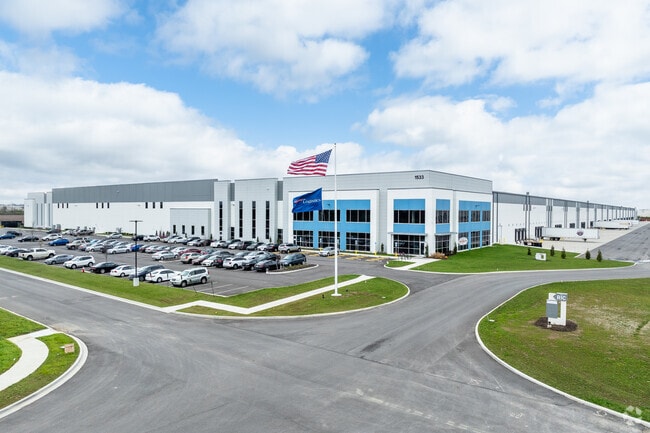
Property Record
1533 Rohr Rd, Lockbourne, OH 43137
NEARBY LISTINGS FOR SALE OR LEASE
Property Detail
1533 Rohr Rd
Columbus
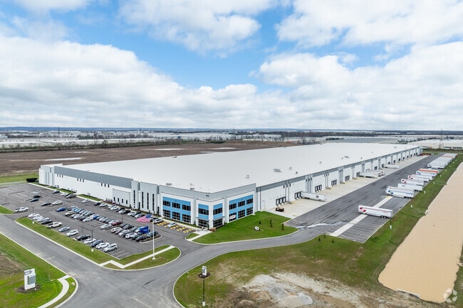
1489 Rohr
Columbus, OH
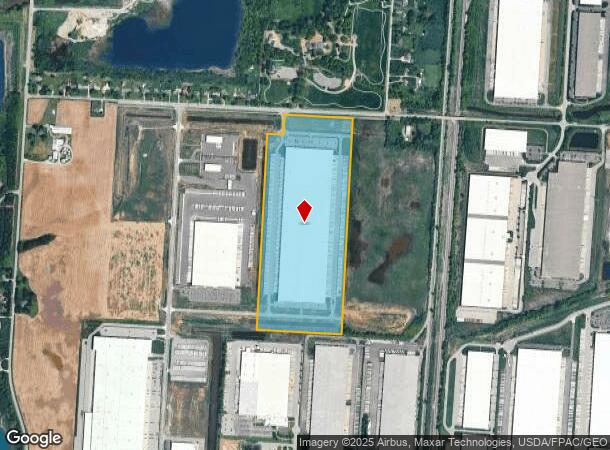
ROHR LOT 2 59.639
495-303783
Franklin
Warehouse
Ohio
2024
2
2024
59.77 AC
009590
Southeast
1,054,500 SF
DEMOGRAPHICS near 1533 Rohr Rd
1 Mile
3 Mile
5 Mile
2024 Total Population
239
19,319
55,569
2029 Population
240
19,537
56,024
Pop Growth 2024-2029
+ 0.42%
+ 1.13%
+ 0.82%
Average Age
41
38
40
2024 Total Households
90
6,837
20,792
HH Growth 2024-2029
0.00%
+ 1.07%
+ 0.67%
Median Household Inc
$65,192
$66,386
$67,577
Avg Household Size
2.70
2.80
2.60
2024 Avg HH Vehicles
2.00
2.00
2.00
Median Home Value
$182,142
$170,971
$178,504
Median Year Built
1975
1976
1977
Nearby Places
Map Layers
Map Styles
 Street
 Aerial
- Restaurants
- Banks
- Shops
- Fitness
- Groceries
PUBLIC TRANSPORTATION
AIRPORT
Rickenbacker International
DRIVE
WALK
Distance
Rickenbacker International
7 min
2.9 mi
John Glenn Columbus International
DRIVE
WALK
Distance
John Glenn Columbus International
28 min
16.7 mi
Freight Ports
Port of Toledo
DRIVE
WALK
Distance
Port of Toledo
204 min
150.6 mi
SALE & LEASE HISTORY
LISTING DATE
SALE/LEASE

Apr 06, 2021
For Lease
Nearby Properties
Address
Land Use
TOTAL SIZE
Lot Size
Zoning
Address
Land Use
TOTAL SIZE
Lot Size
Zoning
587,462 SF
480.43 AC
Address
Land Use
TOTAL SIZE
Lot Size
Zoning
4,200 SF
852.55 AC
Address
Land Use
TOTAL SIZE
Lot Size
Zoning
218,744 SF
167.80 AC
Address
Land Use
TOTAL SIZE
Lot Size
Zoning
1,075,600 SF
49.33 AC
Address
Land Use
TOTAL SIZE
Lot Size
Zoning
1,466,512 SF
49.72 AC
Address
Land Use
TOTAL SIZE
Lot Size
Zoning
43,254 SF
300.98 AC
Address
Land Use
TOTAL SIZE
Lot Size
Zoning
20,888 SF
181 AC
Address
Land Use
TOTAL SIZE
Lot Size
Zoning
1,219,000 SF
59.32 AC
Address
Land Use
TOTAL SIZE
Lot Size
Zoning
1,021,020 SF
68.44 AC
Address
Land Use
TOTAL SIZE
Lot Size
Zoning
1,600,052 SF
70.19 AC
Address
Land Use
TOTAL SIZE
Lot Size
Zoning
1,280,501 SF
69.60 AC
Address
Land Use
TOTAL SIZE
Lot Size
Zoning
150.29 AC
Address
Land Use
TOTAL SIZE
Lot Size
Zoning
816,200 SF
51.08 AC
Address
Land Use
TOTAL SIZE
Lot Size
Zoning
959,688 SF
55.34 AC
Address
Land Use
TOTAL SIZE
Lot Size
Zoning
778,272 SF
42.31 AC
Address
Land Use
TOTAL SIZE
Lot Size
Zoning
903,780 SF
45.43 AC
Address
Land Use
TOTAL SIZE
Lot Size
Zoning
720,200 SF
35.71 AC
Address
Land Use
TOTAL SIZE
Lot Size
Zoning
785,854 SF
30.85 AC
Address
Land Use
TOTAL SIZE
Lot Size
Zoning
676,000 SF
35.76 AC
Address
Land Use
TOTAL SIZE
Lot Size
Zoning
Address
Land Use
TOTAL SIZE
Lot Size
Zoning
592,120 SF
38.67 AC
Address
Land Use
TOTAL SIZE
Lot Size
Zoning
547,200 SF
43.58 AC
Address
Land Use
TOTAL SIZE
Lot Size
Zoning
541,910 SF
36.84 AC
Address
Land Use
TOTAL SIZE
Lot Size
Zoning
743,315 SF
42.17 AC
Address
Land Use
TOTAL SIZE
Lot Size
Zoning
567,000 SF
23.08 AC
Address
Land Use
TOTAL SIZE
Lot Size
Zoning
130,865 SF
9.97 AC
Address
Land Use
TOTAL SIZE
Lot Size
Zoning
767,697 SF
39.49 AC
Address
Land Use
TOTAL SIZE
Lot Size
Zoning
655,288 SF
40.76 AC
Address
Land Use
TOTAL SIZE
Lot Size
Zoning
590,225 SF
42.21 AC
The World's #1 Commercial Real Estate Marketplace
Connect with us
© 2025 CoStar Group
The information above has been obtained from sources believed reliable. While we do not doubt its accuracy we have not verified it and make no guarantee, warranty or representation about it. It is your responsibility to independently confirm its accuracy and completeness. Any projections, opinions, assumptions, or estimates used are for example only and do not represent the current or future performance of the property. The value of this transaction to you depends on tax and other factors which should be evaluated by your tax, financial, and legal advisors. You and your advisors should conduct a careful, independent investigation of the property to determine to your satisfaction the suitability of the property for your needs.