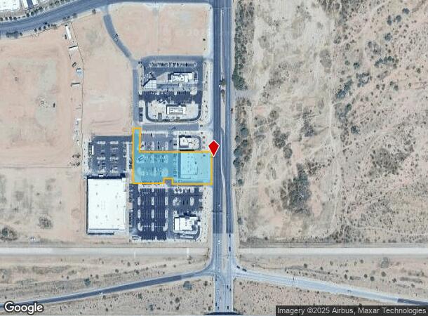
Property Record
1534 S Signal Butte Rd, Mesa, AZ 85209


Current Lease Availabilities
NEARBY LISTINGS FOR SALE OR LEASE
Property Detail
1534 S Signal Butte Rd
Phoenix
Mountain Vista Retail
Phoenix-Mesa-Scottsdale, AZ
MOUNTAIN VISTA RETAIL MCR 1620-41
220-82-009
Maricopa
Storebuilding
Arizona
2025
2
2025
1.29 AC
422615
Red Mountain/Mesa
7,535 SF
DEMOGRAPHICS near 1534 S Signal Butte Rd
1 Mile
3 Mile
5 Mile
2024 Total Population
8,950
97,359
215,525
2029 Population
9,753
109,129
243,100
Pop Growth 2024-2029
+ 8.97%
+ 12.09%
+ 12.79%
Average Age
40
43
43
2024 Total Households
3,367
38,580
84,219
HH Growth 2024-2029
+ 9.65%
+ 12.62%
+ 13.29%
Median Household Inc
$77,953
$64,692
$69,857
Avg Household Size
2.60
2.50
2.50
2024 Avg HH Vehicles
2.00
2.00
2.00
Median Home Value
$352,988
$278,917
$319,763
Median Year Built
2002
1998
1996
Nearby Places
Map Layers
Map Styles
 Street
 Aerial
- Restaurants
- Banks
- Shops
- Fitness
- Groceries
PUBLIC TRANSPORTATION
AIRPORT
Phoenix-Mesa Gateway
DRIVE
WALK
Distance
Phoenix-Mesa Gateway
18 min
11.5 mi
Phoenix Sky Harbor International
DRIVE
WALK
Distance
Phoenix Sky Harbor International
36 min
27.3 mi
Freight Ports
Port of San Diego
DRIVE
WALK
Distance
Port of San Diego
423 min
384.0 mi
Nearby Properties
Address
Land Use
TOTAL SIZE
Lot Size
Zoning
Address
Land Use
TOTAL SIZE
Lot Size
Zoning
493,357 SF
46.94 AC
C-N
Address
Land Use
TOTAL SIZE
Lot Size
Zoning
108,297 SF
102.46 AC
PS
Address
Land Use
TOTAL SIZE
Lot Size
Zoning
Address
Land Use
TOTAL SIZE
Lot Size
Zoning
128,905 SF
7.14 AC
UNDESIGNAT
Address
Land Use
TOTAL SIZE
Lot Size
Zoning
Address
Land Use
TOTAL SIZE
Lot Size
Zoning
209,737 SF
21.98 AC
UNDESIGNAT
Address
Land Use
TOTAL SIZE
Lot Size
Zoning
1,355,382 SF
83.17 AC
PAD
Address
Land Use
TOTAL SIZE
Lot Size
Zoning
467,727 SF
104.86 AC
AG
Address
Land Use
TOTAL SIZE
Lot Size
Zoning
454,704 SF
101.68 AC
AG
Address
Land Use
TOTAL SIZE
Lot Size
Zoning
330,352 SF
28.30 AC
PF
Address
Land Use
TOTAL SIZE
Lot Size
Zoning
52,961 SF
7.94 AC
Address
Land Use
TOTAL SIZE
Lot Size
Zoning
449,435 SF
26.87 AC
LI
Address
Land Use
TOTAL SIZE
Lot Size
Zoning
779,546 SF
53.20 AC
LI
Address
Land Use
TOTAL SIZE
Lot Size
Zoning
422,427 SF
18.21 AC
C-C
Address
Land Use
TOTAL SIZE
Lot Size
Zoning
Address
Land Use
TOTAL SIZE
Lot Size
Zoning
173,840 SF
6 AC
UNDESIGNAT
Address
Land Use
TOTAL SIZE
Lot Size
Zoning
6,335 SF
8.30 AC
Address
Land Use
TOTAL SIZE
Lot Size
Zoning
38,353 SF
5 AC
Address
Land Use
TOTAL SIZE
Lot Size
Zoning
23,180 SF
3.90 AC
UNDESIGNAT
Address
Land Use
TOTAL SIZE
Lot Size
Zoning
4.77 AC
LC
Address
Land Use
TOTAL SIZE
Lot Size
Zoning
345,968 SF
14.65 AC
RM4
Address
Land Use
TOTAL SIZE
Lot Size
Zoning
162,184 SF
4.60 AC
UNDESIGNAT
Address
Land Use
TOTAL SIZE
Lot Size
Zoning
27,121 SF
4.05 AC
Address
Land Use
TOTAL SIZE
Lot Size
Zoning
43,958 SF
4.54 AC
UNDESIGNAT
Address
Land Use
TOTAL SIZE
Lot Size
Zoning
196,400 SF
15.67 AC
Address
Land Use
TOTAL SIZE
Lot Size
Zoning
24,158 SF
5.19 AC
Address
Land Use
TOTAL SIZE
Lot Size
Zoning
13.52 AC
Address
Land Use
TOTAL SIZE
Lot Size
Zoning
62,758 SF
5 AC
UNDESIGNAT
Address
Land Use
TOTAL SIZE
Lot Size
Zoning
4,000 SF
20 AC
CI2
The World's #1 Commercial Real Estate Marketplace
Connect with us
© 2025 CoStar Group
The information above has been obtained from sources believed reliable. While we do not doubt its accuracy we have not verified it and make no guarantee, warranty or representation about it. It is your responsibility to independently confirm its accuracy and completeness. Any projections, opinions, assumptions, or estimates used are for example only and do not represent the current or future performance of the property. The value of this transaction to you depends on tax and other factors which should be evaluated by your tax, financial, and legal advisors. You and your advisors should conduct a careful, independent investigation of the property to determine to your satisfaction the suitability of the property for your needs.