Property Record
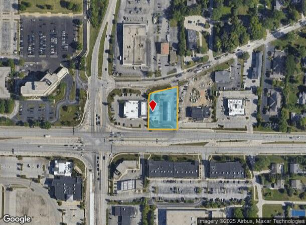
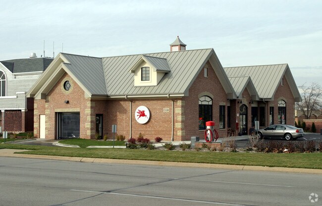
15340 W Bluemound Rd, Elm Grove, WI 53122

NEARBY LISTINGS FOR SALE OR LEASE
Property Detail
15340 W Bluemound Rd
Milwaukee-Waukesha-West Allis, WI
Watertown Plank
EGV-1111-983-003
PARCEL 2 CSM #1573 VOL 10/289 REC AS DOC #815992 PT SW1/4 SEC 26 T7N R20E :: ALSO COM NE CRNR PRCL 2 CSM #1573; S650800W ALNG NWLY LINE OF PRCL 2 181.86 FT TO NW CRNR OF PRCL 2; N ALNG NLY EXTNSN OF W LINE OF PRCL 2 36.37 FT; N650800E ALNG FRMR CNTRL
Commercialnec
Waukesha
X
Wisconsin
55133C0236H
2,7
2024
0.75 AC
2024
Brookfield/New Berlin
201001
Milwaukee/Madison
DEMOGRAPHICS near 15340 W Bluemound Rd
1 Mile
3 Mile
5 Mile
2024 Total Population
4,860
58,530
166,559
2029 Population
5,134
60,745
169,617
Pop Growth 2024-2029
+ 5.64%
+ 3.78%
+ 1.84%
Average Age
44
43
42
2024 Total Households
1,897
24,343
71,515
HH Growth 2024-2029
+ 5.80%
+ 3.71%
+ 1.71%
Median Household Inc
$104,556
$95,584
$86,109
Avg Household Size
2.50
2.40
2.30
2024 Avg HH Vehicles
2.00
2.00
2.00
Median Home Value
$418,077
$344,384
$305,509
Median Year Built
1968
1971
1968
Nearby Places
Map Layers
Map Styles
 Street
 Aerial
- Restaurants
- Banks
- Shops
- Fitness
- Groceries
PUBLIC TRANSPORTATION
AIRPORT
General Mitchell International
DRIVE
WALK
Distance
General Mitchell International
30 min
16.6 mi
Freight Ports
Port Milwaukee
DRIVE
WALK
Distance
Port Milwaukee
22 min
13.8 mi
Nearby Properties
Address
Land Use
TOTAL SIZE
Lot Size
Zoning
Address
Land Use
TOTAL SIZE
Lot Size
Zoning
19.44 AC
Address
Land Use
TOTAL SIZE
Lot Size
Zoning
8.63 AC
C2
Address
Land Use
TOTAL SIZE
Lot Size
Zoning
24.46 AC
Address
Land Use
TOTAL SIZE
Lot Size
Zoning
Address
Land Use
TOTAL SIZE
Lot Size
Zoning
19.25 AC
Address
Land Use
TOTAL SIZE
Lot Size
Zoning
19.44 AC
Address
Land Use
TOTAL SIZE
Lot Size
Zoning
4.54 AC
Address
Land Use
TOTAL SIZE
Lot Size
Zoning
12.50 AC
Address
Land Use
TOTAL SIZE
Lot Size
Zoning
20.02 AC
Address
Land Use
TOTAL SIZE
Lot Size
Zoning
Address
Land Use
TOTAL SIZE
Lot Size
Zoning
34.31 AC
Address
Land Use
TOTAL SIZE
Lot Size
Zoning
17.45 AC
Address
Land Use
TOTAL SIZE
Lot Size
Zoning
10.48 AC
Address
Land Use
TOTAL SIZE
Lot Size
Zoning
Address
Land Use
TOTAL SIZE
Lot Size
Zoning
7.20 AC
Address
Land Use
TOTAL SIZE
Lot Size
Zoning
Address
Land Use
TOTAL SIZE
Lot Size
Zoning
21.94 AC
Address
Land Use
TOTAL SIZE
Lot Size
Zoning
19.44 AC
Address
Land Use
TOTAL SIZE
Lot Size
Zoning
Address
Land Use
TOTAL SIZE
Lot Size
Zoning
Address
Land Use
TOTAL SIZE
Lot Size
Zoning
3.55 AC
Address
Land Use
TOTAL SIZE
Lot Size
Zoning
230,726 SF
26.56 AC
RM1
Address
Land Use
TOTAL SIZE
Lot Size
Zoning
4.79 AC
Address
Land Use
TOTAL SIZE
Lot Size
Zoning
4.53 AC
Address
Land Use
TOTAL SIZE
Lot Size
Zoning
Address
Land Use
TOTAL SIZE
Lot Size
Zoning
Address
Land Use
TOTAL SIZE
Lot Size
Zoning
Address
Land Use
TOTAL SIZE
Lot Size
Zoning
11.34 AC
Address
Land Use
TOTAL SIZE
Lot Size
Zoning
102,604 SF
12.67 AC
PUD
Address
Land Use
TOTAL SIZE
Lot Size
Zoning
13.14 AC
The World's #1 Commercial Real Estate Marketplace
Connect with us
© 2025 CoStar Group
The information above has been obtained from sources believed reliable. While we do not doubt its accuracy we have not verified it and make no guarantee, warranty or representation about it. It is your responsibility to independently confirm its accuracy and completeness. Any projections, opinions, assumptions, or estimates used are for example only and do not represent the current or future performance of the property. The value of this transaction to you depends on tax and other factors which should be evaluated by your tax, financial, and legal advisors. You and your advisors should conduct a careful, independent investigation of the property to determine to your satisfaction the suitability of the property for your needs.