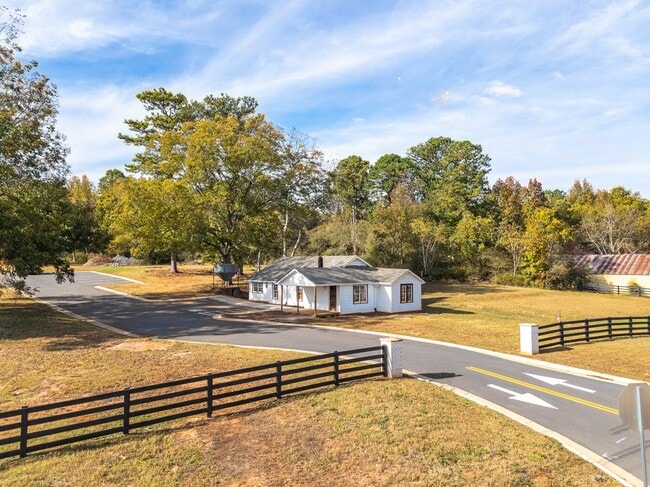
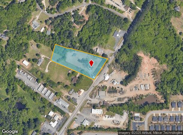
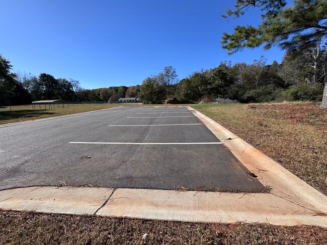
Property Record
1535 Dahlonega Hwy, Cumming, GA 30040
This Property Is For Sale
NEARBY LISTINGS FOR SALE OR LEASE
Property Detail
1535 Dahlonega Hwy
172-034
Coal Mountain
Commercialnec
3-1 905-906-967-968
X
Forsyth
13139C0275G
Georgia
2024
2.78 AC
2025
N Fulton/Forsyth County
130411
Atlanta
1,310 SF
Atlanta-Sandy Springs-Roswell, GA
DEMOGRAPHICS near 1535 Dahlonega Hwy
1 Mile
3 Mile
5 Mile
2024 Total Population
2,775
29,286
85,043
2029 Population
3,026
32,108
93,001
Pop Growth 2024-2029
+ 9.05%
+ 9.64%
+ 9.36%
Average Age
41
40
40
2024 Total Households
1,090
10,450
29,611
HH Growth 2024-2029
+ 8.99%
+ 9.67%
+ 9.34%
Median Household Inc
$94,499
$100,130
$114,141
Avg Household Size
2.60
2.70
2.80
2024 Avg HH Vehicles
2.00
2.00
2.00
Median Home Value
$357,680
$489,692
$550,934
Median Year Built
2004
1999
2002
Nearby Places
- Restaurants
- Banks
- Shops
- Fitness
- Groceries
Nearby Properties
Address
Land Use
TOTAL SIZE
Lot Size
Zoning
Address
Land Use
TOTAL SIZE
Lot Size
Zoning
10.57 AC
PUD
Address
Land Use
TOTAL SIZE
Lot Size
Zoning
15,081 SF
27.53 AC
R3
Address
Land Use
TOTAL SIZE
Lot Size
Zoning
305,332 SF
23.75 AC
CBD
Address
Land Use
TOTAL SIZE
Lot Size
Zoning
6.49 AC
PUD
Address
Land Use
TOTAL SIZE
Lot Size
Zoning
24.78 AC
INST
Address
Land Use
TOTAL SIZE
Lot Size
Zoning
62,085 SF
28.70 AC
INST
Address
Land Use
TOTAL SIZE
Lot Size
Zoning
413,484 SF
127.99 AC
A1
Address
Land Use
TOTAL SIZE
Lot Size
Zoning
159,291 SF
29.19 AC
MU
Address
Land Use
TOTAL SIZE
Lot Size
Zoning
98,743 SF
12.61 AC
CBD
Address
Land Use
TOTAL SIZE
Lot Size
Zoning
267,180 SF
31.01 AC
INST
Address
Land Use
TOTAL SIZE
Lot Size
Zoning
152,668 SF
41.92 AC
CBD
Address
Land Use
TOTAL SIZE
Lot Size
Zoning
268,761 SF
55.50 AC
INST
Address
Land Use
TOTAL SIZE
Lot Size
Zoning
175,237 SF
2.13 AC
CBD
Address
Land Use
TOTAL SIZE
Lot Size
Zoning
68,188 SF
121.31 AC
A1
Address
Land Use
TOTAL SIZE
Lot Size
Zoning
192,550 SF
21.11 AC
CBD
Address
Land Use
TOTAL SIZE
Lot Size
Zoning
155,804 SF
3.24 AC
CBD
Address
Land Use
TOTAL SIZE
Lot Size
Zoning
17,657 SF
59.25 AC
A1
Address
Land Use
TOTAL SIZE
Lot Size
Zoning
1,752 SF
170.87 AC
A1
Address
Land Use
TOTAL SIZE
Lot Size
Zoning
151,580 SF
21.78 AC
MU
Address
Land Use
TOTAL SIZE
Lot Size
Zoning
114,998 SF
13.09 AC
INST
Address
Land Use
TOTAL SIZE
Lot Size
Zoning
2,750 SF
276.79 AC
A1
Address
Land Use
TOTAL SIZE
Lot Size
Zoning
198,331 SF
14.47 AC
M1
Address
Land Use
TOTAL SIZE
Lot Size
Zoning
51.05 AC
HB
Address
Land Use
TOTAL SIZE
Lot Size
Zoning
80,497 SF
9.22 AC
CBD
Address
Land Use
TOTAL SIZE
Lot Size
Zoning
8,235 SF
5.65 AC
CBD
Address
Land Use
TOTAL SIZE
Lot Size
Zoning
12,217 SF
3.85 AC
CBD
Address
Land Use
TOTAL SIZE
Lot Size
Zoning
1.94 AC
PUD
Address
Land Use
TOTAL SIZE
Lot Size
Zoning
113,537 SF
11.94 AC
INST
Address
Land Use
TOTAL SIZE
Lot Size
Zoning
38.85 AC
HB
Address
Land Use
TOTAL SIZE
Lot Size
Zoning
34,359 SF
5.67 AC
INST
The World's #1 Commercial Real Estate Marketplace
Connect with us
© 2025 CoStar Group
The information above has been obtained from sources believed reliable. While we do not doubt its accuracy we have not verified it and make no guarantee, warranty or representation about it. It is your responsibility to independently confirm its accuracy and completeness. Any projections, opinions, assumptions, or estimates used are for example only and do not represent the current or future performance of the property. The value of this transaction to you depends on tax and other factors which should be evaluated by your tax, financial, and legal advisors. You and your advisors should conduct a careful, independent investigation of the property to determine to your satisfaction the suitability of the property for your needs.