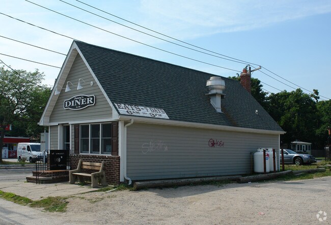
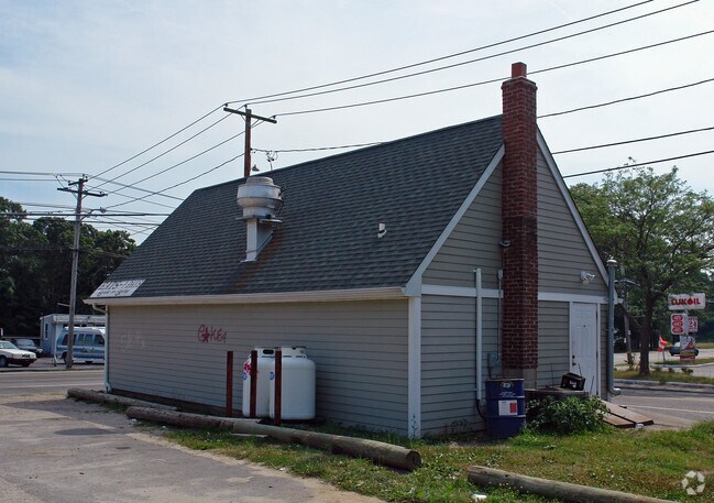
Property Record
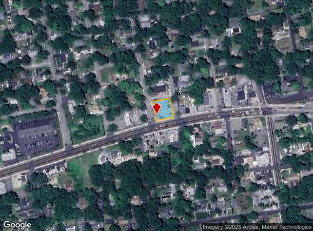
1535 Montauk Hwy, Mastic, NY 11950
NEARBY LISTINGS FOR SALE OR LEASE
Property Detail
1535 Montauk Hwy
Nassau County-Suffolk County, NY
Mastic Park
0200-824-00-04-00-027-001
MASTIC PARK 735 SEC 5 4793-4797 INC
Restaurantbuilding
Suffolk
X
New York
36103C0737H
27
2024
0.41 AC
2024
Eastern Suffolk
159416
Long Island (New York)
DEMOGRAPHICS near 1535 Montauk Hwy
1 Mile
3 Mile
5 Mile
2024 Total Population
10,884
56,112
90,819
2029 Population
10,712
55,549
90,260
Pop Growth 2024-2029
(1.58%)
(1.00%)
(0.62%)
Average Age
38
39
40
2024 Total Households
3,264
18,135
30,275
HH Growth 2024-2029
(1.72%)
(1.12%)
(0.67%)
Median Household Inc
$89,409
$97,595
$100,676
Avg Household Size
3.10
3.00
2.90
2024 Avg HH Vehicles
2.00
2.00
2.00
Median Home Value
$300,603
$353,049
$380,237
Median Year Built
1976
1976
1978
Nearby Places
- Restaurants
- Banks
- Shops
- Fitness
- Groceries
PUBLIC TRANSPORTATION
COMMUTER RAIL
Mastic-Shirley Station (Montauk Branch - Long Island Rail Road)
DRIVE
WALK
Distance
Mastic-Shirley Station (Montauk Branch - Long Island Rail Road)
4 min
1.8 mi
Bellport Station (Montauk Branch - Long Island Rail Road)
DRIVE
WALK
Distance
Bellport Station (Montauk Branch - Long Island Rail Road)
11 min
6.1 mi
AIRPORT
Long Island MacArthur
DRIVE
WALK
Distance
Long Island MacArthur
24 min
15.1 mi
Freight Ports
Port of New Haven
DRIVE
WALK
Distance
Port of New Haven
141 min
55.7 mi
Nearby Properties
Address
Land Use
TOTAL SIZE
Lot Size
Zoning
Address
Land Use
TOTAL SIZE
Lot Size
Zoning
1.70 AC
RRD
Address
Land Use
TOTAL SIZE
Lot Size
Zoning
576 SF
2.70 AC
HB
Address
Land Use
TOTAL SIZE
Lot Size
Zoning
4,016 SF
0.50 AC
R4
Address
Land Use
TOTAL SIZE
Lot Size
Zoning
Address
Land Use
TOTAL SIZE
Lot Size
Zoning
Address
Land Use
TOTAL SIZE
Lot Size
Zoning
Address
Land Use
TOTAL SIZE
Lot Size
Zoning
109.78 AC
Address
Land Use
TOTAL SIZE
Lot Size
Zoning
Address
Land Use
TOTAL SIZE
Lot Size
Zoning
28.82 AC
Address
Land Use
TOTAL SIZE
Lot Size
Zoning
Address
Land Use
TOTAL SIZE
Lot Size
Zoning
Address
Land Use
TOTAL SIZE
Lot Size
Zoning
Address
Land Use
TOTAL SIZE
Lot Size
Zoning
Address
Land Use
TOTAL SIZE
Lot Size
Zoning
48.60 AC
Address
Land Use
TOTAL SIZE
Lot Size
Zoning
19.69 AC
Address
Land Use
TOTAL SIZE
Lot Size
Zoning
0.18 AC
R20
Address
Land Use
TOTAL SIZE
Lot Size
Zoning
30.60 AC
Address
Land Use
TOTAL SIZE
Lot Size
Zoning
0.46 AC
R20
Address
Land Use
TOTAL SIZE
Lot Size
Zoning
0.83 AC
BUS1
Address
Land Use
TOTAL SIZE
Lot Size
Zoning
Address
Land Use
TOTAL SIZE
Lot Size
Zoning
Address
Land Use
TOTAL SIZE
Lot Size
Zoning
7.30 AC
CR60
Address
Land Use
TOTAL SIZE
Lot Size
Zoning
53.54 AC
Address
Land Use
TOTAL SIZE
Lot Size
Zoning
12.31 AC
Address
Land Use
TOTAL SIZE
Lot Size
Zoning
92.78 AC
Address
Land Use
TOTAL SIZE
Lot Size
Zoning
13.63 AC
Address
Land Use
TOTAL SIZE
Lot Size
Zoning
0.62 AC
BUS1
Address
Land Use
TOTAL SIZE
Lot Size
Zoning
22 AC
Address
Land Use
TOTAL SIZE
Lot Size
Zoning
20.30 AC
Address
Land Use
TOTAL SIZE
Lot Size
Zoning
The World's #1 Commercial Real Estate Marketplace
Connect with us
© 2025 CoStar Group
The information above has been obtained from sources believed reliable. While we do not doubt its accuracy we have not verified it and make no guarantee, warranty or representation about it. It is your responsibility to independently confirm its accuracy and completeness. Any projections, opinions, assumptions, or estimates used are for example only and do not represent the current or future performance of the property. The value of this transaction to you depends on tax and other factors which should be evaluated by your tax, financial, and legal advisors. You and your advisors should conduct a careful, independent investigation of the property to determine to your satisfaction the suitability of the property for your needs.