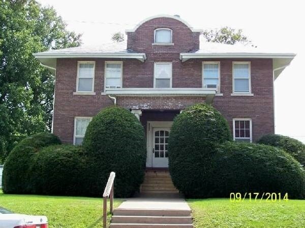
Property Record
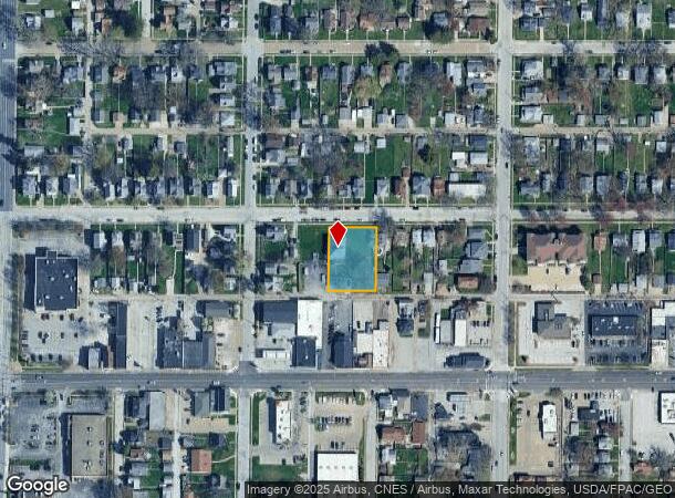
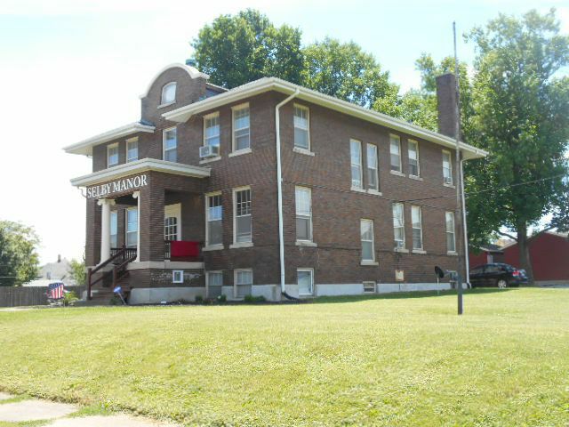
1535 W Pleasant St, Davenport, IA 52804
NEARBY LISTINGS FOR SALE OR LEASE
Property Detail
1535 W Pleasant St
Davenport-Moline-Rock Island, IA-IL
Mitchell's 4Th Add
A0059-15B
MITCHELL'S 4TH ADD LOT: 010 BLOCK: 002 MITCHELL'S 4TH ADDLOT 10 & E 25.66'LOT 11 (EXC THE S10' OF LOT 10 & 11)
Apartment
Scott
X
Iowa
19163C0365H
10,11
2025
0.49 AC
2025
Northwest Davenport
011200
Davenport/Moline/Rock Island
3,840 SF
DEMOGRAPHICS near 1535 W Pleasant St
1 Mile
3 Mile
5 Mile
2024 Total Population
14,505
83,009
150,642
2029 Population
14,321
82,697
149,346
Pop Growth 2024-2029
(1.27%)
(0.38%)
(0.86%)
Average Age
38
39
39
2024 Total Households
5,731
34,975
62,873
HH Growth 2024-2029
(1.36%)
(0.34%)
(0.89%)
Median Household Inc
$52,728
$51,343
$54,677
Avg Household Size
2.30
2.20
2.30
2024 Avg HH Vehicles
2.00
2.00
2.00
Median Home Value
$125,024
$135,962
$144,866
Median Year Built
1948
1957
1959
Nearby Places
Map Layers
Map Styles
 Street
 Aerial
- Restaurants
- Banks
- Shops
- Fitness
- Groceries
PUBLIC TRANSPORTATION
AIRPORT
Quad Cities International
DRIVE
WALK
Distance
Quad Cities International
22 min
11.4 mi
Freight Ports
Port Milwaukee
DRIVE
WALK
Distance
Port Milwaukee
245 min
215.2 mi
SALE & LEASE HISTORY
LISTING DATE
SALE/LEASE

May 30, 2017
For Sale
Nearby Properties
Address
Land Use
TOTAL SIZE
Lot Size
Zoning
Address
Land Use
TOTAL SIZE
Lot Size
Zoning
7,934 SF
8.41 AC
Address
Land Use
TOTAL SIZE
Lot Size
Zoning
3,516 SF
26.74 AC
Address
Land Use
TOTAL SIZE
Lot Size
Zoning
197,194 SF
5.14 AC
Address
Land Use
TOTAL SIZE
Lot Size
Zoning
253,608 SF
9.29 AC
Address
Land Use
TOTAL SIZE
Lot Size
Zoning
3,500 SF
1.54 AC
Address
Land Use
TOTAL SIZE
Lot Size
Zoning
27,306 SF
50.57 AC
Address
Land Use
TOTAL SIZE
Lot Size
Zoning
190,832 SF
3.88 AC
Address
Land Use
TOTAL SIZE
Lot Size
Zoning
300,718 SF
14.71 AC
Address
Land Use
TOTAL SIZE
Lot Size
Zoning
63,359 SF
12.01 AC
Address
Land Use
TOTAL SIZE
Lot Size
Zoning
352,332 SF
34.16 AC
Address
Land Use
TOTAL SIZE
Lot Size
Zoning
472,569 SF
47.24 AC
Address
Land Use
TOTAL SIZE
Lot Size
Zoning
61,623 SF
2.18 AC
Address
Land Use
TOTAL SIZE
Lot Size
Zoning
76,853 SF
0.56 AC
Address
Land Use
TOTAL SIZE
Lot Size
Zoning
25,176 SF
13.85 AC
Address
Land Use
TOTAL SIZE
Lot Size
Zoning
77,187 SF
0.88 AC
Address
Land Use
TOTAL SIZE
Lot Size
Zoning
27,312 SF
15.04 AC
Address
Land Use
TOTAL SIZE
Lot Size
Zoning
70,098 SF
9.72 AC
Address
Land Use
TOTAL SIZE
Lot Size
Zoning
8,000 SF
4.59 AC
Address
Land Use
TOTAL SIZE
Lot Size
Zoning
104,415 SF
5.89 AC
Address
Land Use
TOTAL SIZE
Lot Size
Zoning
9,658 SF
8.07 AC
Address
Land Use
TOTAL SIZE
Lot Size
Zoning
153,329 SF
2.35 AC
Address
Land Use
TOTAL SIZE
Lot Size
Zoning
96,529 SF
3.52 AC
Address
Land Use
TOTAL SIZE
Lot Size
Zoning
4,800 SF
18.86 AC
Address
Land Use
TOTAL SIZE
Lot Size
Zoning
72,554 SF
0.38 AC
Address
Land Use
TOTAL SIZE
Lot Size
Zoning
111,452 SF
40 AC
Address
Land Use
TOTAL SIZE
Lot Size
Zoning
12,648 SF
8.28 AC
Address
Land Use
TOTAL SIZE
Lot Size
Zoning
50,880 SF
11.36 AC
Address
Land Use
TOTAL SIZE
Lot Size
Zoning
54,644 SF
2.41 AC
Address
Land Use
TOTAL SIZE
Lot Size
Zoning
213,686 SF
23.29 AC
Address
Land Use
TOTAL SIZE
Lot Size
Zoning
10,724 SF
1.51 AC
The World's #1 Commercial Real Estate Marketplace
Connect with us
© 2025 CoStar Group
The information above has been obtained from sources believed reliable. While we do not doubt its accuracy we have not verified it and make no guarantee, warranty or representation about it. It is your responsibility to independently confirm its accuracy and completeness. Any projections, opinions, assumptions, or estimates used are for example only and do not represent the current or future performance of the property. The value of this transaction to you depends on tax and other factors which should be evaluated by your tax, financial, and legal advisors. You and your advisors should conduct a careful, independent investigation of the property to determine to your satisfaction the suitability of the property for your needs.